Charleston in Mississippi County, Missouri — The American Midwest (Upper Plains)
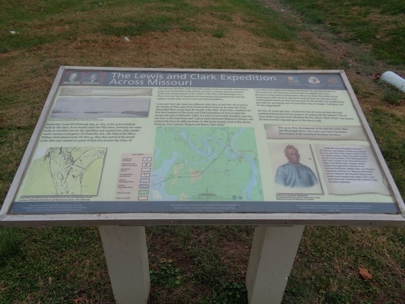
The Lewis and Clark Expedition Across Missouri
Inscription.
Meriwether Lewis left Pittsburgh Aug. 30, 1803, in the 55-foot keelboat built for him there. As he headed down the Ohio River, slowed by low water levels, he recruited men for the expedition and acquired two other smaller vessels (canoes or pirogues). At Clarksville, Ind., (the Falls of the Ohio), William Clark joined Lewis. On Nov. 14, 1803, they arrived at the mouth of the Ohio and camped at a point of land near present-day Cairo, Ill.
Over the next five days, Lewis and Clark made a series of scientific observations using such instruments as the sextant, surveyor's compass and chronometer. Clark made measurements of the widths of the Ohio and Mississippi rivers. These were the first of hundreds of observations and measurements that the captains would make on the Lewis and Clark Expedition.
Lewis and Clark also made two different visits (Nov. 16 and Nov. 18) to land in the vicinity of what came to be known as Bird's Point on the west side of the Mississippi River across from the mouth of the Ohio. These visits constitute the first time members of the Lewis and Clark Expedition set foot on land that became the state of Missouri. Clark, in a letter to his brother Jonathan, says they met four or five Americans and "a great many Showonee [Shawnee] Indians, and traded with them for different kinds of wild meets [meats], Such as Biar [bear], Venisons, Ducs [ducks], Tongues and Beaver Tales [tails]."
Lewis adds some additional details in his journal. He says that on Nov. 16: "We found here som Shawnees and Delwars incamped; one of the Shawnees a respectable looking Indian offered me three beverskins for my dog [Seaman] with which he appeared much pleased, the dog was of the newfoundland breed one that I prised much for his docility and qualifications generally for my journey and of course there was no bargan. I had given 20$ for this dogg myself."
On Nov. 18, Lewis says they "reached the huts of some persons who had established themselves for the purpose of trading with the Indians." One of these traders may have been Abraham Bird for whom "Bird's Point" was named. He had received a Spanish grant in this area in 1798.
(aside:)
Nov. 14-20, 1803: Encampment at the junction of the Ohio and Mississippi Rivers: the Lewis and Clark Expedition first sets foot in the Louisiana Purchase Territory
(side quote:)
"this evening landed on the point at which the Ohio and Mississippi form there junchon"
Meriwether Lewis, Nov. 14, 1803
(aside:)
Shawnee and Delaware Indians
The Shawnee and Delaware Indians encountered by Lewis and Clark in the vicinity of Bird's Point were splinter
groups of those two tribes that had moved to the west bank of the Mississippi River with Louis Lorimier in the 1780s following the defeat of the British (who Lorimier and the Indians had supported) at the time of the American Revolution. Initially some 1,200 Shawnee (sometimes referred to as "Absentee Shawnees") and 600 Delaware had relocated along several creeks (most conspicuously Apple Creek) in the area between Ste. Genevieve and Lorimier's Cape Girardeau settlement.
Erected by National Park Service, Missouri Dept of Natural Resources, and Missouri Lewis and Clark Bicentennial Commission.
Topics and series. This historical marker is listed in these topic lists: Exploration • Native Americans. In addition, it is included in the Lewis & Clark Expedition series list. A significant historical date for this entry is November 14, 1803.
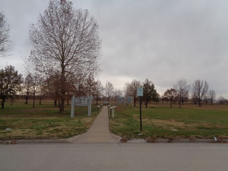
Location. 36° 54.217′ N, 89° 21.098′ W. Marker is in Charleston, Missouri, in Mississippi County. Marker is on Beasley Park Road east of State Highway 105. Marker is at the entrance of The First Steps Into the Louisiana Purchase outdoor exhibit. Touch for map. Marker is at or near this postal address: 201 Beasley Park Rd, Charleston MO 63834, United States of America. Touch for directions.
Other nearby markers. At least 8 other markers are within 12 miles of this marker, measured as the crow flies. Warren Eastman Hearnes (approx. 1.4 miles away); Mississippi County War Memorial (approx. 1˝ miles away); Mississippi County (approx. 3 miles away); Missouri Sharecropper Strike of 1939 (approx. 4.6 miles away); Riverlore (approx. 11.8 miles away in Illinois); Magnolia Manor (approx. 11.9 miles away in Illinois); African American Troops in the Civil War (approx. 12 miles away in Illinois); The Cairo Public Library (approx. 12 miles away in Illinois). Touch for a list and map of all markers in Charleston.
Credits. This page was last revised on December 25, 2020. It was originally submitted on December 25, 2020, by Jason Voigt of Glen Carbon, Illinois. This page has been viewed 292 times since then and 40 times this year. Photos: 1, 2. submitted on December 25, 2020, by Jason Voigt of Glen Carbon, Illinois.

