Land Use
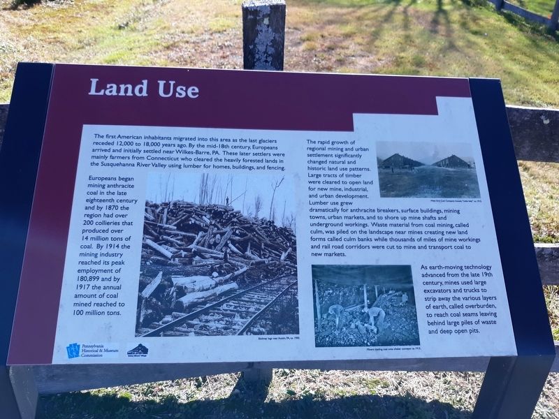
Europeans began mining anthracite coal in the late eighteenth century and by 1870 the region had over 200 collieries that produced over 14 million tons of coal. By 1914 the mining industry reached its peak employment of 180,899 and by 1917 the annual amount of coal mined reached to 100 million tons.
The rapid growth of regional mining and urban settlement significantly changed natural and historic land use patterns. Large tracts of timber were cleared to open land for new mine, industrial, and urban development. Lumber use grew dramatically for anthracite breakers, surface buildings, mining towns, urban markets, and to shore up mine shafts and underground workings. Waste material from coal mining, called culm, was piled on the landscape near mines creating new land forms called culm banks while thousands of miles of mine workings and rail road corridors were cut to mine and transport coal to new markets.
As earth-moving
technology advanced from the late 19th century, mines used large excavators and trucks to strip away the various layers of earth, called overburden, to reach coal seams leaving behind large piles of waste and deep open pits.Erected by Pennsylvania Historical & Museum Commission.
Topics. This historical marker is listed in this topic list: Industry & Commerce. A significant historical year for this entry is 1870.
Location. 40° 59.583′ N, 75° 51.75′ W. Marker is in Eckley, Pennsylvania, in Luzerne County. Marker is on Main Street, on the left when traveling west. On the grounds of the Eckley Miners' Village & Museum (Ghost Town). Touch for map. Marker is in this post office area: Weatherly PA 18255, United States of America. Touch for directions.
Other nearby markers. At least 8 other markers are within walking distance of this marker. Eckley Veterans Memorial (about 600 feet away, measured in a direct line); Land Use Consequences (approx. ¼ mile away); The Slate Picker's House (approx. ¼ mile away); Laborer’s Double Dwelling (approx. 0.3 miles away); Eckley Miners’ Village (approx. 0.3 miles away); The Church of the Immaculate Conception (approx. 0.4 miles away); Exploring the Corridor (approx. 0.4 miles away); a different marker also named Eckley Miners’ Village (approx. 0.4 miles away). Touch for a list and map of all markers in Eckley.
Credits. This page was last revised on December 30, 2020. It was originally submitted on December 28, 2020, by Craig Doda of Napoleon, Ohio. This page has been viewed 87 times since then and 12 times this year. Photos: 1, 2, 3. submitted on December 28, 2020, by Craig Doda of Napoleon, Ohio. • Bill Pfingsten was the editor who published this page.


