Havre de Grace in Harford County, Maryland — The American Northeast (Mid-Atlantic)
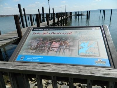
Principio Destroyed
Star-Spangled Banner National Historic Trail
Photographed by Bill Pfingsten, April 3, 2013
1. Principio Destroyed Marker
In this raid Hughes' losses included five 24-pound cannon in a battery meant to protect the ironworks and twenty-eight 32-pounders ready to be shipped. He never financially recovered.
[map caption]
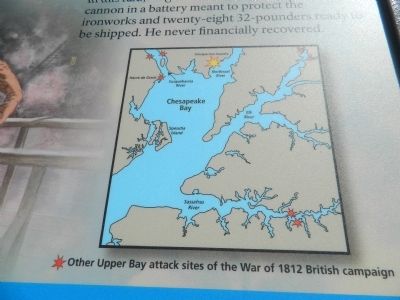
Other Upper Bay attack sites of the War of 1812 British campaign
[painting caption]
The same day the British invaded Havre de Grace, they destroyed Principio Iron Foundry.
(C) Gerry Embleton, Courtesy of the National Park Service
Erected by National Park Service / U.S. Department of the Interior.
Topics and series. This historical marker is listed in this topic list: War of 1812. In addition, it is included in the Star-Spangled Banner National Historic Trail series list. A significant historical date for this entry is May 3, 1813.
Location. 39° 32.421′ N, 76° 5.09′ W. Marker is in Havre de Grace, Maryland, in Harford County. It can be reached from Commerce Street. Marker is near the Concord Point Lighthouse on the Havre
this page online

Regionally, this marker is in the Baltimore Metro Region and in Central Maryland. It is also in the American Mid-Atlantic, in the Chesapeake Bay Region, and on the Eastern Seaboard. Globally, it is in the North Atlantic Region, North America, the Western Hemisphere, the Western World, and the Anglosphere. Historically, it finds itself in what was once one of the original Thirteen Colonies and also the Antebellum South.
Other nearby markers. At least 8 other markers are within walking distance of this marker: British Landing (within shouting distance of this marker); The point where the Susquehanna River meets the Chesapeake Bay (within shouting distance of this marker); Dangerous Waters (within shouting distance of this marker); John O'Neill (within shouting distance of this marker); Concord Point Light Station (within shouting distance of this marker); Gold Star Families Memorial Monument (within shouting distance of this marker); Havre de Grace (within shouting distance of this
Photographed by Bill Pfingsten, April 3, 2013
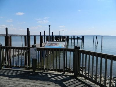
2. Principio Destroyed Marker
Another marker is no longer nearby. Concord Point Lighthouse (was within shouting distance of this marker but has been replaced with another marker now near it).
Photographed by Bill Pfingsten, April 3, 2013
3. Location of Principio Foundry
Credits. This page was last revised on December 30, 2020. It was originally submitted on April 5, 2013, by Bill Pfingsten of Bel Air, Maryland. This page has been viewed 839 times since then and 41 times this year. Last updated on December 29, 2020, by Carl Gordon Moore Jr. of North East, Maryland. Photos: 1, 2, 3. submitted on April 5, 2013, by Bill Pfingsten of Bel Air, Maryland. • J. Makali Bruton was the editor who published this page.
