Mules and Men
1821-1932
| — | Delaware Canal Lock 19 State Park | — |
Joe Reed
Boatman
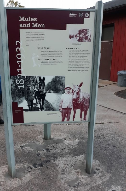
Lunch is served. This mule team demonstrates their dependability by eating lunch and continuing work without guidance from the driver.
Mule Power
Mules provided the power to move boats along the Delaware Canal. The mule is the offspring of male donkey and a female horse. Compared to a horse, the surefooted mule ate less, had stronger endurance and better health. It was natural for a team to put twenty-five miles or more under their hooves each day.
Outfitting A Mule
Equipment included a harness, fly net, bells, hat and feed bag. Canallers owned their mules and harness, often bought from the coal company's stables and equipment stores.
A Mule's Day
The working day for the mules began with grooming, light feeding and harness fitting. Some mule drivers fed their team the first meal after working an hour, claiming the animals stayed healthier that way. When the tow line went slack it was time to feed the mules. The driver hung a feed bag around each animal's neck allowing it to eat while working.
Mules had an unusual form of relaxation. According to one boatman, Howard Swope, if the mules seemed tired during the day, the driver "... would let them have a roll or two in a nearby field and then continue on for several more hours as the mules would then be as fresh as if they had a nap."
The drivers, quite attached to their teams during the long hours together, fondly bragged about the mules' intelligence and instinct. A well trained team traveled the towpath unattended for
this page online
Once moving, the mules hardly strained to pull the coal laden boats through the channel.
Long working
hours provided time for
a driver to grow attached to the strong
mules, Notice the fly protection gear.
Topics and series. This historical marker is listed in these topic lists: Animals • Waterways & Vessels. In addition, it is included in the Delaware Canal (AKA Delaware Division of the Pennsylvania Canal) series list.
Location. 40° 32.967′ N, 75° 5.083′ W. Marker is in Upper Black Eddy, Pennsylvania, in Bucks County. It is on Sanctuary Hill Circle, on the left when traveling south. Touch for map. Marker is in this post office area: Upper Black Eddy PA 18972, United States of America. Touch for directions.
Regionally, this marker is in Southeast Pennsylvania and in Greater Philadelphia. It is also in the American Northeast and in the Mid-Atlantic. Globally, it is in North America, the Western Hemisphere, the Western World, and the Anglosphere. Historically, it finds itself in what was once the Haudenosaunee
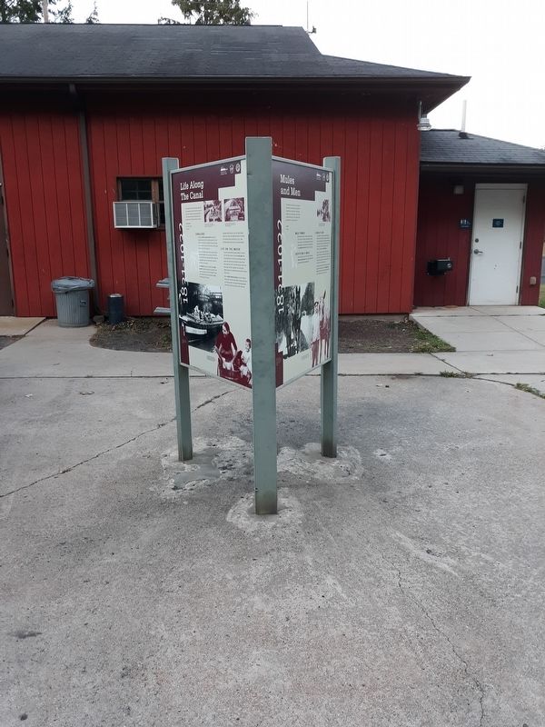
Other nearby markers. At least 8 other markers are within 2 miles of this marker, measured as the crow flies: Delaware Canal (here, next to this marker); Life Along The Canal (here, next to this marker); Canal Boats (here, next to this marker); a different marker also named Delaware Canal (a few steps from this marker); Hazzard's Bridge (approx. half a mile away); Veterans Memorial, Bridgeton Twp (approx. 1.4 miles away); Milford Railroad (approx. 1.4 miles away in New Jersey); Train Disaster (approx. 1.4 miles away in New Jersey). Touch for a list and map of all markers in Upper Black Eddy.
Credits. This page was last revised on December 31, 2020. It was originally submitted on December 30, 2020, by Craig Doda of Napoleon, Ohio. This page has been viewed 299 times since then and 20 times this year. Photos: 1, 2. submitted on December 30, 2020, by Craig Doda of Napoleon, Ohio. • Bill Pfingsten was the editor who published this page.
