Dalton in Lackawanna County, Pennsylvania — The American Northeast (Mid-Atlantic)
War Memorial
Photographed by William Fischer, Jr., December 30, 2020
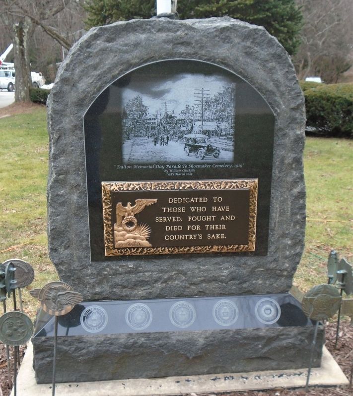
1. War Memorial
served, fought and died for
their country's sake.
[Illustration caption reads]
"Dalton Memorial Day Parade To Shoemaker Cemetery, 1919"
By William Chickillo
Vet's March 2015
Topics. This memorial is listed in this topic list: Military.
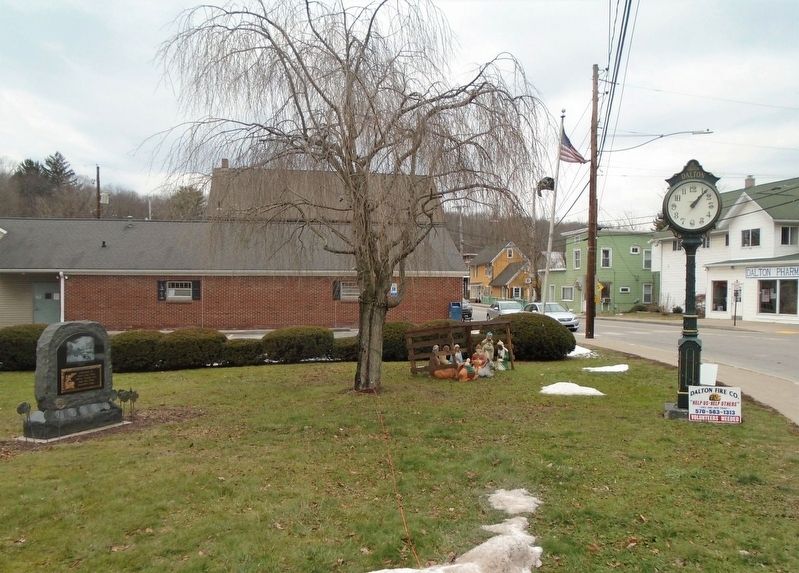
Location. 41° 32.064′ N, 75° 44.171′ W. Memorial is in Dalton, Pennsylvania, in Lackawanna County. It is at the intersection of Main Street (Pennsylvania Route 632) and Turnpike Road, on the right when traveling east on Main Street. Marker is in Dalton Memorial Park. Touch for map. Memorial is at or near this postal address: 101 West Main Street, Dalton PA 18414, United States of America. Touch for directions.

Regionally, this memorial is in the Wyoming Valley and in Greater Scranton and Wilkes-Barre. It is also in the American Northeast, in the Mid-Atlantic, in Appalachia, and specifically in Northern Appalachia. Globally, it is in North America, the Western Hemisphere, the Western World, and the Anglosphere. Historically, it finds itself in what was once the Haudenosaunee (Iroquois) Confederacy
this page online
Other nearby markers. At least 8 other markers are within 3 miles of this marker, measured as the crow flies: Margaretta Elizabeth Belin (approx. 1.7 miles away); Elder Miller (approx. 1.7 miles away); Hickory Grove Cemetery (approx. 2.3 miles away); The Northern Electric Interurban Trolley (approx. 2.3 miles away); Professor Howard D. Jennings (approx. 2.3 miles away); Station 17: Maple Sugaring (approx. 2.4 miles away); a different marker also named Professor Howard D. Jennings (approx. 2.4 miles away); History of Maple Syrup (approx. 2.4 miles away).
Photographed by William Fischer, Jr., December 30, 2020
2. War Memorial
Credits. This page was last revised on December 30, 2020. It was originally submitted on December 30, 2020, by William Fischer, Jr. of Reynoldsburg, Ohio. This page has been viewed 246 times since then and 9 times this year. Photos: 1, 2. submitted on December 30, 2020, by William Fischer, Jr. of Reynoldsburg, Ohio.
