Farmington Hills in Oakland County, Michigan — The American Midwest (Great Lakes)
John Garfield House
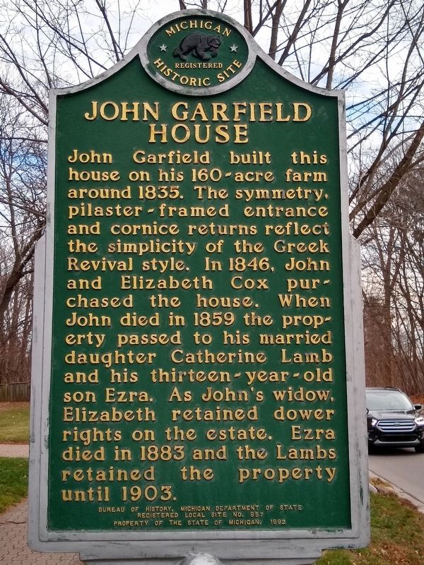
Photographed by Joel Seewald, December 23, 2020
1. John Garfield House Marker
Erected 1992 by Bureau of History, Michigan Department of State. (Marker Number L957.)
Topics and series. This historical marker is listed in these topic lists: Architecture • Notable Buildings. In addition, it is included in the Michigan Historical Commission series list. A significant historical year for this entry is 1835.
Location. 42° 30.758′ N, 83° 24.097′ W. Marker is in Farmington Hills, Michigan, in Oakland County. It is on West Thirteen Mile Road 0.2 miles west of Drake Road, on the right when traveling west. Touch for map. Marker is at or near this postal address: 35810 West Thirteen mile Road, Farmington MI 48334, United States of
this page online

Regionally, this marker is in Southeast Michigan and in Greater Detroit. It is also in the American Midwest. Globally, it is in North America, the Western Hemisphere, the Western World, and the Anglosphere. Historically, it finds itself in what was once the Northwest Territory.
Other nearby markers. At least 8 other markers are within 2 miles of this marker, measured as the crow flies: Eber Durham House (about 400 feet away, measured in a direct line); Hamilton Jones House (approx. one mile away); The Harger House (approx. one mile away); The Pettibone House (approx. one mile away); Theron Murray House (approx. 1.1 miles away); The Worker's Camp (approx. 1.1 miles away); Boorn-Halsted House (approx. 1.1 miles away); North Farmington Cemetery (approx. 1.2 miles away). Touch for a list and map of all markers in Farmington Hills.
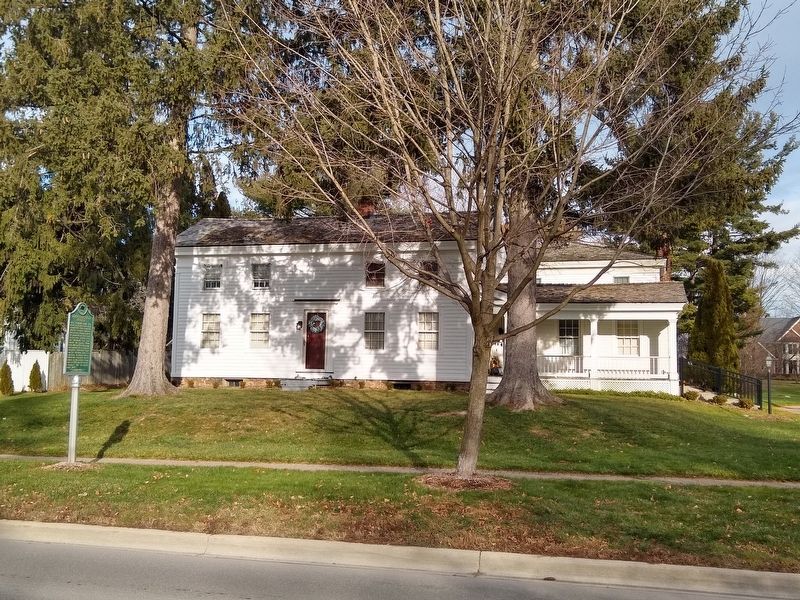
Photographed by Joel Seewald, December 23, 2020
2. John Garfield House and Marker

Photographed by Joel Seewald, December 23, 2020
3. John Garfield House and Marker
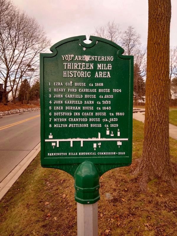
Photographed by Joel Seewald, December 23, 2020
4. Thirteen Mile Historic Area Sign
The John Garfield House is part of the Thirteen Mile Historic Area. This sign is at the east end of the historic area at Valley Bend, about 450 feet east of the John Garfield House.
Credits. This page was last revised on December 31, 2020. It was originally submitted on December 30, 2020, by Joel Seewald of Madison Heights, Michigan. This page has been viewed 1,656 times since then and 121 times this year. Photos: 1, 2, 3, 4. submitted on December 30, 2020, by Joel Seewald of Madison Heights, Michigan.
