Middlefield in Otsego County, New York — The American Northeast (Mid-Atlantic)
Mill & Water Power
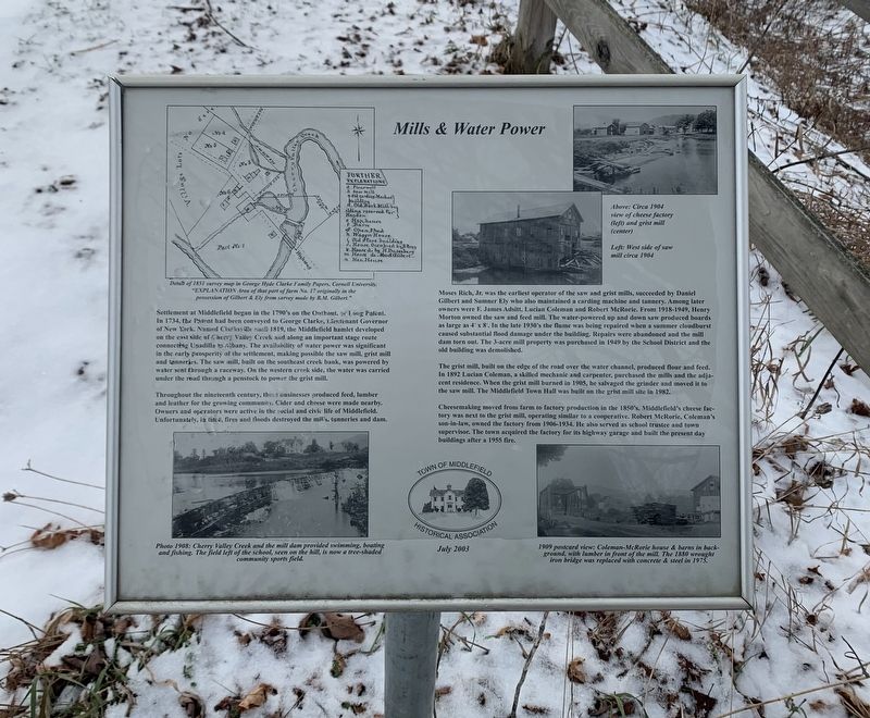
Settlement at Middlefield began in the 1790's on the Outkout, or Long Patent. In 1734, the Patent had been conveyed to George Clarke, Lieutenant Governor of New York. Named Clarksville until 1819, the Middlefield hamlet developed on the east side of Cherry Valley Creek and along an important stage route connecting Unadilla to Albany. The availability of water power was significant in the early prosperity of the settlement, making possible the saw mill, grist mill, and tanneries. The saw mill, built on the southeast creek bank, was powered bywater sent through a raceway. On the western creek side, the water was carried under the road through a penstock to power the grist mill.
Throughout the nineteenth century, these businesses produced feed, lumber and leather for the growing community. Cider and cheese were made nearby. Owners and operators were active in the social and civic life of Middlefield. Unfortunately, in time, fires and floods destroyed the mills, tanneries and dam.
Moses Rich, Jr. was the earliest operator of the saw and grist mills, succeeded by Daniel Gilbert and Sumner Ely who also maintained a carding machine and tannery. Among later owners were F. James Adsitt, Lucian Coleman and Robert McRorie. From 1918-1949, Henry Morton owned the saw and feed mill. The water-powered up and down saw produced boards as large as 4' x 8'. In the late 1930's the flume was being repaired when a summer cloudburst caused substantial flood damage under the building. Repairs were abandoned and the mill dam torn out. The 3-acre mill property was purchased in 1949 by the School District and the old building was demolished.
The grist mill, built on the edge of the road over the water channel, produced flour and feed. In 1892 Lucian Coleman, a skilled mechanic and carpenter, purchased the mills and the adjacent residence. When the grist mill burned in 1905, he salvaged the grinder and moved it to the saw mill. The Middlefield Town Hall was built on the grist mill site in 1982.
Cheesemaking moved from farm to factory production in the 1850's. Middlefield's cheese factory was next to the grist mill, operating similar to a cooperative. Robert McRorie, Coleman's son-in-law, owned the factory from 1906-1934. He also served as school trustee and town supervisor. The town acquired the factory for its highway garage and built the present day buildings after a 1955 fire.
Drawing and Photo Captions
Top Left Map: Detail of 1851 survey map in George Hyde Clarke Family Papers, Cornell University.
"EXPLANATION Area of that part of farm No. 17 originally in the possession of Gilbert & Ely from survey made by B.M. Gilbert."
Center Photo:
West side of saw mill circa 1904.
Top Right Photo: Circa 1904 view of cheese factory (left) and grist mill(center)
Bottom Right Photo: 1909 postcard view: Coleman-McRorie house & barns in background, with lumber in front of the mill. The 1880 wrought iron bridge was replaced with concrete & steel in 1975.
Bottom Left Photo: Photo 1908: Cherry Valley Creek and the mill dam provided swimming, boating and fishing. The field left of the school, seen on the hill, is now a tree-shaded community sports field.
Erected 2003 by Town of Middlefield Historical Association.
Topics. This historical marker is listed in these topic lists: Industry & Commerce • Settlements & Settlers. A significant historical date for this entry is July 19, 2003.
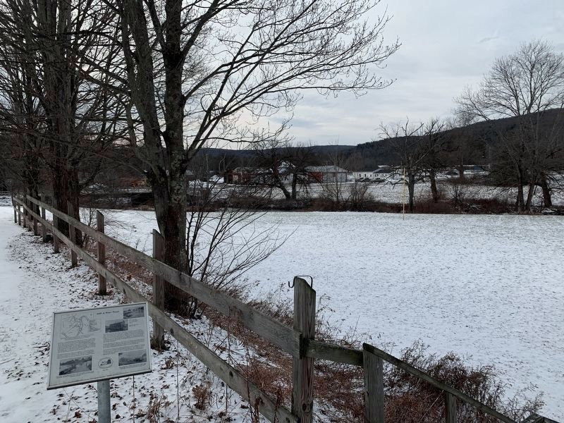
Location. 42° 41.385′ N, 74° 50.485′ W. Marker is in Middlefield, New York, in Otsego County. Marker can be reached from County Route 35, on the left when traveling east. Located next to the Town of Middlefield Historical Association Schoolhouse Museum. Touch for map. Marker is at or near this postal address: 3698 County Road 35, Roseboom NY 13450, United States of America. Touch for directions.
Other nearby markers. At least 8 other markers are within 4 miles of this marker, measured as the crow flies. District No. 1 School - Middlefield (a few steps from this marker); Middlefield War Memorial (within shouting distance of this marker); District School (about 300 feet away, measured in a direct line); Baptist Society (approx. 0.2 miles away); Middlefield Hamlet Historical District (approx. 0.2 miles away); Westford Veterans Monument (approx. 3˝ miles away); "Natty Bumpo" (approx. 3.8 miles away); Indian Grave (approx. 3.9 miles away). Touch for a list and map of all markers in Middlefield.
Also see . . . Town of Middlefield Schoolhouse Museum. Town of Middlefield Historical Association website homepage (Submitted on December 31, 2020, by Michael Herrick of Southbury, Connecticut.)
Credits. This page was last revised on November 9, 2021. It was originally submitted on December 30, 2020, by Steve Stoessel of Niskayuna, New York. This page has been viewed 96 times since then and 5 times this year. Photos: 1, 2, 3. submitted on December 30, 2020, by Steve Stoessel of Niskayuna, New York. • Michael Herrick was the editor who published this page.


