Marker Logo
THE HISTORICAL
MARKER DATABASE
“Bite-Size Bits of Local, National, and Global History”
Glendive in Dawson County, Montana — The American West (Mountains)
 

Henry Dion Building

Merrill Avenue Historic District
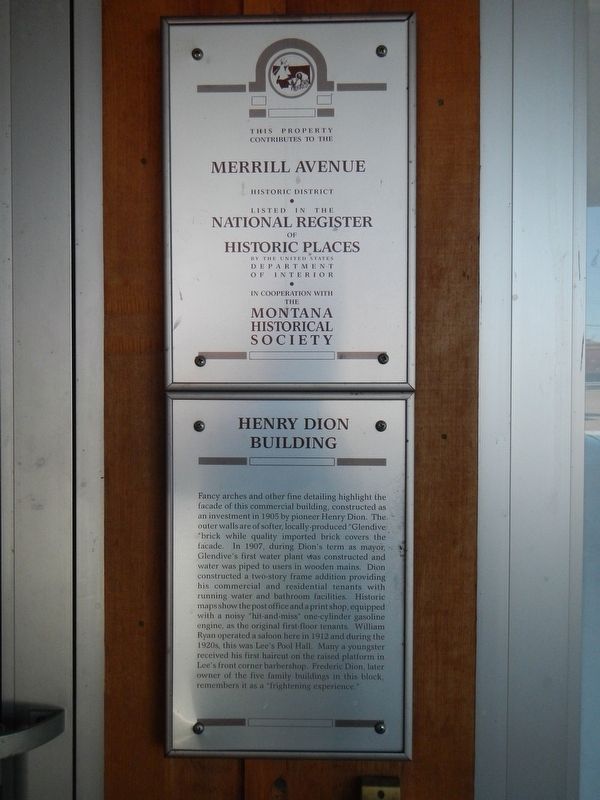
 
 
Henry Dion Building Marker image. Click for full size.
Photographed by Barry Swackhamer, September 10, 2020
1. Henry Dion Building Marker
Inscription. Fancy arches and other fine detailing highlight the façade of this commercial building, constructed as an investment in 1905 by pioneer Henry Dion. The outer walls are of softer, locally produced “Glendive brick” while quality imported brick covers the façade. In 1907, during Dion’s term as mayor, Glendive’s first water plant was constructed and water was piped to users in wooden mains. Dion constructed a two-story frame addition, providing his commercial and residential tenants with running water and bathroom facilities. Historic maps show the post office and a print shop, equipped with a noisy “hit-and-miss” one-cylinder gasoline engine, as the original first-floor tenets. William Ryan operated a saloon here in 1912 and during the 1920s, this was Lee’s Pool Hall. Many a youngster received his first haircut on the raised platform in Lee’s front corner barbershop. Frederic Dion, later owner of the five family buildings in this block, remembers it as a “frightening experience.”
 
Topics and series. This historical marker is listed in this topic list: Industry & Commerce. In addition,
Paid Advertisement
Click or scan to see
this page online
it is included in the Montana National Register Sign Program series list. A significant historical year for this entry is 1905.
 
Location. 47° 6.238′ N, 104° 42.817′ W. Marker is in Glendive, Montana, in Dawson County. It is on South Merrill Avenue near West Bell Street, on the right when traveling south. Touch for map. Marker is at or near this postal address: 114 South Merrill Avenue, Glendive MT 59330, United States of America. Touch for directions.

Regionally, this marker is in Montana’s Missouri River Country. It is also in the American Mountain West, in the Lewis & Clark Corridor, on the prairies, on the Great Plains, and specifically on the Northern Plains. Globally, it is in North America, the Western Hemisphere, the Western World, and the Anglosphere. Historically, it finds itself in what was once Rupert’s Land and also the Louisiana Purchase.

Other nearby markers. At least 8 other markers are within walking distance of this marker: Dion Brothers Building (a few steps from this marker); Dion Building / Exchange Bank (within shouting distance of this marker); 107 West Bell Street (within shouting distance of this
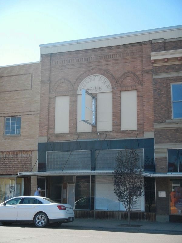
Henry Dion Building and Marker image. Click for full size.
Photographed by Barry Swackhamer, September 10, 2020
2. Henry Dion Building and Marker
The marker is on the left, above the trunk of the white automobile.
marker); J.C. Penney Store (within shouting distance of this marker); Dawson County World War Memorial (within shouting distance of this marker); Krug Building (about 300 feet away, measured in a direct line); Glendive, MT (about 400 feet away); The Price (about 500 feet away). Touch for a list and map of all markers in Glendive.
 
 
Credits. This page was last revised on December 31, 2020. It was originally submitted on December 31, 2020, by Barry Swackhamer of Brentwood, California. This page has been viewed 269 times since then and 18 times this year. Photos:   1, 2. submitted on December 31, 2020, by Barry Swackhamer of Brentwood, California.

m=163803

CeraNet Cloud Computing sponsors the Historical Marker Database.
This website earns income from purchases you make after using our links to Amazon.com. We appreciate your support.
Paid Advertisement
Jul. 31, 2026