Near Mechanicsville in Hanover County, Virginia — The American South (Mid-Atlantic)
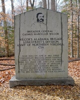
Wilcox’s Alabama Brigade,
Longstreet’s Division,
— Army of Northern Virginia, CSA —
Wilcox’s Alabama Brigade, Longstreet’s Division, Army of Northern Virginia, CSA
Near here on June 27, 1862, three Confederate brigades under General Cadmus M. Wilcox ascended this hill, broke the Union line, and later assisted in capturing a battery of artillery. Wilcox’s own Alabama brigade spearheaded the charge, losing nearly 600 men killed and wounded of the 1850 soldiers in the four regiments.
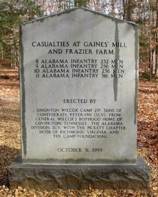
(reverse side)
Casualties at Gaines’ Mill and Frazier Farm
8 Alabama Infantry 232 men
9 Alabama Infantry 256 men
10 Alabama Infantry 236 men
11 Alabama Infantry 316 men
Erected by:
Simonton Wilcox Camp 257, Sons of Confederate Veterans (SCV), from General Wilcox’s boyhood home of Covington, Tennessee, the Alabama Division, SCV, with the Pickett Chapter, MOSB of Richmond, Virginia, and the Camp Foundations.
October 31, 1999
Erected 1999 by Sons of Confederate Veterans.
Topics and series. This historical marker is listed in this topic list: War, US Civil. In addition, it is included in the Sons of Confederate Veterans/United Confederate Veterans series list. A significant historical month for this entry is June 1991.
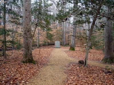
Location. 37° 34.38′ N, 77° 17.76′ W. Marker is near Mechanicsville, Virginia, in Hanover County. Marker can be reached from Watt House Road, 0.7 miles south of Cold Harbor Road (Virginia Route 156), on the right when traveling south. This monument is located on the walking trail along Boatswain Creek in the Gaines' Mill Battlefield unit of the Richmond National Battlefield Park. Touch for map. Marker is in this post office area: Mechanicsville VA 23111, United States of America. Touch for directions.
Other nearby markers. At least 8 other markers are within walking distance of this marker. Intensity of Battle (a few steps from this marker); Wilcox’s Brigade, CSA (a few steps from this marker); Union Rifle Pits (about 300 feet away, measured in a direct line); Morell’s Division, USA (about 300 feet away); Watt Farm Road (about 500 feet away); Mistaken Identity (about 600 feet away); Balloons Over the Battlefield (about 600 feet away); The Cavalry Charge (about 600 feet away). Touch for a list and map of all markers in Mechanicsville.
Also see . . .
1. CWSAC Battle Summary. Gaines’ Mill (Submitted on February 23, 2009.)
2. Gaines’ Mill Podcast. 8-stop, 1.5-mile walking tour narrated by NPS historian, Robert Krick. (Submitted on February 23, 2009.)
3. The Richmond National Parks Quarterly Newsletter. Monument Erected on Battlefield. (Submitted on February 23, 2009.)
Credits. This page was last revised on April 23, 2024. It was originally submitted on February 23, 2009. This page has been viewed 1,995 times since then and 39 times this year. Photos: 1, 2, 3. submitted on February 23, 2009.


