Near Mechanicsville in Hanover County, Virginia — The American South (Mid-Atlantic)
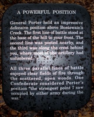
A Powerful Postion
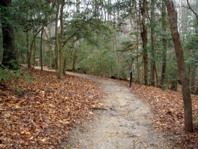
All three parallel lines of battle enjoyed clear fields of fire through the scattered, open woods. One Confederate considered Porter’s position “the strongest point I saw occupied by either army during the war.”
Erected by National Park Service.
Topics. This historical marker is listed in this topic list: War, US Civil.
Location. This marker has been replaced by another marker nearby. It was located near 37° 34.503′ N, 77° 17.523′ W. Marker was near Mechanicsville, Virginia, in Hanover County. Marker could be reached from Watt House Road, 0.7 miles south of Cold Harbor Road (Virginia Route 156), on the right when traveling south. This marker is located on the walking trail along Boatswain Creek in the Gaines' Mill Battlefield unit of the Richmond National Battlefield Park. Touch for map. Marker was in this post office area: Mechanicsville VA 23111, United States of America. Touch for directions.
Other nearby markers. At least 8 other markers are within walking distance of this location . Powerful Position (here, next to this marker); Battle of Gaines' Mill (about 300 feet away, measured in a direct line); The Battle Begins (about 300 feet away); The Union Left Flank (about 500 feet away); Hood's Attack (about 500 feet away); a different marker also named The Battle of Gaines’ Mill (about 500 feet away); Gaines' Mill (about 500 feet away); Lee’s First Victory: At a Huge Cost (about 500 feet away). Touch for a list and map of all markers in Mechanicsville.
Related marker. Click here for another marker that is related to this marker. New Marker At This Location titled "Powerful Position".
Also see . . . CWSAC Battle Summary. Gaines’ Mill (Submitted on February 23, 2009, by Bernard Fisher of Richmond, Virginia.)
Credits. This page was last revised on November 5, 2021. It was originally submitted on February 23, 2009, by Bernard Fisher of Richmond, Virginia. This page has been viewed 1,287 times since then and 10 times this year. Photos: 1, 2. submitted on February 23, 2009, by Bernard Fisher of Richmond, Virginia.

