Ragtown in San Bernardino County, California — The American West (Pacific Coastal)
Site of Ragtown
And The Buckeye Mining District
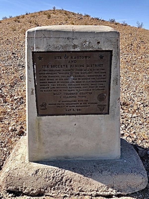
Photographed by Stephen Mersman, November 14, 2020
1. Site of Ragtown Marker
At this location, Ragtown stood as a part of the once-booming "Buckeye Mining District". One mine in the district, the Bagdad-Chase, discovered by John Suter in the 1880s, was to become the largest single source of copper and gold in San Bernardino County. The owner, Benjamin Chase, built the Ludlow and Southern Railroad, just west of here, to carry ore to the Santa Fe Railroad in Ludlow.
Billy Holcomb Chapter
E Clampus Vitus
In Cooperation with the
United States Department of the Interior
Bureau of Land Management
May 3, 1981
Erected 1981 by Billy Holcomb Chapter, E Clampus Vitus.
Topics and series. This historical marker is listed in these topic lists: Industry & Commerce • Railroads & Streetcars • Settlements & Settlers. In addition, it is included in the E Clampus Vitus series list.
Location. 34° 39.656′ N, 116° 8.876′ W. Marker is in Ragtown, California, in San Bernardino County. It is on Bagdad Chase Road 4.7 miles south of Main Street, on the right when traveling south. Touch for map. Marker is in this post office area: Ludlow CA 92338,
this page online

Regionally, this marker is in Greater Los Angeles, in the Mojave Desert, in the Peninsular Ranges, and specifically in the Transverse Ranges. It is also in the American Southwest. Globally, it is in North America, on the Ring of Fire, on the Pacific Rim, in the Western Hemisphere, in the Western World, and in the Anglosphere. Historically, it finds itself in what was once New Spain and also Mexico’s Alta California.
Other nearby markers. At least 2 other markers are within 5 miles of this marker, measured as the crow flies: Tonopah and Tidewater Railroad Shops (approx. 4.4 miles away); Project Carryall (approx. 4.4 miles away).
Credits. This page was last revised on October 16, 2025. It was originally submitted on January 2, 2021, by Craig Baker of Sylmar, California. This page has been viewed 792 times since then and 75 times this year. Photo 1. submitted on January 2, 2021, by Craig Baker of Sylmar, California. • J. Makali Bruton was the editor who published this page.
Editor’s want-list for this marker. A wide shot of the marker and its surroundings. • Can you help?
