Westerville in Franklin County, Ohio — The American Midwest (Great Lakes)
Blendon Presbyterian Church
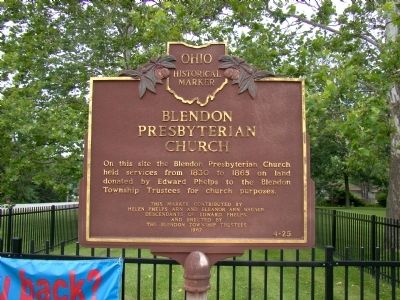
Photographed by J. J. Prats, July 12, 2008
1. Blendon Presbyterian Church Marker
Erected 1967 by The Blendon Township Trustees, and contributed by Helen Phelps and Eleanor Arn Wagner, descendants of Edward Phelps. (Marker Number 4-25.)
Topics and series. This historical marker is listed in this topic list: Religion & Religious Structures. In addition, it is included in the Ohio Historical Society / The Ohio History Connection series list. A significant historical year for this entry is 1830.
Location. This marker has been replaced by another marker nearby. It was located near 40° 5.7′ N, 82° 54.333′ W. Marker was in Westerville, Ohio, in Franklin County. It was at the intersection of South Hempstead Road and Dempsey Road, on the left when traveling north on South Hempstead Road. Touch for map. Marker was in this post office area: Westerville OH 43081, United States of America. Touch for directions.

Regionally, this marker was in the Scioto Valley and in the Columbus Metropolitan Area. It was also in the American Midwest and in
this page online
Other nearby markers. At least 8 other markers are within walking distance of this location: Blendon Township's Early Presbyterian Churches and Church Bell (a few steps from this marker); Phelps Acre Park (within shouting distance of this marker); This Monument (within shouting distance of this marker); Edward Phelps (within shouting distance of this marker); First Blendon Presbyterian Church (within shouting distance of this marker); Blendon Central Cemetery (about 500 feet away, measured in a direct line); Blendon Township War Memorial (about 500 feet away); Squire's Glen Farm (approx. 0.8 miles away). Touch for a list and map of all markers in Westerville.
Related marker. Click here for another marker that is related to this marker. This marker has been replaced by the linked marker, which has new information.
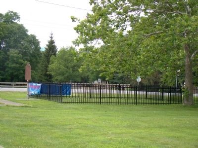
Photographed by J. J. Prats, July 12, 2008
2. Blendon Presbyterian Church Location and Marker
Credits. This page was last revised on January 5, 2021. It was originally submitted on July 26, 2008, by J. J. Prats of Powell, Ohio. This page has been viewed 1,109 times since then and 36 times this year. Last updated on January 5, 2021, by Grant & Mary Ann Fish of Galloway, Ohio. Photos: 1, 2. submitted on July 26, 2008, by J. J. Prats of Powell, Ohio. • Devry Becker Jones was the editor who published this page.
