Vienna in Fairfax County, Virginia — The American South (Mid-Atlantic)
Freeman Store and Museum
Caught in Conflict
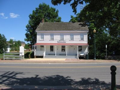
In 1859, Abram Lydecker, a New Jersey merchant, purchased land in Vienna on which to build a large combination dwelling and store. The Lydecker family was displaced early as the Civil War swirled around the small village. Vienna village changed hands many times and the Lydecker’s store and residence was occupied by both sides. Union officers were quartered here and kept their horses in the cellar. The Confederate army used it as a hospital.
The Alexandria, Loudoun and Hampshire Railroad passed nearby. A wooden bridge connected the store with the tracks. On June 17, 1861, Confederate troops ambushed and routed soldiers from four companies of the First Ohio Regiment less than one-half mile from this spot as they approached Vienna by train. The Federals, most of whom had left the train to fight, were forced to retreat on foot when the engineer hurriedly escaped with the locomotive and attached cars.
After the war, Anderson Freeman joined Lydecker, his father-in-law, in the business. When the next generation took over, it became the Freeman Store. The store closed in 1929 but remained a residence until the 1950s.
The Town of Vienna purchased the building in 1969. It was restored and opened as a museum and old-time general store. The restored building was dedicated June 6, 1976, and is operated by volunteers of Historic Vienna, Inc.
Erected by Civil War Trails.
Topics and series. This historical marker is listed in these topic lists: Railroads & Streetcars • War, US Civil. In addition, it is included in the Virginia Civil War Trails series list. A significant historical month for this entry is June 1836.
Location. 38° 54.194′ N, 77° 15.925′ W. Marker is in Vienna, Virginia, in Fairfax County. Marker is at the intersection of Church Street and Dominion Avenue, on the right when traveling north on Church Street. Touch for map. Marker is at or near this postal address: 131 Church Street NE, Vienna VA 22180, United States of America. Touch for directions.
Other nearby markers. At least 8 other markers are within walking distance of this marker. Freeman House (within shouting distance of this marker); Washington & Old Dominion Railroad Regional Park (within shouting distance of this marker); Vienna Centennial Park (within shouting distance of this marker); The Arlington & Fairfax Railway (within shouting distance of this marker); Veterans Memorial (about 500 feet away, measured in a direct line); Vienna Station (about 500 feet away); Tracks into History (about 500 feet away); Salsbury Spring (approx. 0.3 miles away). Touch for a list and map of all markers in Vienna.
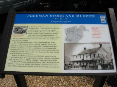
More about this marker. The marker features two pictures. The main one is a photograph from the war of the store, captioned, “The Freeman House and Store during the War.” A smaller newspaper drawing is captioned, “Fight on the railroad near Vienna, June 17, 1861.”
The marker also displays a map of Civil War related sites in Vienna.
Also see . . .
1. Historic Vienna - Freeman Store. (Submitted on July 12, 2007, by Craig Swain of Leesburg, Virginia.)
2. Civil War Sites Along the W & OD Trail. The Alexandria, Loudoun, and Hampshire became the Washington and Old Dominion Railroad, and is now a rails-to-trails park. (Submitted on July 12, 2007, by Craig Swain of Leesburg, Virginia.)

Photographed By Craig Swain, July 20, 2007
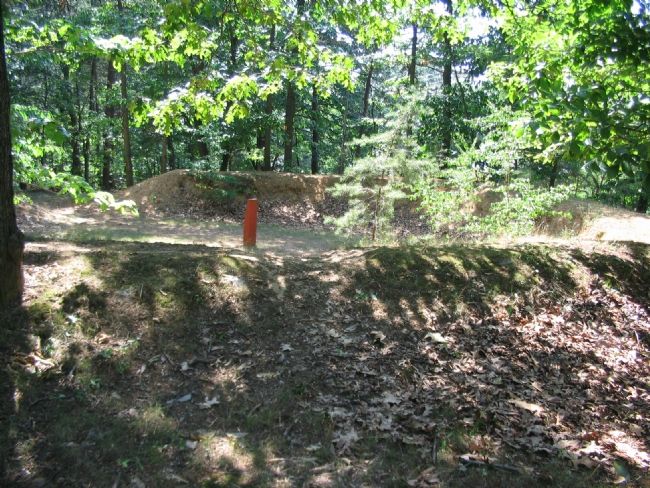
3. Freedom Hill Fort
Located to the North of Freeman Store in a park off Old Courthouse Road (Route 677), Freedom Hill Fort was constructed to defend the approaches to Vienna from the various Confederate raiders active in the area. The existing earthworks are part of an artillery position.
Credits. This page was last revised on May 20, 2022. It was originally submitted on July 12, 2007, by Craig Swain of Leesburg, Virginia. This page has been viewed 3,240 times since then and 57 times this year. Photos: 1, 2. submitted on July 12, 2007, by Craig Swain of Leesburg, Virginia. 3. submitted on July 24, 2007, by Craig Swain of Leesburg, Virginia. 4. submitted on May 28, 2018, by Devry Becker Jones of Washington, District of Columbia. • J. J. Prats was the editor who published this page.


