Quihi in Medina County, Texas — The American South (West South Central)
Early New Fountain Community
Ebenezer Methodist Church of New Fountain
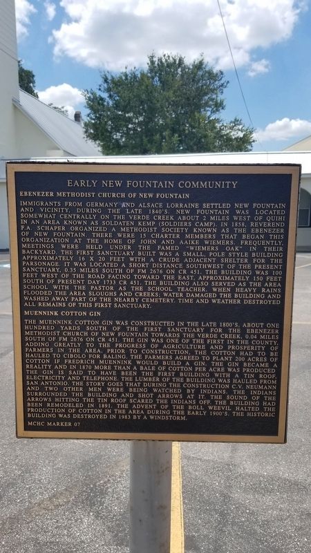
Immigrants from Germany and Alsace Lorraine settled New Fountain and vicinity, during the late 1840's. New Fountain was located somewhat centrally on the Verde Creek about 2 miles west of Quihi in an area known as Soldaten Kemp (Soldiers Camp). In 1858, Reverend F.A. Schaper organized a Methodist Society known as the Ebenezer of New Fountain. There were 15 charter members that began this organization at the home of John and Aaike Wiemers. Frequently, meetings were held under the famed "Wiemers Oak" in their backyard. The first sanctuary built was a small, pole style building approximately 16 x 20 feet with a crude adjacent shelter for the parsonage. It was located a short distance southwest of the present sanctuary, 0.35 miles south of FM 2676 on CR 451. The building was 100 feet west of the road facing toward the east. Approximately 150 feet south of present day 1733 CR 451. The building also served as the area school with the pastor as the school teacher. When heavy rains flooded the area sloughs and creeks; water damaged the building and washed away part of the nearby cemetery. Time and weather destroyed all remains of this first sanctuary.
Muennink Cotton Gin
The Muennink Cotton Gin was constructed in the late 1800's. About one hundred yards south of the first sanctuary for the Ebenezer Methodist Church of New Fountain towards the Verde Creek, 0.04 miles south of FM 2676 on CR 451. The gin was one of the first in the county, adding greatly to the progress of agriculture and prosperity of farmers in the area. Prior to construction, the cotton had to be hauled to Cibolo for baling. The farmers agreed to plant 200 acres of cotton if Fredrich Muennink would build a gin. The gin became a reality and in 1870 more than a bale of cotton per acre was produced. The gin is said to have been the first building with a tin roof, electricity and telephone. The lumber of the building was hauled from San Antonio. The story goes that during the construction C.V. Neumann and two other men were being watched by Indians. The Indians surrounded the building and shot arrows at it. The sound of the arrows hitting the tin roof scared the indians off. The building had been remodeled in 1891. The advent of the boll weevil halted the production of cotton in the area during the early 1900's. The historic building was destroyed in 1983 by a windstorm.
Erected by Medina County Historical Commission. (Marker Number 7.)
Topics. This historical marker is listed in these topic lists: Churches & Religion • Industry & Commerce. A significant historical year for this entry is 1858.
Location. 29° 23.23′
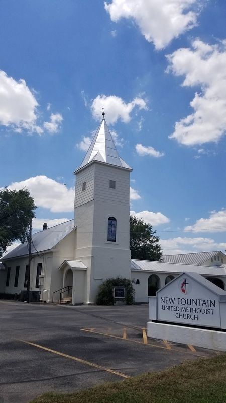
N, 99° 3.484′ W. Marker is in Quihi, Texas, in Medina County. Marker is on Farm to Market Road 2676, 0.1 miles east of County Highway 451, on the left when traveling west. The marker is located at the front of the New Fountain United Methodist Church. Touch for map. Marker is in this post office area: Hondo TX 78861, United States of America. Touch for directions.
Other nearby markers. At least 8 other markers are within 4 miles of this marker, measured as the crow flies. New Fountain United Methodist Church (here, next to this marker); Quihi Bethlehem Lutheran Church Cemetery (approx. 1.8 miles away); Bethlehem Lutheran Church (approx. 1.8 miles away); Masonic Cemetery (approx. 1.8 miles away); a different marker also named Bethlehem Lutheran Church (approx. 1.8 miles away); General Woll's Road (approx. 1.9 miles away); Town of Quihi (approx. 1.9 miles away); Vandenburg (approx. 4 miles away). Touch for a list and map of all markers in Quihi.
Credits. This page was last revised on January 10, 2021. It was originally submitted on January 10, 2021, by James Hulse of Medina, Texas. This page has been viewed 374 times since then and 30 times this year. Photos: 1, 2. submitted on January 10, 2021, by James Hulse of Medina, Texas. • J. Makali Bruton was the editor who published this page.

