Near Rosebud in Rosebud County, Montana — The American West (Mountains)
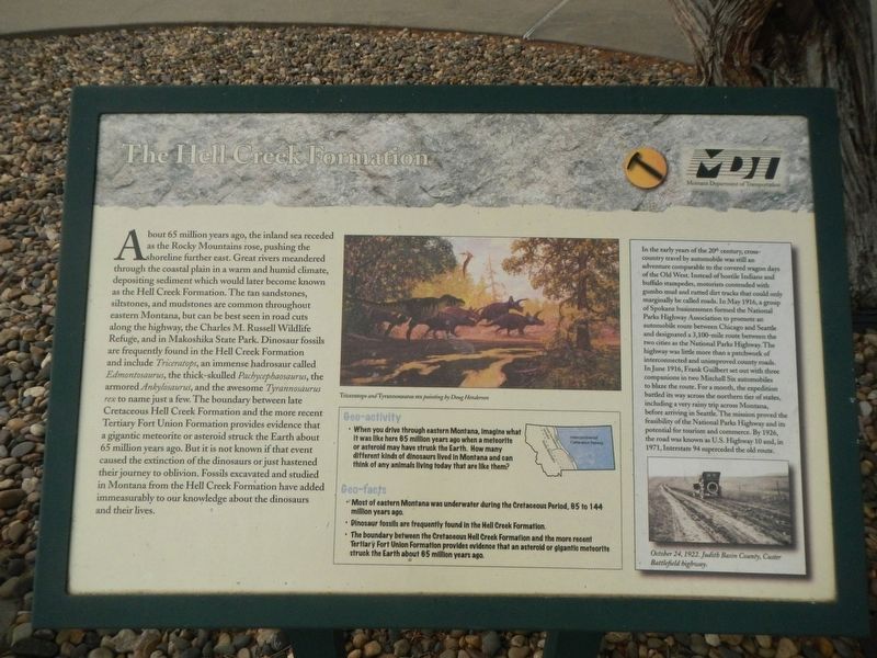
The Hell Creek Formation
Inscription.
About 65 million years ago, the inland sea receded as the Rocky Mountains rose, pushing the shoreline further east. Great rivers meandered through the coastal plain in a warm and humid climate, depositing sediment which would later become known as the Hell Creek Formation. The tan sandstones, siltstones, and mudstones are common throughout eastern Montana, but can be best seen in road cuts along the highway, the Charles M. Russell Wildlife Refuge, and the Makoshika State Park. Dinosaur fossils are frequently found in the Hell Creek Formation and include Triceratops, an immense hadrosaur called Edmontosaurus, the thick-skulled Pachycephaosaurus, the armored Ankylosaurus, and the awesome Tyrannosaurus rex to name just a few. The boundary between late Cretaceous Hell Creek Formation and the more recent Tertiary Fort Union Formation provides evidence that a gigantic meteorite or asteroid struck the Earth about 65 million years ago. But it is not known if that event caused the extinction of the dinosaurs or just hastened their journey to oblivion. Fossils excavated and studied in Montana from the Hell Creek Formation have added immeasurably to our knowledge about the dinosaurs and their lives.
Geo-activity
• When you drive through eastern Montana, imagine what it was like here 65 million years ago when a meteorite or asteroid may have struck the Earth. How many different kinds of dinosaurs lived in Montana and can (you) think of any animals living today that are like them?
Geo-facts
• Most of eastern Montana was underwater during the Cretaceous Period, 65 to 144 million years ago.
• Dinosaur fossils are frequently found in the Hell Creek Formation.
• The boundary between the Cretaceous Hell Creek Formation and the more recent Tertiary Fort Union Formation provides evidence that an asteroid or gigantic meteorite struck the Earth about 65 million years ago.
(side-bar on the right:)
In the early years of the 20th century, cross-country travel by automobile was still an adventure comparable to the covered wagon days of the Old West. Instead of hostile Indians and buffalo stampedes, motorists contended with gumbo mud and rutted dirt tracks that could only marginally be called roads. In May 1916, a group of Spokane businessmen formed the National Parks Highway Association to promote an automobile route between Chicago and Seattle and designated a 3,000-mile route between the two cities as the National Parks Highway. The highway was little more than a patchwork of interconnected and unimproved county roads. In June 1916, Frank Guilbert set out with three companions in two Mitchell Six automobiles
to blaze the route. For a month, the expedition battled its way across the northern tier of states, including a very rainy trip across Montana, before arriving in Seattle. The mission prove the feasibility of the National Parks Highway and its potential for tourism and commerce. By 1926, the road was known as U.S. Highway 10 and, in 1971, Interstate 94 superseded the old route.
Erected by Montana Department of Transportation.
Topics. This historical marker is listed in these topic lists: Paleontology • Roads & Vehicles.
Location. 46° 16.142′ N, 106° 18.387′ W. Marker is near Rosebud, Montana, in Rosebud County. Marker can be reached from Interstate 94 at milepost 117, on the right when traveling west. The marker is located at the Hathaway Rest Area Westbound. Touch for map. Marker is in this post office area: Rosebud MT 59347, United States of America. Touch for directions.
Other nearby markers. At least 8 other markers are within 8 miles of this marker, measured as the crow flies. Join the Voyage of Discovery (here, next to this marker); Cattle Brands (within shouting distance of this marker); Rosebud (within shouting distance of this marker); The Miles City Air Force Station (approx. 1.4 miles away); Scouting South of the Yellowstone (approx. 5.8 miles away); St. Philip's Episcopal Church (approx. 6.4 miles away); The Seventh Passes in Review (approx. 6.6 miles away); Rosebud Creek (approx. 8.1 miles away). Touch for a list and map of all markers in Rosebud.
Credits. This page was last revised on January 12, 2021. It was originally submitted on January 12, 2021, by Barry Swackhamer of Brentwood, California. This page has been viewed 252 times since then and 29 times this year. Photos: 1, 2. submitted on January 12, 2021, by Barry Swackhamer of Brentwood, California.

