Near Rosebud in Rosebud County, Montana — The American West (Mountains)
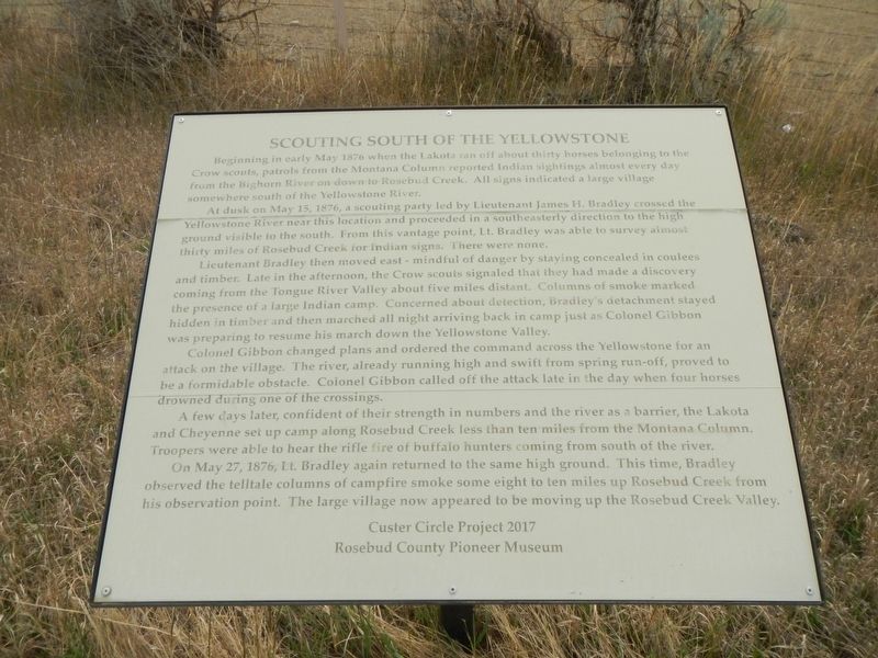
Scouting South of the Yellowstone
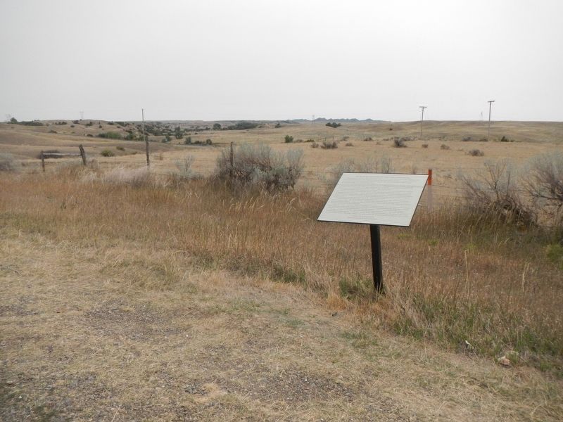
At dusk on May 15, 1876, a scouting party led by Lieutenant James H. Bradley crossed the Yellowstone River near this location and proceeded in a southeasterly direction to the high ground visible to the south. From this vantage point, Lt. Bradley was able to survey almost thirty miles of Rosebud Creek for Indian signs. There were none.
Lieutenant Bradley then moved east - mindful of danger by staying concealed in coulees and timber. Late in the afternoon, the Crow scouts signaled that they had made a discovery coming from the Tongue River Valley about five mile distant. Columns of smoke marked the presence of a large Indian camp. Concerned about detection, Bradley's detachment stayed hidden in timber and then marched all night arriving back in camp just as Colonel Gibbon was preparing to resume his march down the Yellowstone Valley.
Colonel Gibbon changed plans and ordered the command across the Yellowstone for an attack on the village. The river, already running high and swift from spring run-off, proved to be a formidable obstacle. Colonel Gibbon called off the attack late in the day when four horses drowned during one of the crossings.
A few days later, confident of their strength in numbers and the river as a barrier, the Lakota and Cheyenne set up camp along Rosebud Creek less than ten miles from the Montana Column. Troopers wee able to hear the rifle fire of buffalo hunters coming from south of the river.
On May 27, 1876, Lt. Bradley again returned to the same high ground. This time, Bradley observed the telltale columns of campfire smoke sone eight to ten miles up Rosebud Creek from his observation point. The large village now appeared to be moving up there Rosebud Creek Valley.
Erected 2017 by Custer Circle Project 2017 and Rosebud County Pioneer Museum.
Topics. This historical marker is listed in this topic list: Wars, US Indian. A significant historical date for this entry is May 15, 1876.
Location. 46° 16.159′ N, 106° 25.694′ W. Marker is near Rosebud, Montana, in Rosebud County. Marker is on Frontage Road/Old Highway 10 near Interstate 94, on the left when traveling west. The marker is on the frontage road just off the Interstate 94 exit at milepost 106. Touch for map. Marker is in this post office area: Rosebud MT 59347, United States of America. Touch for directions.
Other nearby markers. At least 8 other markers are within 6 miles of this marker, measured as the crow flies. St. Philip's Episcopal Church (approx. ¾ mile away); The Seventh Passes in Review (approx. 0.9 miles away); Rosebud Creek (approx. 2.4 miles away); Ready to March (approx. 2.8 miles away); Join the Voyage of Discovery (approx. 5.8 miles away); The Hell Creek Formation (approx. 5.8 miles away); Cattle Brands (approx. 5.8 miles away); Rosebud (approx. 5.8 miles away). Touch for a list and map of all markers in Rosebud.
Credits. This page was last revised on January 12, 2021. It was originally submitted on January 12, 2021, by Barry Swackhamer of Brentwood, California. This page has been viewed 252 times since then and 33 times this year. Photos: 1, 2. submitted on January 12, 2021, by Barry Swackhamer of Brentwood, California.

