Red Hook in Dutchess County, New York — The American Northeast (Mid-Atlantic)
Building the Bridge
Bridge Structure
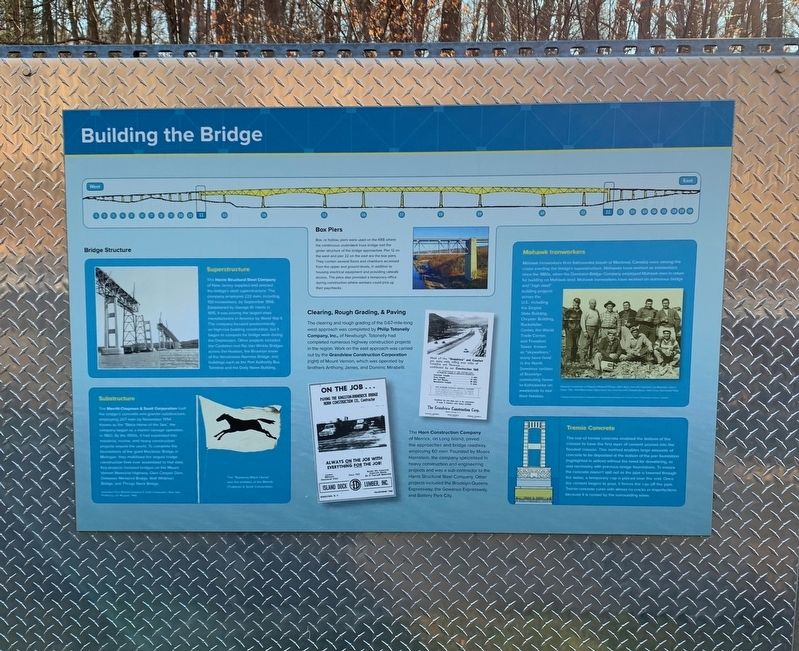
Superstructure
The Harris Structural Steel Company of New Jersey supplied and erected the bridge's steel superstructure. The company employed 222 men, including 150 ironworkers by September 1956. Established by George W. Harris in 1915, it was among the largest steel manufacturers in America by World War II. The company focused predominantly on high-rise building construction, but it began to compete for bridge work during the Depression. Other projects included the Castleton and Rip Van Winkle Bridges across the Hudson, the Brooklyn tower of the Verrazzano Narrows Bridge, and buildings such as the Port Authority Bus Terminal and the Daily News Building.
Substructure
The Merritt-Chapman & Scott Corporation built the bridge's concrete and granite substructure employing 207 men by November 1954. Known as the "Black Horse of the Sea” the company began as a marine salvage operation in 1860. By the 1950s, it had expanded into industrial, marine, and heavy construction projects around the world. To complete the foundations of the giant Mackinac Bridge in Michigan, they mobilized the largest bridge construction fleet ever assembled to that date. Key projects included bridges on the Mount Vernon Memorial Highway, Glen Canyon Dam, Delaware Memorial Bridge, Walt Whitman, and Bridge, and Throgs Neck Bridge
Photo Caption: The "Runaway Black Horse" was the emblem of the Mermitt-Chapman & Scott Corporation.
Box Piers
Box, or hollow, piers were used on the KRB where the continuous underdeck truss bridge met the girder structure of the bridge approaches. Pier 12 on the west and Pier 22 on the east are the box piers. They contain several floors and chambers accessed from the upper and ground levels, in addition to housing electrical equipment and providing catwalk access. The piers also provided a temporary office during construction where workers could pick up their paychecks.
Clearing, Rough Grading, & Paving
The clearing and rough grading of the 0.67-mile-long west approach was completed by Philip Totonelly Company, Inc., of Newburgh. Totonelly had completed numerous highway construction projects in the region. Work on the east approach was carried out by the Grandview Construction Corporation (right) of Mount Vernon, which was operated by brothers Anthony, James, and Dominic Mirabelli.
The Horn Construction Company of Merrick, on Long Island, paved the approaches and bridge roadway, employing 60 men. Founded by Moses Hornstein, the company specialized in heavy construction and engineering projects and was a sub-contractor to the Harris Structural Steel Company. Other projects included the Brooklyn-Queens Expressway, the Gowanus Expressway, and Battery Park City.
Mohawk Ironworkers
Mohawk ironworkers from Kahnawake (south of Montreal Canada) were among the crews erecting the bridge's superstructure. Mohawks have worked as ironworkers since the 1880s, when the Dominion Bridge Company employed Mohawk men in return for building on Mohawk land. Mohawk ironworkers have worked on numerous bridge and "high steel” building projects across the US, including the Empire State Building, Chrysler Building, Rockefeller Center, the World Trade Center, and Freedom Tower. Known as "skywalkers" many have lived Gowanus section of Brooklyn commuting home to Kahnawake on weekends to see their families.
Tremie Concrete
The use of tremie concrete enabied the bottom of the caisson to have the first layer of cement poured into the flooded caisson. This method enables large amounts of concrete to be deposited at the bottom of the pier foundation (highlighted in yellow) without the need for dewatering, as was necessary with previous bridge foundations. To ensure the concrete doesn't spill out as the pipe is lowered through the water, a temporary cap is placed over the end. Once the cement begins to pour, it forces the cap off the pipe. Tremie concrete cures with almost no cracks or imperfections because it is cooled by the surrounding water.
Topics. This historical marker is listed in this topic list: Bridges & Viaducts. A significant historical month for this entry is September 1956.
Location. 41° 58.372′ N, 73° 55.847′ W. Marker is in Red Hook, New York, in Dutchess County. Marker is on New York State Route 199, half a mile west of River Road (County Route 103), on the right. Touch for map. Marker is in this post office area: Red Hook NY 12571, United States of America. Touch for directions.
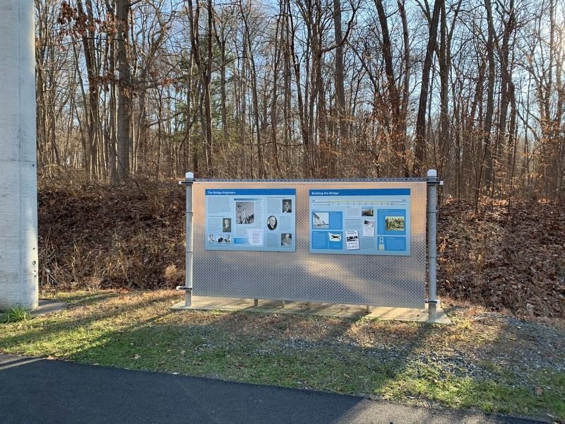
Other nearby markers. At least 8 other markers are within 4 miles of this marker, measured as the crow flies. The Bridge Engineers (here, next to this marker); The New York State Bridge Authority (about 300 feet away, measured in a direct line); Scenic Splendor Unsurpassed Anywhere (about 300 feet away); Hudson River National Historic Landmark District (approx. ¾ mile away); Old Rhinebeck (approx. 2.2 miles away); St. Margaret's (approx. 2½ miles away); David Van Ness (approx. 3.1 miles away); Hendricks House (approx. 3.1 miles away). Touch for a list and map of all markers in Red Hook.
Credits. This page was last revised on January 15, 2021. It was originally submitted on January 7, 2021, by Steve Stoessel of Niskayuna, New York. This page has been viewed 242 times since then and 88 times this year. Last updated on January 12, 2021, by Steve Stoessel of Niskayuna, New York. Photos: 1, 2. submitted on January 7, 2021, by Steve Stoessel of Niskayuna, New York. • Michael Herrick was the editor who published this page.

