Harrisonburg, Virginia — The American South (Mid-Atlantic)
Court Square & Springhouse
Temporary Prison Camp

Photographed by Mark Parker, December 19, 2024
1. Court Square & Springhouse Marker
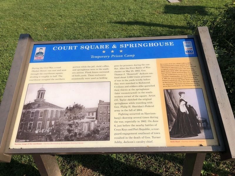
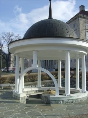
During the Civil War, a road (Market Street) ran east and west through the courthouse square, dividing it roughly in half. The courthouse occupied the northern portion while the jail, clerk’s office, and springhouse were in the southern section. Plank fences surrounded both yards. These enclosures occasionally were used as holding pens for prisoners during the conflict. After the First Battle of Winchester on May 25, 1862, Gen. Thomas J. “Stonewall” Jackson confined about 2,000 Union prisoners of war in the yards briefly before they were marched to Richmond. Civilians and soldiers alike quenched their thirsts at the springhouse (later reconstructed) in the southwestern corner of the square. Artist J.E. Taylor sketched the original springhouse while traveling with Gen. Philip H. Sheridan’s Federal army in the fall of 1864.
Fighting occurred on Harrisonburg’s doorstep several times during the war, especially in 1862/. On June 6, just before the nearby battles of Cross keys and Port Republic, a rearguard engagement southeast of town resulted in the death of Gen. Turner Ashby, Jackson’s cavalry chief.
(Sidebar):
For a town of its size (about 1,400 in 1860), Harrisonburg had a large number of hotels, reflecting its importance as the county seat and a regional commercial center. The American Hotel (built about 1820), also known as McMahon’s Tavern, which stood on main Street opposite the southeastern corner of the square, was a popular stopping place during the war. On June 5, 1863, the local newspaper reported that the famous Confederate spy, Belle Boyd, had “been in Harrisonburg for a few days past, stopping at the American.” The hotel was destroyed in the great Harrisonburg fire on Christmas Day, 1870
Erected by Shenandoah
this page online
Topics and series. This historical marker is listed in this topic list: War, US Civil. In addition, it is included in the Virginia Civil War Trails series list. A significant historical month for this entry is May 1863.
Location. 38° 26.95′ N, 78° 52.131′ W. Marker is in Harrisonburg, Virginia. It is on Main Street (Business U.S. 11), on the left when traveling north. Touch for map. Marker is in this post office area: Harrisonburg VA 22801, United States of America. Touch for directions.

Regionally, this marker is in the Shenandoah Valley. It is also in the American South and specifically in the Upper South. Globally, it is in North America, the Western Hemisphere, the Western World, and the Anglosphere. Historically, it finds itself in what was once the territory of the Mississippian Culture, one of the original Thirteen Colonies, one of the Confederate States of America, and the Antebellum South.
Other nearby markers. At least 8 other markers are within walking distance of this marker: Charlotte Harris Lynched (here, next to this marker); Rockingham County Vietnam Memorial
Photographed by Devry Becker Jones (CC0), October 17, 2020
2. Court Square & Springhouse Marker
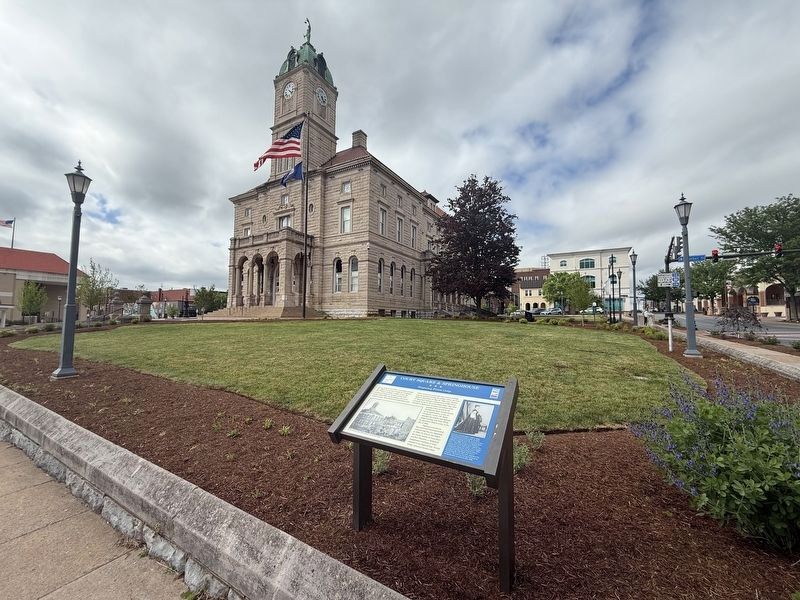
This is a previous iteration of the marker. Note that the inscription is identical although formatting is slightly different.
Another marker is no longer nearby. Rockingham County Vietnam Memorial (was within shouting distance of this marker but has been replaced with another marker now near it).
More about this marker. On the left is a Wartime courthouse photo (1834 courthouse, Harrisonburg’s third). To the right is a portrait of Belle Boyd in the sidebar.
Photographed by Robert H. Moore, II, February 26, 2009
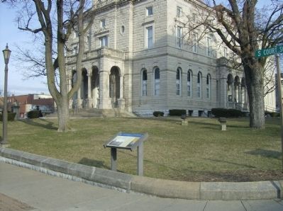
4. Court Square & Springhouse Marker as seen in front of the modern courthouse
Photographed by Robert H. Moore, II, February 26, 2009
5. Reconstructed springhouse
Credits. This page was last revised on May 2, 2026. It was originally submitted on February 26, 2009, by Robert H. Moore, II of Winchester, Virginia. This page has been viewed 3,085 times since then and 181 times this year. Photos: 1. submitted on January 16, 2025, by Mark Parker of Hickory, North Carolina. 2. submitted on October 18, 2020, by Devry Becker Jones of Washington, District of Columbia. 3. submitted on May 2, 2026, by Devry Becker Jones of Washington, District of Columbia. 4, 5. submitted on February 26, 2009, by Robert H. Moore, II of Winchester, Virginia. • Craig Swain was the editor who published this page.
