Ennis in Ellis County, Texas — The American South (West South Central)
Ennis City Hall
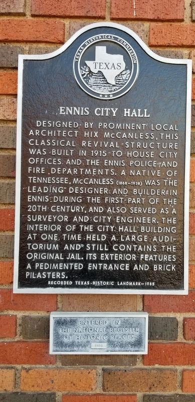
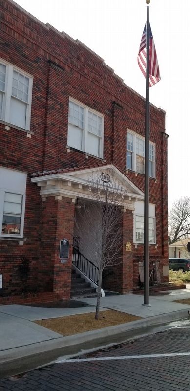
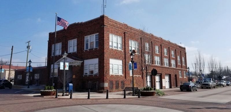
Designed by prominent local architect Hix McCanless, this Classical Revival structure was built in 1915 to house city offices and the Ennis police and fire departments. A native of Tennessee, McCanless (1868-1938) was the leading designer and builder in Ennis during the first part of the 20th century, and also served as a surveyor and city engineer. The interior of the city hall building at one time held a large auditorium and still contains the original jail. Its exterior features a pedimented entrance and brick pilasters.
Recorded Texas Historic Landmark - 1985
Entered in the National Register of Historic Places 1986
Erected 1985 by Texas Historical Commission. (Marker Number 7097.)
Topics. This historical marker is listed in these topic lists: Industry & Commerce • Law Enforcement. A significant historical year for this entry is 1915.
Location. 32° 19.592′ N, 96° 37.638′ W. Marker is in Ennis, Texas, in Ellis County. Marker is at the intersection of West Brown Street and South Dallas Street, on the left when traveling west on West Brown Street. Touch for map. Marker is at or near this postal address: 109 West Brown Street, Ennis TX 75119, United States of America. Touch for directions.
Other nearby markers. At least 8 other markers are within walking distance of this marker. Ennis National Bank Building (about 400 feet away, measured in a direct line); Town of Ennis (about 600 feet away); Minnie McDowal (about 700 feet away); Railroads in Ennis (about 700 feet away); LaJuan Schlegel (about 700 feet away); The Southern Pacific Railroad in Ennis (about 700 feet away); Pierce Park (about 800 feet away); Katie Daffan (approx. 0.2 miles away). Touch for a list and map of all markers in Ennis.
Also see . . . Ennis Texas. Between 1874 and 1890, the population of Ennis grew tenfold from approximately 300 to 3,000. Many of the new settlers came from the war-torn Confederate States of America and others came from the war-ravaged European nations that later became Czechoslovakia.[6] This early growth was attributed to the success of cotton production in the region, making Ennis a center of trade and commerce for both farmers and the railroad. The influx of Czech migrants would also shape and transform the cultural heritage of the community for years to come. Source: Wikipedia (Submitted on January 17, 2021, by James Hulse of Medina, Texas.)
Credits. This page was last revised on January 18, 2021. It was originally submitted on January 17, 2021, by James Hulse of Medina, Texas. This page has been viewed 242 times since then and 23 times this year. Photos: 1, 2, 3. submitted on January 17, 2021, by James Hulse of Medina, Texas. • J. Makali Bruton was the editor who published this page.


