Simpson Methodist Church Cemetery
Established 1876
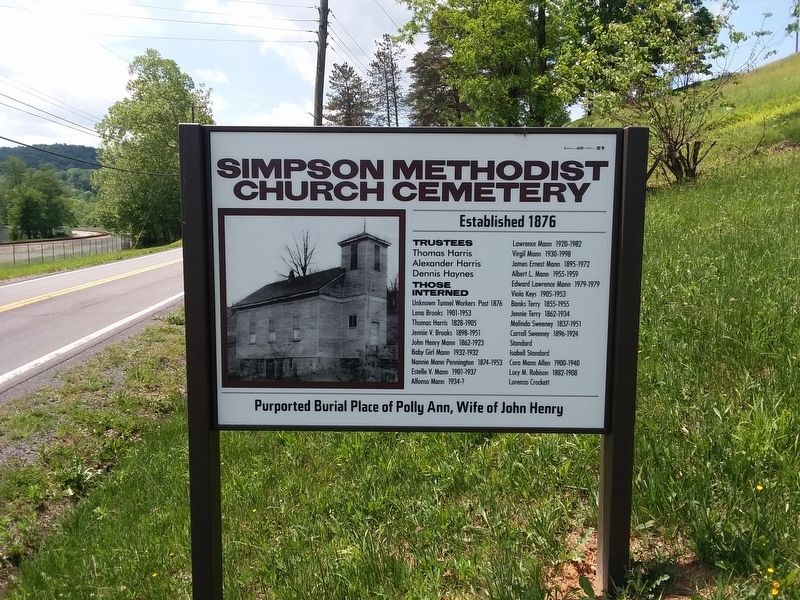
Trustees
Thomas Harris • Alexander Harris • Dennis Haynes •
Those
Interned
Unknown Tunnel Workers Post 1876 •
Lena Brooks 1901-1953 •
Thomas Harris 1828-1905 •
Jennie V. Brooks 1898-1951 •
John Henry Mann 1862-1923 •
Baby Girl Mann 1932-1932 •
Nannie Mann Pennington 1874-1953 •
Estelle V. Mann 1901-1937 •
Alfonso Mann 1934-? •
Lawrence Mann 1920-1982 •
Virgil Mann 1930-1998 •
James Ernest Mann 1895-1972 •
Albert L. Mann 1955-1959 •
Edward Lawrence Mann 1979-1979 •
Viola Keys 1905-1953 •
Banks Terry 1855-1955 •
Jennie Terry 1862-1934 •
Malinda Sweeney 1837-1951 •
Carroll Sweeney 1896-1924 •
Standard •
Isabell Standard •
Cora Mann Allen 1900-1940 •
Lucy M. Robison 1882-1908 •
Lorenzo Crockett
Purported Burial Place of Polly Ann, Wife of John Henry
Topics. This historical marker is listed in these topic lists: African Americans • Cemeteries & Burial Sites • Railroads & Streetcars • Religion & Religious Structures. A significant historical year for this entry is 1876.
Location. 37° 39.099′ N, 80° 45.286′ W. Marker is in Talcott, West Virginia, in Summers County. It is on West
this page online

Regionally, this marker is in the Southern Coalfields. It is also in the American South, specifically in the Upper South, in Appalachia, and specifically in Southern Appalachia. Globally, it is in North America, the Western Hemisphere, the Western World, and the Anglosphere. Historically, it finds itself in what was once the territory of the Mississippian Culture.
Other nearby markers. At least 8 other markers are within walking distance of this marker: John Henry Historical Park (approx. 0.4 miles away); Keaton Exhibit (approx. 0.4 miles away); John Henry (approx. 0.4 miles away); Hungards Creek Trestle (approx. half a mile away); John Henry Burial Site (approx. half a mile away); Big Bend Engineering Building (approx. 0.6 miles away); Tunnel Construction Technology Improves (approx. 0.6 miles away); Great Bend Tunnel Construction
Credits. This page was last revised on January 23, 2021. It was originally submitted on January 20, 2021, by Craig Doda of Napoleon, Ohio. This page has been viewed 437 times since then and 27 times this year. Photos: 1, 2. submitted on January 20, 2021, by Craig Doda of Napoleon, Ohio. • Devry Becker Jones was the editor who published this page.
