Thurmond in Fayette County, West Virginia — The American South (Appalachia)
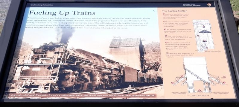
Fueling Up Trains
New River Gorge National River
| — | National Park Service, U.S. Department of the Interior | — |
Photographed by Craig Doda, February 16, 2020
1. Fueling Up Trains Marker
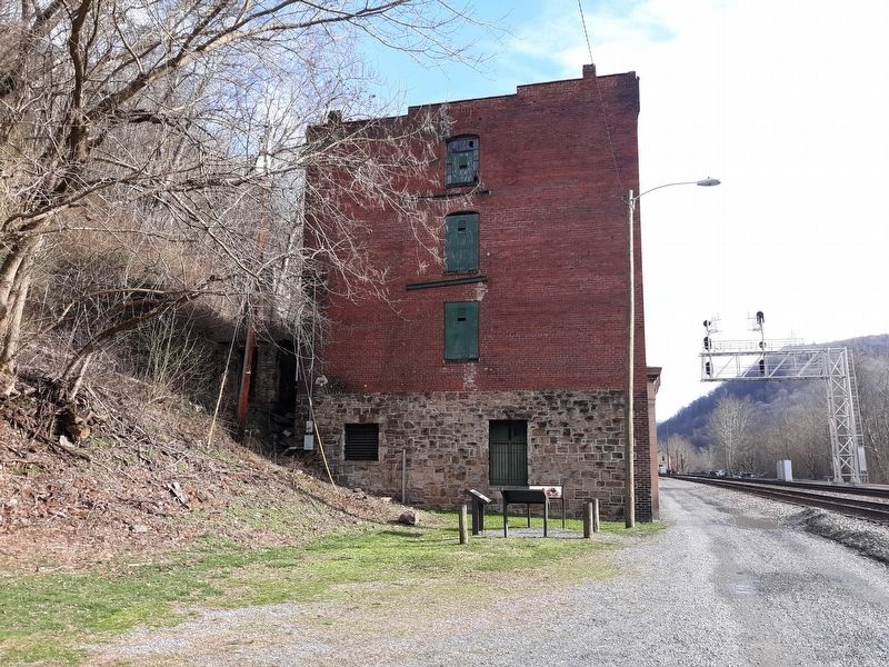
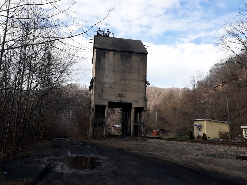
A major use of coal was as fuel for steam trains. Coal was used to heat the water in the boiler of each locomotive, making steam that powered the train engines. As one of the few places in the gorge where locomotives could be refueled, the coaling station was one of the most important structures in town. This tall building not only supplied locomotives with coal, but also replenished these huge machines with sand, which was used to enhance a train's traction abilities while moving along the rail lines. Trains were resupplied with water at a water column just up the tracks.
The Coaling Station
1. Coal to be used as locomotive fuel was off-loaded from a train car into the receiving hopper below the tracks.
2. Coal was sent by conveyor to a roll crusher, then to the boot where buckets collected the crushed coal.
3. An elevator transported these loaded buckets of coal to the top of the station.
4. Coal was dumped into a feeder chute that directed it into one of two storage bins.
5. Coal was dispensed into a locomotive's fuel tender from above through adjustable gates on either side of this structure.
6. Sandwas also dispensed into the locomotives, used for train traction.
Click or scan to see
this page online
Erected by National Park Service, U.S. Department of the Interior.
Topics. This historical marker is listed in these topic lists: Industry & Commerce • Notable Places • Railroads & Streetcars.
Location. 37° 57.583′ N, 81° 4.883′ W. Marker is in Thurmond, West Virginia, in Fayette County. It is on Thurmond Road (County Road 25/2) 0.2 miles north of Beury Mountain Road (County Road 25/2), on the right when traveling north. Touch for map. Marker is at or near this postal address: 144 Beury Mountain Rd, Thurmond WV 25936, United States of America. Touch for directions.

Regionally, this marker is in the New River Gorge and in Greater Charleston Area. It is also in the American South, specifically in the Upper South, in Appalachia, and specifically in Southern Appalachia. Globally, it is in North America, the Western Hemisphere, the Western World, and the Anglosphere. Historically, it finds itself in what was once the territory of the Mississippian Culture.
Other nearby markers. At least 8 other

Photographed by Tom Bosse, September 20, 2025
2. Fueling Up Trains Marker
Other markers no longer nearby. Thurmond’s Decline (was about 400 feet away, measured in a direct line but has been permanently removed); The Heart of Town (was about 400 feet away but has been permanently removed); The Railroad Was the Town (was about 400 feet away but has been permanently removed).
Photographed by Craig Doda, February 16, 2020
3. Fueling Up Trains Marker
Photographed by Craig Doda, February 16, 2020
4. Fueling Up Trains Marker
Photographed by Craig Doda, February 16, 2020
5. Fueling Up Trains Marker
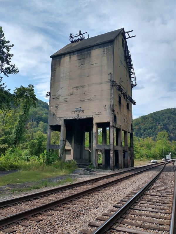
Photographed by Tom Bosse, September 20, 2025
6. The Coaling Station
Credits. This page was last revised on February 3, 2026. It was originally submitted on January 21, 2021, by Craig Doda of Napoleon, Ohio. This page has been viewed 344 times since then and 13 times this year. Photos: 1. submitted on January 21, 2021, by Craig Doda of Napoleon, Ohio. 2. submitted on February 2, 2026, by Tom Bosse of Jefferson City, Tennessee. 3, 4, 5. submitted on January 21, 2021, by Craig Doda of Napoleon, Ohio. 6. submitted on February 2, 2026, by Tom Bosse of Jefferson City, Tennessee. • Devry Becker Jones was the editor who published this page.
