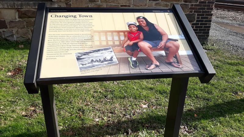
Changing Town
New River Gorge National River
— National Park Service, U.S. Department of the Interior —
As access to places outside the gorge improved, Thurmond's importance declined. Area coal mines also declined in productivity. The most significant changes, however, came by 1949 when the nation's railroad industry had switched from steam to diesel-powered engines. As a major center for C&O Railway's steam locomotive operations, Thurmond was the final place on this line to service steam trains. Eventually, these train facilities were no longer needed.
Over the years, town businesses closed or moved away, as did many residents. But as coal production in the gorge continued to decline, a new outdoor recreation industry grew. The first whitewater boating company, Wildwater, opened here in 1968. Other whitewater rafting businesses later followed. In 1978, the National Park Service established New River Gorge National River. This park preserves not only the nature, scenery, and recreational opportunities of the gorge, but also interprets historic communities like Thurmond for the enjoyment of present and future generations.
Erected by National Park Service, U.S. Department of the Interior.
Topics. This historical marker is listed in these topic lists: Industry & Commerce • Railroads & Streetcars • Waterways & Vessels. A significant historical year for this entry is 1949.
Location.
Other nearby markers. At least 8 other markers are within walking distance of this marker. A Town Built on Top of Itself (within shouting distance of this marker); Fueling Up Trains (within shouting distance of this marker); July 2013 (about 400 feet away, measured in a direct line); 1998 (about 400 feet away); 1995 (about 400 feet away); 1995 - 1998 (about 400 feet away); a different marker also named 1995 (about 400 feet away); 1993 (about 400 feet away). Touch for a list and map of all markers in Thurmond.
Credits. This page was last revised on January 21, 2021. It was originally submitted on January 21, 2021, by Craig Doda of Napoleon, Ohio. This page has been viewed 113 times since then and 9 times this year. Photos: 1, 2. submitted on January 21, 2021, by Craig Doda of Napoleon, Ohio. • Devry Becker Jones was the editor who published this page.

