Near Ashland City in Cheatham County, Tennessee — The American South (East South Central)
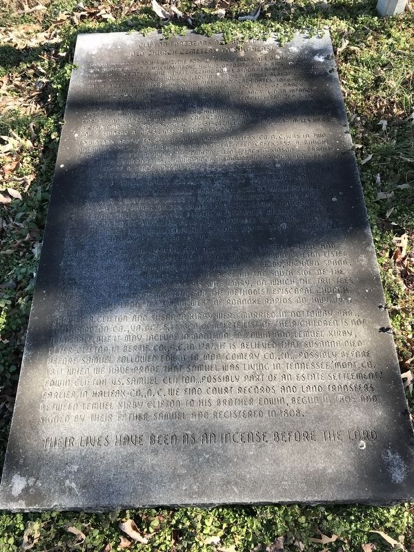
Clifton Forebears are Buried in Old Church Cemetery to Southeast
Inscription.
Edwin Clifton and his wife, the former Nancy Folks are buried in the old cemetery on a hillside above Hwy.12, opposite the spring used by the early members when their meeting house stood nearby. Many graves there are not marked; however, Edwin's father, Samuel Albert Clifton has a mice tall marker giving his birth and death dates: 10-6-1743 — 5-19-1834. He outlived son Edwin who died in 1826 age 62, Nancy b. 11-14-1772 d. age 68 in 1840. Their children were: Samuel d. in infancy; Martha b. c1796 mar. a Mr. James; Wm. b. 1793; Lemuel Kirby 2nd b. 1801; Mary b. c1803 mar. Joseph Smith; Benj. Mince b. 1804. These children were born in Halifax Co., N.C. The other children born near this spot in early Tenn. home on Half Pone Creek: James Mallory b. 1810; Hester Ann b. c1812 mar. Mr. blank Rogers; Isaac b. c1815; Rebecca b. c1817 mar. Miles Harris; Edward Lindsey b. c1818; Joseph John b. c1819.
Edwin and Nancy Folks Clifton's home in Halifax Co., N.C. was in two adjoining tracts, both bordering on Great/Deep Creek; 558 a. bought from John Sledge bounded by Edward Elliott, Jack Atkinson, blankBradley, blankJenkins, Edward Elms, the windings of Mountain Branch and Great Creek. The 147 a. place bought from Edward Elms was bounded by Henry Haws, Edwin Clifton's 558 a. place, Benj. Williamson, later Isaac Edward's property, Great Creek, and later by Jesse A. Faulcon.
On Nov. 16, 1803, Edwin and Nancy deeded an acre of their property on the bank of Great/Deep Creek to trustees Sandford Wilson, Lark Dawson, James Mallory, James Wilson, Willis Johnston, Joshua Vaughan, Edwin Clifton and their successors so that a Methodist meeting house of worship could be built. The deed was witnessed by Lemuel K. Clifton and Jon DeBerry. In 1812, Clifton's Meeting House stood on this acre as seen in Halifax Co., N.C. DB 22:153.
We do not know the relationship between this meeting house and New Hope Methodist Church, but in 1804 we find Edwin Clifton listed as a New Hope trustee with Benj. Nevell, Davis Bagby, Richard Spann, and Larkin Donon. They received one acre on the south side of the road from Stephen Pepper and his wife Mary, on which the trustees shall build a house of worship for the Methodist Episcopal Church, DB 20:126. This land lies 3.8. mi. west of Roanoke Rapids on Hwy. 158.
Samuel A. Clifton and Susanna Kirby were married in Nottoway Par., Southampton Co., Va., Oct. 5, 1763. A complete list of their children is not available, but it may include in addition to Edwin and Lemuel Kirby, Peter Clifton in Bertie Co., N.C., in 1787. It is believed that Susanna died before Samuel followed Edwin to Montgomery Co., TN., possibly before 1811 when we have proof that Samuel was
living in Tennessee. Mont. Co. Edwin Clifton vs. Samuel Clifton, possibly part of an estate settlement. Earlier in Halifax Co., N.C. we find court records and land transfers between Lemuel Kirby Clifton to his brother Edwin, begun in 1805 and signed by their father Samuel and registered in 1808.
Their lives have been as an incense before the Lord
Topics. This historical marker is listed in these topic lists: Churches & Religion • Settlements & Settlers. A significant historical date for this entry is October 16, 1803.
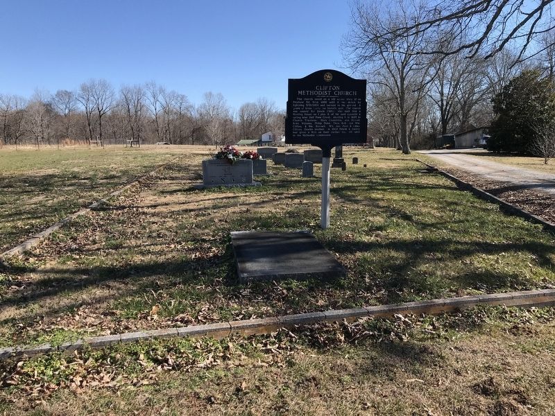
Location. 36° 21.936′ N, 87° 10.669′ W. Marker is near Ashland City, Tennessee, in Cheatham County. Marker is on Tennessee 12, 0.1 miles south of Ranch Road, on the left when traveling south. Touch for map. Marker is at or near this postal address: 3520 TN 12, Ashland City TN 37015, United States of America. Touch for directions.
Other nearby markers. At least 8 other markers are within 9 miles of this marker, measured as the crow flies. Clifton Methodist Church (here, next to this marker); Neptune (approx. 1.6 miles away); Old Neptune School (approx. 2.3 miles away); Pat Head Summitt (approx. 3.4 miles away); Harpeth Shoals (approx. 4˝ miles away); Willie Blount (approx. 7 miles away); Sycamore Mill (approx. 7.7 miles away); Pleasant View (approx. 8.1 miles away). Touch for a list and map of all markers in Ashland City.
Related markers. Click here for a list of markers that are related to this marker.
Credits. This page was last revised on January 24, 2021. It was originally submitted on January 24, 2021, by Duane and Tracy Marsteller of Murfreesboro, Tennessee. This page has been viewed 251 times since then and 22 times this year. Photos: 1, 2. submitted on January 24, 2021, by Duane and Tracy Marsteller of Murfreesboro, Tennessee.

