Near Fredericksburg in Spotsylvania County, Virginia — The American South (Mid-Atlantic)
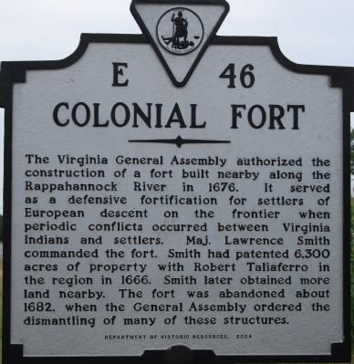
Colonial Fort
Erected 2004 by Department of Historic Resources. (Marker Number E-46.)
Topics and series. This historical marker is listed in this topic list: Forts and Castles. In addition, it is included in the Virginia Department of Historic Resources (DHR) series list. A significant historical year for this entry is 1676.
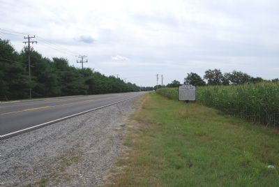
Location. 38° 15.803′ N, 77° 26.285′ W. Marker is near Fredericksburg, Virginia, in Spotsylvania County. Marker is at the intersection of Tidewater Trail (Virginia Route 2) and Mansfield Club Drive, on the right when traveling south on Tidewater Trail. Touch for map. Marker is in this post office area: Fredericksburg VA 22408, United States of America. Touch for directions.
Other nearby markers. At least 8 other markers are within walking distance of this marker. The Slaughter Pen Farm (approx. 0.2 miles away); Battle of Fredericksburg (approx. 0.2 miles away); a different marker also named Battle of Fredericksburg (approx. 0.2 miles away); a different marker also named Slaughter Pen Farm (approx. 0.2 miles away); a different marker also named Slaughter Pen Farm (approx. ¼ mile away); a different marker also named Slaughter Pen Farm (approx. 0.3 miles away); a different marker also named Slaughter Pen Farm (approx. 0.4 miles away); a different marker also named Slaughter Pen Farm (approx. half a mile away). Touch for a list and map of all markers in Fredericksburg.
Credits. This page was last revised on February 2, 2023. It was originally submitted on July 13, 2007, by Dawn Bowen of Fredericksburg, Virginia. This page has been viewed 2,372 times since then and 96 times this year. Photos: 1, 2. submitted on July 13, 2007, by Dawn Bowen of Fredericksburg, Virginia. • J. J. Prats was the editor who published this page.

