San Luis Obispo in San Luis Obispo County, California — The American West (Pacific Coastal)
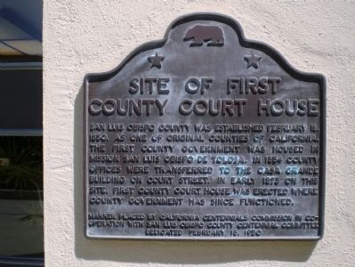
Site of First County Court House
Marker placed by California Centennials Commission in cooperation with San Luis Obispo County Centennial Committee
Dedicated February 18, 1950
Erected 1950 by California Centennials Commission in cooperation with San Luis Obispo County Centennial Committee.
Topics. This historical marker is listed in these topic lists: Government & Politics • Notable Buildings. A significant historical date for this entry is February 18, 1850.
Location. 35° 16.941′ N, 120° 39.688′ W. Marker is in San Luis Obispo, California, in San Luis Obispo County. Marker can be reached from the intersection of Osos Street and Monterey Street. Touch for map. Marker is in this post office area: San Luis Obispo CA 93401, United States of America. Touch for directions.
Other nearby markers. At least 8 other markers are within walking distance of this marker. J. P. Andrews Building (within shouting distance of this marker); San Luis Obispo Sesquicentennial (about 300 feet away, measured in a direct line); General John C. Fremont (about 600 feet away); “Love” and “Double Joy” (approx. 0.2 miles away); Site of Ah Louis Store (approx. 0.2 miles away); Juan Bautista de Anza National Historic Trail (approx. 0.2 miles away); Chong's Candy Store (approx. 0.2 miles away); Presbyterian Church (approx. 0.2 miles away). Touch for a list and map of all markers in San Luis Obispo.
More about this marker. Although the marker looks like those used by the State of California to designate California State Historical Landmarks, this site is in fact not such a landmark.
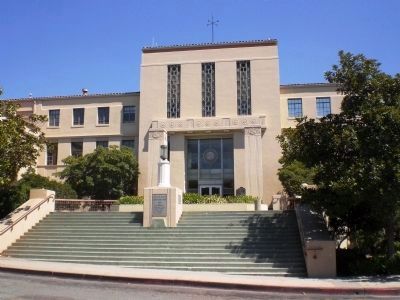
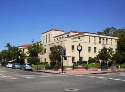
Regarding Site of First County Court House. The courthouse (subject of the marker) was completed in 1873, a handsome 3-story Greek Revival style building. It was demolished in 1940 and succeeded by the building pictured to the left and below, although that too has now been succeeded by a newer 1960's era building.
Additional keywords. Courthouse

Photographed By Andrew Ruppenstein, September 6, 2008
2. (Second) San Luis Obispo County Court House (Constructed 1940)
The historical marker is located just to the right of the Osos Street entrance. Of the two plaques visible on the lighting plinth on the steps, one notes that A.R. Walker and P.A. Eisen were the architects and Charles D. Eggleston was the construction superintendent, while the other (larger) notes the county supervisors in 1940 were Claude Arnold, Henry Twisselman, Alfred Ferrini, John Norton, and A.A. Erhart.
Credits. This page was last revised on October 21, 2020. It was originally submitted on March 1, 2009, by Andrew Ruppenstein of Lamorinda, California. This page has been viewed 1,732 times since then and 25 times this year. Photos: 1, 2, 3. submitted on March 1, 2009, by Andrew Ruppenstein of Lamorinda, California. • Kevin W. was the editor who published this page.

