Brownsville in Cameron County, Texas — The American South (West South Central)
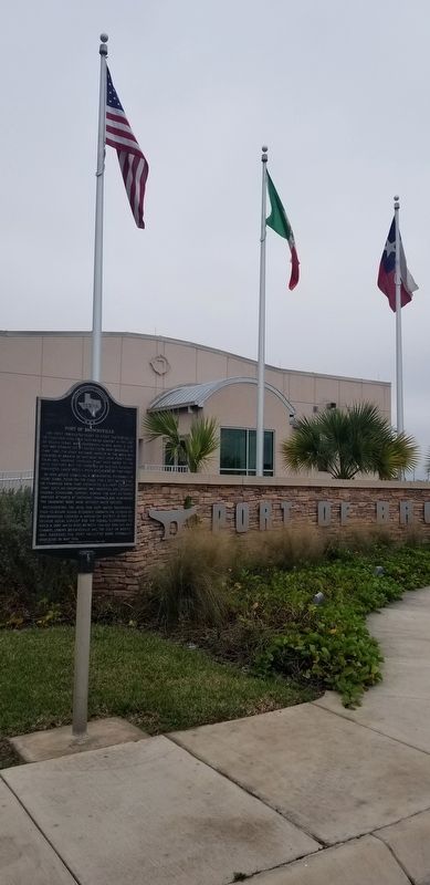
Port of Brownsville
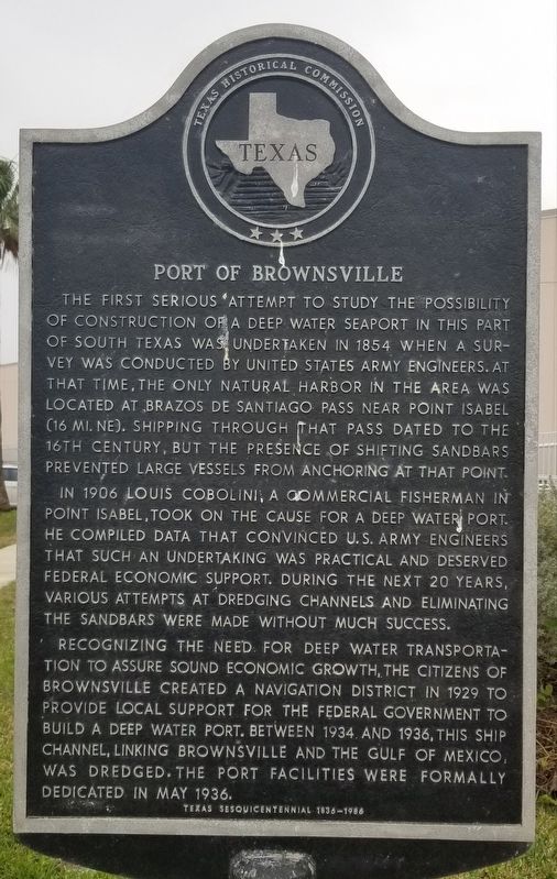
The first serious attempt to study the possibility of construction of a deep water seaport in this part of South Texas was undertaken in 1854 when a survey was conducted by United States Army engineers. At that time, the only natural harbor in the area was located at Brazos de Santiago Pass near Point Isabel (16 mi. NE). Shipping through that pass dated to the 16th Century, but the presence of shifting sandbars prevented large vessels from anchoring at that point.
In 1906 Louis Cabolini, a commercial fisherman in Point Isabel, took on the cause for a deep water port. He compiled data that convinced U.S. Army engineers that such an undertaking was practical and deserved federal economic support. During the next 20 years, various attempts at dredging channels and eliminating the sandbars were made without much success.
Recognizing the need for deep water transportation to assure sound economic growth, the citizens of Brownsville created a navigation district in 1929 to provide local support for the Federal Government to build a deep water port. Between 1934 and 1936, this ship channel, linking Brownsville and the Gulf of Mexico, was dredged. The port facilities were formally dedicated in May 1936.
Texas Sesquicentennial 1836 - 1986
Erected 1986 by Texas Historical Commission. (Marker Number 4080.)
Topics. This historical marker is listed in these topic lists: Industry & Commerce • Waterways & Vessels. A significant historical month for this entry is May 1936.
Location. 25° 57.062′ N, 97° 24.678′ W. Marker is in Brownsville, Texas, in Cameron County. Marker is at the intersection of Capt Donald L Foust Road and North Indiana Street, on the right when traveling east on Capt Donald L Foust Road. Touch for map. Marker is at or near this postal address: 1000 Capt Donald L Foust Road, Brownsville TX 78521, United States of America. Touch for directions.
Other nearby markers. At least 8 other markers are within 5 miles of this marker, measured as the crow flies. Fallen Side by Side (approx. 4.7 miles away); A Daunting Defense (approx. 4.7 miles away); These Brave Men (approx. 4.8 miles away); Monumental History (approx. 4.8 miles away); The Resaca de la Palma Battlesite (approx. 4.8 miles away); Resaca de la Palma (approx. 4.8 miles away); Border War (approx. 4.8 miles away); Hand-to-Hand (approx. 4.8 miles away). Touch for a list and map of all markers in Brownsville.
Also see . . . Brownsville Texas. Brownsville was made county seat of the new Cameron County on January 13, 1849, and a post office went into operation on February 3. Within a short time the town's population—swollen by refugees from Matamoros and Forty-niners taking the Gila route to the gold fields of California—had increased to more than 1,000. Despite a cholera epidemic in the spring of 1849 that reportedly killed nearly half the population, the town continued to boom. Brownsville soon replaced Matamoros as the leading trade center for northern Mexico. Source: The Handbook of Texas (Submitted on January 26, 2021, by James Hulse of Medina, Texas.)
Credits. This page was last revised on July 12, 2022. It was originally submitted on January 26, 2021, by James Hulse of Medina, Texas. This page has been viewed 404 times since then and 45 times this year. Last updated on July 11, 2022, by Joe Lotz of Denton, Texas. Photos: 1, 2, 3. submitted on January 26, 2021, by James Hulse of Medina, Texas. • J. Makali Bruton was the editor who published this page.


