Bristow in Prince William County, Virginia — The American South (Mid-Atlantic)
The "Tigers" of Louisiana
Bristoe Station
September 9, 2012
1. The “Tigers” of Louisiana Marker
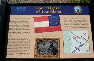
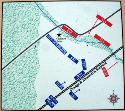
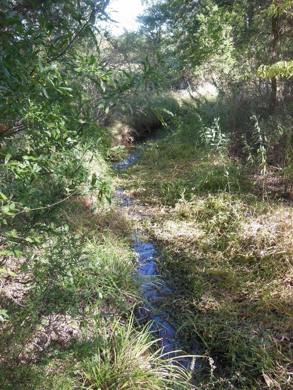
In this creek bed, three Louisiana regiments made a stand. These men, many recruited from the wharves of New Orleans, had already established a reputation as hard fighters and were labeled “Tigers” by their comrades. Their brigade commander here at Bristoe was Col. Henry Forno. After first skirmishing with the Federals along Kettle Run, 1 ½ miles to the southwest along the railroad, Forno withdrew the 6th and 8th Louisiana regiments to this area and sent the rest of his brigade to the high ground near Brentsville Road, behind you ¼ mile.
As the first Federal regiment arrived, the Louisianans laid down a devastating fire. As the afternoon continued, they kept a heavy fire as more and more Federal regiments arrived in the field in front of you. Forno ordered up the 5th Louisiana Infantry to this area to bolster the line. By 4:30 p.m., with ammunition running low and facing overwhelming odds in an ever-increasing Federal force in their front and flanks, Forno pulled his men back toward Bristoe Station, ¼ mile behind you. The Louisianans left 83 dead and wounded here as they pulled back.
The enemy coming down the railroad attacked the Louisiana Brigade. Col. [Forno], was in command, had his men lying down in the pines – & as the Federals advanced, he kept perfectly quiet till they were within 50 or 60 yards – then fired and charged. Many were killed and wounded; the rest ran like turkeys…
Maj. Campbell Brown, CSA staff officer
Erected 2012
this page online
Topics. This historical marker is listed in this topic list: War, US Civil.
Location. 38° 43.335′ N, 77° 32.573′ W. Marker is in Bristow, Virginia, in Prince William County. It can be reached from Iron Brigade Unit Avenue. Marker is located on the 1861-1862 Trail at Bristoe Station Battlefield Heritage Park. Touch for map. Marker is in this post office area: Bristow VA 20136, United States of America. Touch for directions.

Regionally, this marker is in the Washington Metropolitan Area, in Northern Virginia, and in the Piedmont. It is also in the American South, specifically in the Upper South, in the Mid-Atlantic, and on the Eastern Seaboard. Globally, it is in the North Atlantic Region, North America, the Western Hemisphere, the Western World, and the Anglosphere. Historically, it finds itself in what was once the territory of the Mississippian Culture, one of the original Thirteen Colonies, one of the Confederate States of America, and the Antebellum South.
Other nearby markers. At
September 9, 2012
2. The “Tigers” of Louisiana Marker
Other markers no longer nearby. Deadly Day for Excelsior Brigade (was about 300 feet away, measured in a direct line but has been replaced with another marker now near it); Battle Along the Railroad (was about 700 feet away but has been replaced with another marker now near it).
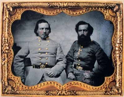
More about this marker. The marker displays (Above) Flag of the 6th Louisiana Infantry Courtesy of the Museum of the Confederacy and (Below) Alcibiades DeBlanc and Robert Perry, 6th Louisiana Infantry Courtesy of Confederate Memorial Hall, New Orleans LA.
The marker
September 2, 2012
3. Close-up of Map on Marker
September 9, 2012
4. Close-up of Photo on Marker
Photographed by Bradley Owen, October 18, 2016
5. Creek Bed
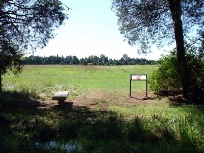
According to the map on the marker, this creek bed would have been the position taken by the 6th Louisiana.
Credits. This page was last revised on January 27, 2021. It was originally submitted on September 12, 2012. This page has been viewed 991 times since then and 36 times this year. Last updated on January 26, 2021. Photos: 1, 2, 3, 4. submitted on September 12, 2012. 5. submitted on January 25, 2021, by Bradley Owen of Morgantown, West Virginia. • Bernard Fisher was the editor who published this page.
