Stevenson Ranch near Santa Clarita in Los Angeles County, California — The American West (Pacific Coastal)
Mentryville
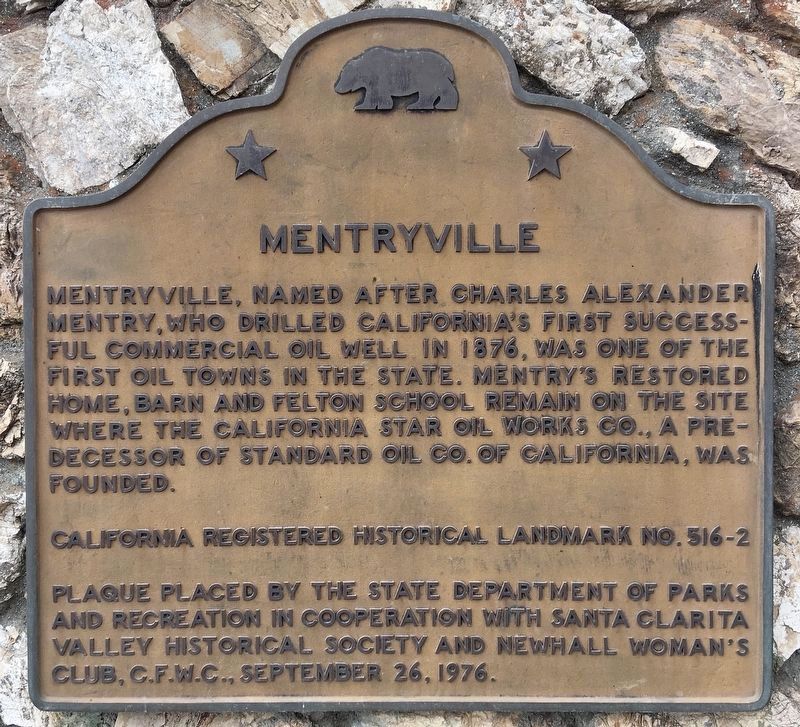
Photographed by Craig Baker, October 22, 2022
1. Mentryville Marker
Erected 1976 by State Department of Parks and Recreation, Santa Clarita Valley Historical Society, and Newhall Woman's Club, C.F.W.C. (Marker Number 516-2.)
Topics and series. This historical marker is listed in these topic lists: Industry & Commerce • Natural Resources • Notable Places • Settlements & Settlers. In addition, it is included in the California Historical Landmarks series list. A significant historical year for this entry is 1876.
Location. 34° 22.772′ N, 118° 36.651′ W. Marker is near Santa Clarita, California, in Los Angeles County. It is in Stevenson Ranch. It can be reached from Pico Canyon Road 3 miles west of Interstate 5. Touch for map. Marker is in this post office area: Stevenson Ranch CA 91381, United States of America. Touch for directions.

Regionally,
this page online
Other nearby markers. At least 8 other markers are within 3 miles of this marker, measured as the crow flies: Mentryville’s Barn (a few steps from this marker); Pico Cottage (within shouting distance of this marker); Movie Façade House (within shouting distance of this marker); Felton School (about 600 feet away, measured in a direct line); First Commercial Oil Well In California (approx. 1.2 miles away); Apology (approx. 2.6 miles away); Pioneer Oil Refinery (approx. 2.7 miles away); Oak of the Golden Dream (approx. 2.7 miles away). Touch for a list and map of all markers in Santa Clarita.
Regarding Mentryville. Chevron donated this parkland after the historic buildings were damaged by the 1994 Northridge Earthquake.
Related markers. Click here for a list of markers
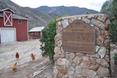
Photographed by Michael Kindig, January 15, 2012
2. Mentryville Marker
Also see . . . Friends of Mentryville. (Submitted on May 15, 2010.)
Additional commentary.
1. Pico #4, California Historical Landmark No. 516
The first commercially successful oil well in California was drilled here in Mentryville. Drilled in 1878, it produced oil until it was shut down in 1990.
— Submitted May 13, 2010, by Konrad R Summers of Santa Clarita, California.
2. Pico #4
To see the marker at Pico #4, walk 1½ miles up the canyon from Mentryville, along the paved road. The marker is on the right, before the pavement ends.
— Submitted January 31, 2018, by Craig Baker of Sylmar, California.
Additional keywords. Marker Tree
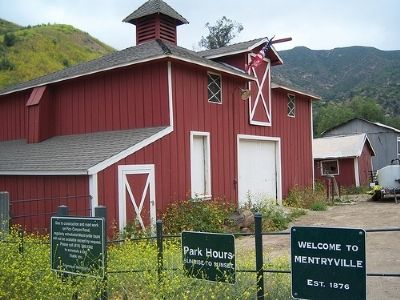
Photographed by Konrad R Summers, May 12, 2008
3. Mentryville Barn

Photographed by Craig Baker, January 30, 2018
4. Mentry’s Home
Pico Cottage — The Superintendent’s House.
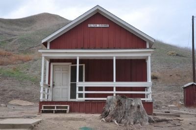
Photographed by Michael Kindig, January 15, 2012
5. Felton School
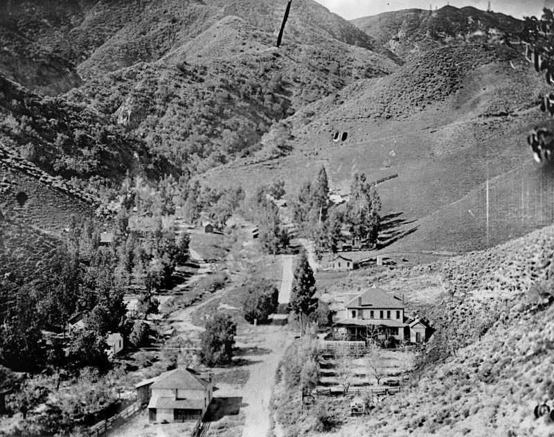
6. Mentryville - 1920s
Photographed by Craig Baker, January 5, 2021
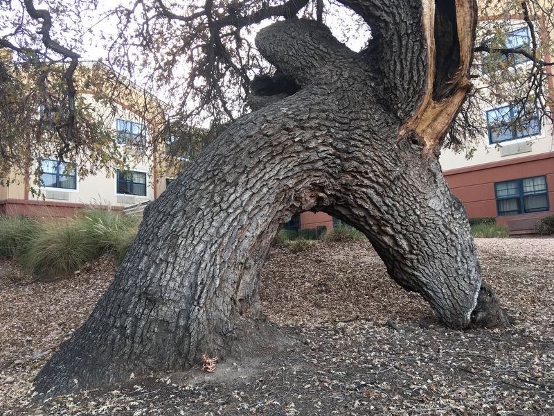
7. “Marker Tree”
Branches were tied to the ground centuries ago by indigenous people as a directional marker. This one points the way to a source of asphaltum in Pico Canyon. Location: 24940 Pico Canyon Rd, behind the hotel.
Photographed by Craig Baker
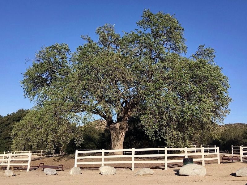
8. Old Glory Oak Tree
Located in Pico Canyon Park, designated a Los Angeles County Historic Landmark in 2024.
Credits. This page was last revised on September 7, 2026. It was originally submitted on May 13, 2010, by Konrad R Summers of Santa Clarita, California. This page has been viewed 2,324 times since then and 71 times this year. Last updated on January 26, 2021, by Craig Baker of Sylmar, California. Photos: 1. submitted on October 27, 2022, by Craig Baker of Sylmar, California. 2. submitted on January 16, 2012, by Michael Kindig of Elk Grove, California. 3. submitted on May 13, 2010, by Konrad R Summers of Santa Clarita, California. 4. submitted on March 13, 2018, by Craig Baker of Sylmar, California. 5. submitted on January 16, 2012, by Michael Kindig of Elk Grove, California. 6. submitted on May 29, 2024, by Craig Baker of Sylmar, California. 7. submitted on January 26, 2021, by Craig Baker of Sylmar, California. 8. submitted on September 27, 2024, by Craig Baker of Sylmar, California. • J. Makali Bruton was the editor who published this page.
