Rumson in Monmouth County, New Jersey — The American Northeast (Mid-Atlantic)
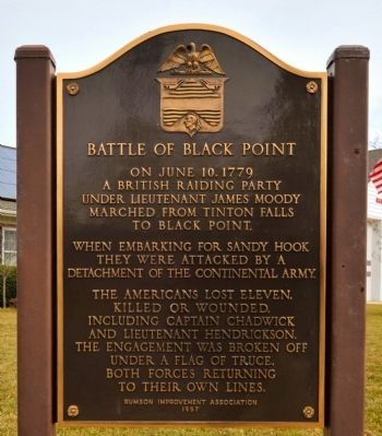
Battle of Black Point
When embarking for Sandy Hook they were attacked by a detachment of the Continental Army.
The Americans lost eleven, killed or wounded, including Captain Chadwick and Lieutenant Hendrickson. The engagement was broken off under a flag of truce, both forces returning to their own lines.
Erected 1957 by Rumson Improvement Association.
Topics. This historical marker is listed in this topic list: War, US Revolutionary. A significant historical month for this entry is June 1864.
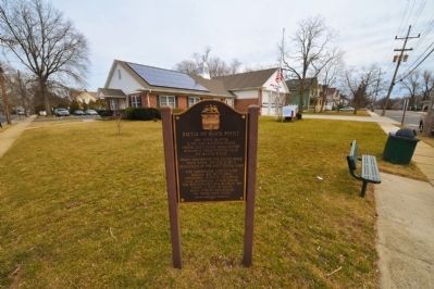
Location. 40° 22.317′ N, 73° 59.967′ W. Marker is in Rumson, New Jersey, in Monmouth County. Marker is at the intersection of East River Road and Black Point Road on East River Road. The marker is in the front lawn of one of the Rumson firehouses. Touch for map. Marker is at or near this postal address: 140 East River Road, Rumson NJ 07760, United States of America. Touch for directions.
Other nearby markers. At least 8 other markers are within 2 miles of this marker, measured as the crow flies. 1945 - 2005 Rumson Veterans Monument (approx. ¾ mile away); Huddy’s Leap (approx. 1.3 miles away); Jumping Point Park (approx. 1.3 miles away); Twin Lights Mystery Cannon (approx. 1.8 miles away); Electric Power Station (approx. 1.8 miles away); Powerhouse (approx. 1.8 miles away); The Navesink Light Station (approx. 1.9 miles away); a different marker also named Navesink Light Station (approx. 1.9 miles away). Touch for a list and map of all markers in Rumson.
Credits. This page was last revised on June 16, 2016. It was originally submitted on March 2, 2009, by Ronald Claiborne of College Station, Texas. This page has been viewed 2,067 times since then and 97 times this year. Photos: 1, 2. submitted on March 2, 2009, by Ronald Claiborne of College Station, Texas. • Kevin W. was the editor who published this page.

