Suffolk, Virginia — The American South (Mid-Atlantic)
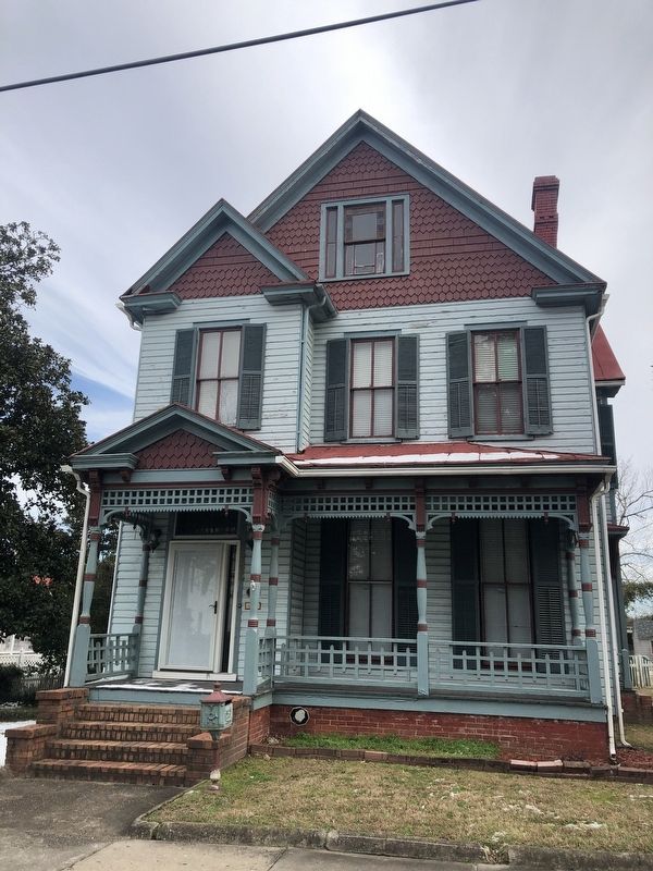
Safe Haven
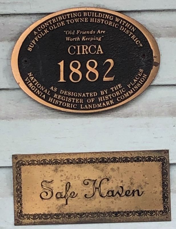
Suffolk Olde Towne Historic District
as designated by the
National Register of Historic Places
Virginia Historic Landmark Commission
"Old Friends Are
Worth Keeping"
circa
1882
Topics. This historical marker is listed in this topic list: Architecture. A significant historical year for this entry is 1882.
Location. 36° 43.858′ N, 76° 34.696′ W. Marker is in Suffolk, Virginia. It is on Pinner Street just south of Finney Avenue, on the right when traveling north. Touch for map. Marker is at or near this postal address: 234 Pinner St, Suffolk VA 23434, United States of America. Touch for directions.

Regionally, this marker is in Virginia’s Hampton Roads, specifically in Coastal Virginia, and in the Hampton Roads Metropolitan Area. It is also in the American South, specifically in the Upper South, in the Tidewater, and on the Eastern Seaboard. Globally, it is in the North Atlantic Region, North America, the Western Hemisphere, the Western World, and the Anglosphere. Historically, it finds itself in what was once the territory of the Mississippian Culture, one of the
this page online
Other nearby markers. At least 8 other markers are within walking distance of this marker: Civil War Militia of Suffolk and Nansemond County (approx. ¼ mile away); Remembrance Garden Monuments (approx. ¼ mile away); Confederate Monument (approx. ¼ mile away); Obici-Oderzo Fountain Marker (approx. 0.3 miles away); Watering Fountain (approx. 0.3 miles away); Old City Hall Bell (approx. 0.3 miles away); Spanish War Veterans Memorial (approx. 0.3 miles away); Siege of Suffolk (approx. 0.3 miles away). Touch for a list and map of all markers in Suffolk.
Credits. This page was last revised on February 1, 2023. It was originally submitted on January 31, 2021, by Devry Becker Jones of Washington, District of Columbia. This page has been viewed 458 times since then and 30 times this year. Photos: 1, 2. submitted on January 31, 2021, by Devry Becker Jones of Washington, District of Columbia.
