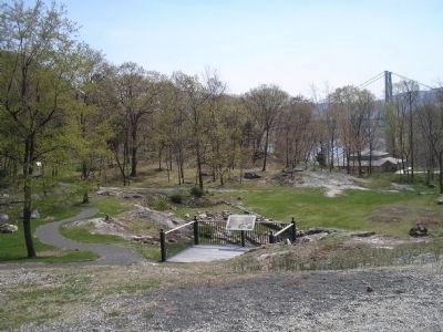
Fort Montgomery in Orange County, New York — The American Northeast (Mid-Atlantic)
The Battle of Fort Montgomery
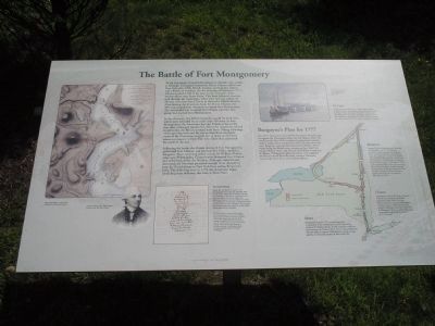
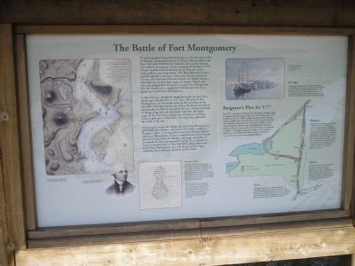
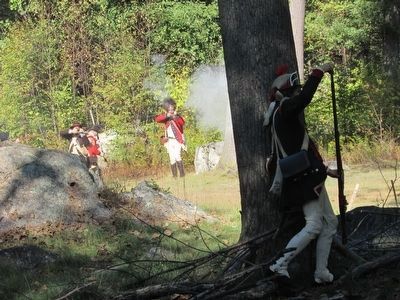
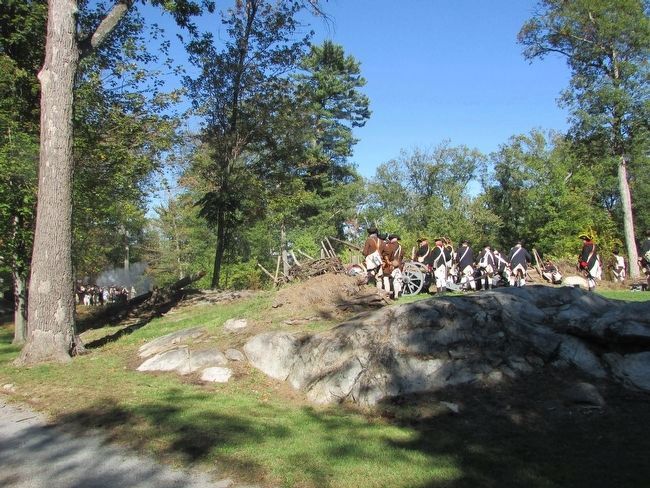
In the afternoon, the British began an assault on both forts, which were defended by no more than 700 men. At Fort Montgomery, the Americans kept the British at bay as the two sides exchanged musket fire. When the Americans refused to surrender, the British stormed both forts. Taking advantage of the growing dark and the smoky haze from the battle, many of the Americans escaped, but as many as 275 were taken as prisoners to New York City where they remained for much of the war.
Following the battle, the British destroyed Fort Montgomery, garrisoned Fort Clinton, and burned New York’s capital at Kingston. Then, receiving orders to join Sir William Howe’s army near Philadelphia, Clinton’s men destroyed Fort Clinton and sailed back down the Hudson. Although captured and destroyed, the forts had presented enough of an obstacle to keep the British forces in New York from aiding Burgoyne’s army. The following year, in 1778, the Americans began rebuilding their defenses, this time at West Point.
The Coded Message
D[ea]r Sir. W. Howe is gone to the Chessapeak bay with the greater part of the army. I hear he has landed but am not certain[.] I am left to command here with too small a force to make any effectual diversion in your favor[.] I shall try something at any rate. It may be of use to you. I own to you I think Sr. W.’s move just at this time the worst he could take[.] much joy on your success.
Sir Henry Clinton sent this coded message to General Burgoyne, who lost the hourglass-shaped cipher necessary to decode it properly. Nevertheless, Burgoyne got the gist of the message and replied that Clinton should do what he could to help. You can see the coded message within the hourglass shading on the letter and read its transcription above. Courtesy Clements Library University of Michigan.
Erected by Fort Montgomery State Historic Site.
Topics. This historical marker is listed in these topic lists: Forts and Castles
Photographed By Bill Coughlin, July 10, 2009
2. Markers in Fort Montgomery State Historic Site
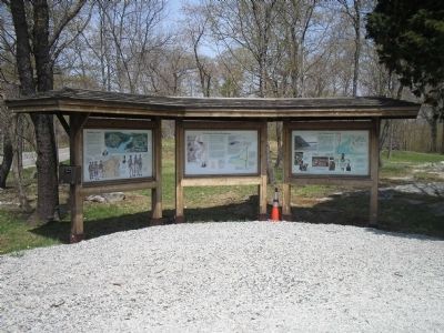
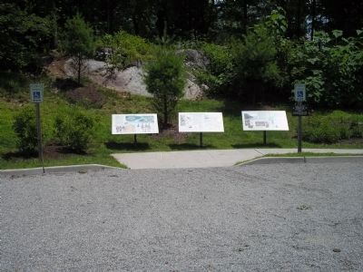
This set of three markers were relocated from near Route 9W on the walking trail to the north end of the visitor center parking lot. The "Battle of Fort Montgomery" marker is the center marker in the photo.
Location. 41° 19.451′ N, 73° 59.246′ W. Marker is in Fort Montgomery, New York, in Orange County. Marker is on U.S. 9W, on the right when traveling north. Marker is in Fort Montgomery State Historic Site on the walking trail, near Route 9W. Touch for map. Marker is in this post office area: Fort Montgomery NY 10922, United States of America. Touch for directions.
Other nearby markers. At least 8 other markers are within walking distance of this marker. Building a Fort (here, next to this marker); Fort Montgomery Today (here, next to this marker); The Historic 1777 & 1779 Trails (within shouting distance of this marker); Powder Magazine (within shouting distance of this marker); Gardens of the Fort (within shouting distance of this marker); Three Sisters Garden (about 300 feet away, measured in a direct line); Guard House (about 300 feet away); Soldiers’ Necessary (about 300 feet away). Touch for a list and map of all markers in Fort Montgomery.
More about this marker. The left side of the marker contains a map of the plan of attack on the Forts Clinton and Montgomery, upon the Hudson River. The map has the caption “Plan of the Attack, by John Hill. Courtesy New York State Library."
Under the map is a picture of Sir Henry Clinton, by J. Stuart Rogers. Courtesy New
York State Library.
On a sidebar is the details of Burgoyne’s Plan for 1777
For 1777, Lieutenant General John Burgoyne devised a plan to capture the Champlain Valley and the Hudson River. He would invade New York’s northern frontier from Canada, while a smaller force invaded New York’s frontier from the west. Burgoyne expected that General Sir William Howe would bring the British army occupying up the Hudson River, and that the three forces would join in Albany. If Burgoyne’s plan succeeded, New England would be isolated from the other colonies. However, none of the three forces ever reached Albany.
St. Leger
Lieutenant Colonel Barry St. Leger’s force stalled at Fort Schuyler (the American name for Fort Stanwix in Rome). After the bloody battle of Oriskany and the defection of the Native American component of his expedition, reinforcements led by Major General Benedict Arnold forced St. Leger to retreat to Canada.
Burgoyne
Stopped by the Americans near Saratoga on September 19, 1777, Burgoyne received a coded message (see graphic) from Sir Henry Clinton and decided to await his assistance. Clinton successfully captured Forts Montgomery and Clinton, but Burgoyne was defeated in a second battle near Saratoga on October 7, 1777, and surrendered his entire army ten days later. Most historians consider this the turning point of the Revolutionary
War, because it helped convince France to openly enter the war on America’s side early in 1778.
Clinton
Lieutenant General Sir Henry Clinton was left to command the British garrison in New York City after Howe moved to capture Philadelphia. Clinton sent a coded message (see graphic) offering to provide a division in Burgoyne’s force, to which Burgoyne desperately responded he should do it “directly.”
Howe
Burgoyne’s plans for 1777 assumed that the commander of the British army in New York City, General Sir William Howe, would cooperate with him and move up the Hudson River. Howe instead followed his own plans to capture Philadelphia, leaving a large garrison to maintain control of New York City.
Related markers. Click here for a list of markers that are related to this marker. This series of markers follow the walking tour of the Fort Montgomery Battlefield.
Also see . . . The Battle of Fort's (sic) Montgomery and Clinton. The American Revolutionary War website entry (Submitted on April 27, 2008, by Bill Coughlin of Woodland Park, New Jersey.)
Credits. This page was last revised on August 19, 2021. It was originally submitted on April 27, 2008, by Bill Coughlin of Woodland Park, New Jersey. This page has been viewed 1,791 times since then and 31 times this year. Last updated on February 5, 2021, by Carl Gordon Moore Jr. of North East, Maryland. Photos: 1, 2. submitted on December 3, 2009, by Bill Coughlin of Woodland Park, New Jersey. 3, 4, 5, 6. submitted on April 27, 2008, by Bill Coughlin of Woodland Park, New Jersey. 7, 8. submitted on October 11, 2015, by Bill Coughlin of Woodland Park, New Jersey. • Michael Herrick was the editor who published this page.
