The Original Cooperative Center
Commercial Hub
— Explore Hampton 2010: From the Sea to the Stars —

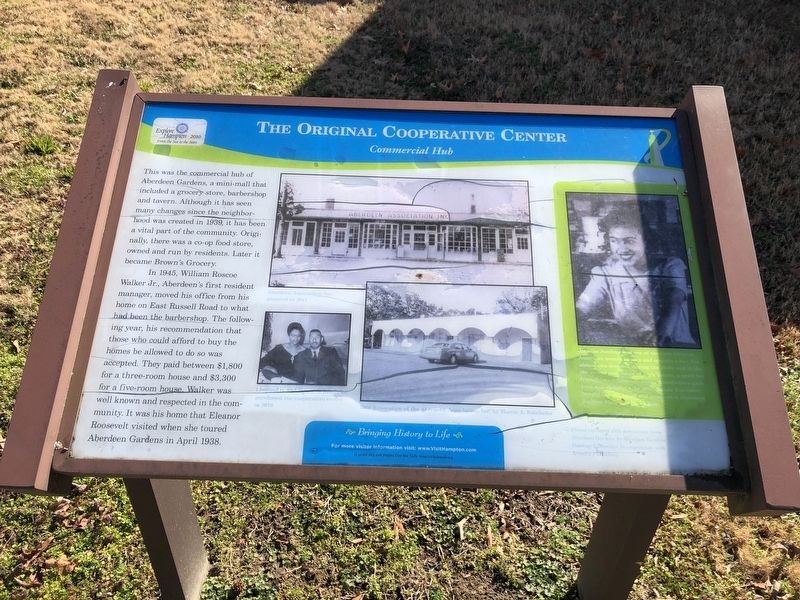
This was the commercial hub of Aberdeen Gardens, a mini-mall that included a grocery store, barbershop and tavern. Although it has seen many changes since the neighborhood was created in 1939, it has been a vital part of the community. Originally, there was a co-op food store, owned and run by residents. Later it became Brown's Grocery.
In 1945, William Roscoe Walker, Jr., Aberdeen's first resident manager, moved his office from his home on East Russell Road to what had been the barbershop. The following year, his recommendation that those who could afford to buy the homes be allowed to do so was accepted. They paid between $1,800 for a three-bedroom house and $3,300 for a five-bedroom house. Walker was well known and respected in the community. It was his home that Eleanor Roosevelt visited when she toured Aberdeen Gardens in April 1938.
Erected 2010 by Hampton Convention & Visitor Bureau.
Topics and series. This historical marker is listed in these topic lists: African Americans • Industry & Commerce • Settlements & Settlers. In addition, it is included in the Eleanor Roosevelt series list. A significant historical month for this entry is April 1938.
Location. 37° 1.948′ N, 76° 24.501′ W. Marker is in Hampton, Virginia. It is
Other nearby markers. At least 8 other markers are within 3 miles of this marker, measured as the crow flies. The Todd Farmhouse (a few steps from this marker); Once Hampton Institute's Farm (a few steps from this marker); Aberdeen Elementary School (within shouting distance of this marker); The Beginnings of Aberdeen Gardens (within shouting distance of this marker); Aberdeen Gardens (approx. 0.2 miles away); Tucker's Cemetery (approx. 0.6 miles away); Deaf and Blind School (approx. 2.1 miles away); George W. Carver High School (approx. 2.2 miles away). Touch for a list and map of all markers in Hampton.

Credits. This page was last revised on February 1, 2023. It was originally submitted on February 7, 2021, by Devry Becker Jones of Washington, District of Columbia. This page has been viewed 111 times since then and 15 times this year. Photos: 1, 2. submitted on February 7, 2021, by Devry Becker Jones of Washington, District of Columbia.