Dumfries in Prince William County, Virginia — The American South (Mid-Atlantic)
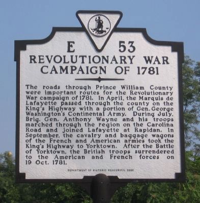
Revolutionary War Campaign of 1781
Erected 2000 by Department of Historic Resources. (Marker Number E-53.)
Topics and series. This historical marker is listed in these topic lists: Settlements & Settlers • War, US Revolutionary. In addition, it is included in the Former U.S. Presidents: #01 George Washington, the The Washington-Rochambeau Route, and the Virginia Department of Historic Resources (DHR) series lists. A significant historical year for this entry is 1781.
Location. 38° 33.977′ N, 77° 19.465′ W. Marker is in Dumfries, Virginia, in Prince William County. Marker is on Frayley Boulevard (U.S. 1) north of Williamstown Drive, on the right when traveling north. It is next to Cecil Garrison Park. Touch for map. Marker is in this post office area: Dumfries VA 22026, United States of America. Touch for directions.
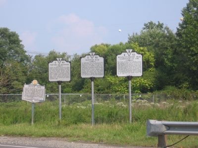
Other nearby markers. At least 8 other markers are within walking distance of this marker. Dumfries Raid (here, next to this marker); Graham Park (a few steps from this marker); History of Dumfries (a few steps from this marker); Dumfries - Love’s Tavern (approx. 0.2 miles away); Colonial Dumfries - Williams Ordinary (approx. 0.2 miles away); Prince William County Court House (approx. ¼ mile away); Weems-Botts House (approx. 0.3 miles away); Dumfries Methodist Church Bell (approx. 0.3 miles away). Touch for a list and map of all markers in Dumfries.
More about this marker. This marker replaces a marker with the same number that was located on Route 1 at the northern town line. It was entitled just "Campaign of 1781" and read: Lafayette, coming to Virginia to take command, moved by this road, April 1781. Here passed Washington and Rochambeau going to Yorktown, September 1781.
A different marker with this same number was listed in early Virginia Historical Marker lists, located on Route 1 at the south town line. It was titled "Early Land Patents" and read: Here on Quantico Creek, land was first patented by Richard Hawkins in 1653.
Also see . . .
1. Historic Documentation of the Route Taken... ...by Generals Washington and Rochambeau en route to and from Yorktown through Prince William County, Virginia. Prepared for Prince William County Planning in August 2002 and updated in April 2004. (Submitted on September 26, 2007, by Kevin W. of Stafford, Virginia.)
2. Virtual Tour of The King's Highway. (Submitted on January 22, 2008, by Kevin W. of Stafford, Virginia.)
Credits. This page was last revised on February 8, 2021. It was originally submitted on September 12, 2006, by Jeremy Prats of Afton, Virginia. This page has been viewed 3,000 times since then and 75 times this year. Last updated on February 7, 2021, by Carl Gordon Moore Jr. of North East, Maryland. Photos: 1, 2. submitted on September 12, 2006, by Jeremy Prats of Afton, Virginia. • Bernard Fisher was the editor who published this page.

