Hesperia in San Bernardino County, California — The American West (Pacific Coastal)
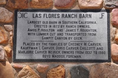
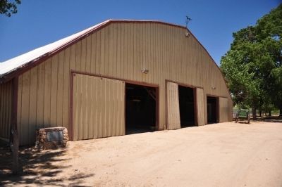
Las Flores Ranch Barn
Erected 1980 by The families of Chesney W. Carver, Kaughman L. Carver, Doris Carver, Chilcott and Marjorie Carver Weirick, owners from 1937 to 1980. Boyd Maddox, Foreman.
Topics. This historical marker is listed in these topic lists: Agriculture • Notable Buildings • Settlements & Settlers. A significant historical year for this entry is 1872.
Location. 34° 18.671′ N, 117° 19.439′ W. Marker is in Hesperia, California, in San Bernardino County. Marker is on California Route 173, 2 miles California Route 138. The marker is located on the Las Flores Ranch, which is private property, not open to the public. The plaque is on the left side of the entrance to the old barn. Touch for map. Marker is in this post office area: Hesperia CA 92345, United States of America. Touch for directions.
Other nearby markers. At least 8 other markers are within 7 miles of this marker, measured as the crow flies. Las Flores Ranch / Mojave Trail (within shouting distance of this marker); Garces-Smith Monument (approx. 4.8 miles away); Atongai Indian Village (approx. 5.2 miles away); Hesperia’s Original Water Source (approx. 5.2 miles away); Elliot Ranch (approx. 5.6 miles away); Summit Train Station (approx. 5.6 miles away); Mormon Lumber Road (approx. 5.6 miles away); Mojave Indian Trail / Hesperia Lakes (approx. 6˝ miles away). Touch for a list and map of all markers in Hesperia.
Credits. This page was last revised on February 10, 2021. It was originally submitted on December 18, 2011, by Michael Kindig of Elk Grove, California. This page has been viewed 1,368 times since then and 45 times this year. Last updated on February 10, 2021, by Craig Baker of Sylmar, California. Photos: 1, 2, 3. submitted on December 18, 2011, by Michael Kindig of Elk Grove, California. • J. Makali Bruton was the editor who published this page.


