Temple Hills in Prince George's County, Maryland — The American Northeast (Mid-Atlantic)
Original Federal Boundary Stone, District of Columbia, Southeast 4
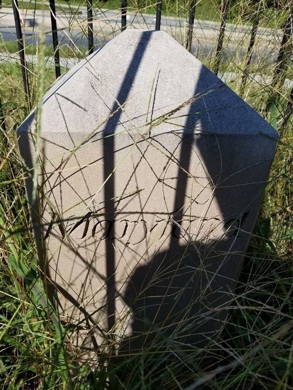
Photographed by Roberto Bernate, October 1, 2018
1. Original Federal Boundary Stone, District of Columbia, Southeast 4 Marker
Erected 2015.
Topics and series. This historical marker is listed in this topic list: Political Subdivisions. In addition, it is included in the Original Federal Boundary Stones series list. A significant historical year for this entry is 1792.
Location. 38° 51.107′ N, 76° 57.715′ W. Marker is in Temple Hills, Maryland, in Prince George's County. It is on Southern Avenue 0.1 miles south of Naylor Road SE (State Route 637), on the right when traveling north. Located at 7 9th St SE, Washington, DC 20003 on the northwest side of the Kings Crossing Apartment parking lot. It is adjacent and to the southeast of Southern Avenue Southeast. Touch for map. Marker is at or near this postal address: 3011 Southern Ave, Temple Hills MD 20748, United States of America. Touch for directions.

Regionally, this marker is in the Washington Metropolitan Area. It is also in the American South, specifically in the Upper South, in the Mid-Atlantic, and on the Eastern Seaboard. Globally, it is in the North Atlantic Region, North America, the Western Hemisphere,
this page online
Other nearby markers. At least 8 other markers are within walking distance of this marker: Allen Chapel AME Church Stormwater Features (approx. 0.6 miles away in District of Columbia); Battery Ricketts (approx. 0.8 miles away in District of Columbia); Escape Allée (1838) (approx. 0.8 miles away in District of Columbia); A Museum Without Walls (approx. 0.9 miles away in District of Columbia); Memorial Grove (1841-1895) (approx. 0.9 miles away in District of Columbia); The Litter Bell (approx. 0.9 miles away in District of Columbia); The Anacostia River: People and Places (approx. 0.9 miles away in District of Columbia); Activist Grove (1833-1845) (approx. 0.9 miles away in District of Columbia).
Another marker is no longer nearby. Thurgood Marshall (was approx. 0.9 miles away in District of Columbia but has been permanently removed).
Regarding Original Federal Boundary Stone, District of Columbia, Southeast 4. Original Federal Boundary Stones Historical Markers.
Additional keywords. Original
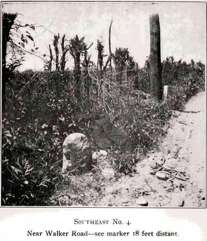
Photographed by Hathi Trust
2. Southeast No. 4
Near Walker Road -- See marker 18 feet distant
Near Walker Road -- See marker 18 feet distant
The marker 18 feet distant marks the spot where the District Line crosses the public street.
“It is about twenty inches out of the ground, and were it not for its general resemblance to the other mile stones would hardly be taken for a boundary stone. It is about one eighth of a mile northwest from Oxon Run and remote from any house. This stone should be replaced at once, as it is rounded, battered and chipped on every side, so that few fragments of the lettering remain.” -- Fred E. Woodward
From Fred Eugene Woodward, A Ramble Along the Boundary Stones of the District of Columbia With a Camera, 1907, “Read before the Society, May 14, 1906,” Reprinted from Proceedings of the Columbia Historical Society, Vol. 10, 1907.
“It is about twenty inches out of the ground, and were it not for its general resemblance to the other mile stones would hardly be taken for a boundary stone. It is about one eighth of a mile northwest from Oxon Run and remote from any house. This stone should be replaced at once, as it is rounded, battered and chipped on every side, so that few fragments of the lettering remain.” -- Fred E. Woodward
From Fred Eugene Woodward, A Ramble Along the Boundary Stones of the District of Columbia With a Camera, 1907, “Read before the Society, May 14, 1906,” Reprinted from Proceedings of the Columbia Historical Society, Vol. 10, 1907.
Credits. This page was last revised on February 11, 2021. It was originally submitted on July 29, 2020, by Roberto Bernate of Arlington, Virginia. This page has been viewed 257 times since then and 20 times this year. Last updated on February 11, 2021, by Allen C. Browne of Silver Spring, Maryland. Photos: 1. submitted on July 29, 2020, by Roberto Bernate of Arlington, Virginia. 2. submitted on February 11, 2021, by Allen C. Browne of Silver Spring, Maryland. • Bill Pfingsten was the editor who published this page.
