Near Farmville in Prince Edward County, Virginia — The American South (Mid-Atlantic)
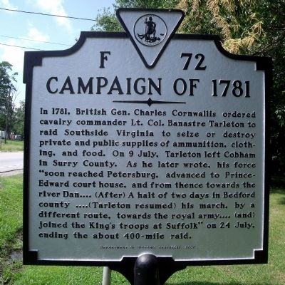
Campaign of 1781
Erected 2006 by Department of Historic Resources. (Marker Number F-72.)
Topics and series. This historical marker is listed in this topic list: War, US Revolutionary. In addition, it is included in the Virginia Department of Historic Resources (DHR) series list. A significant historical year for this entry is 1781.
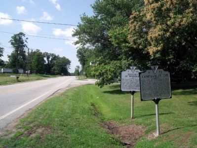
Location. 37° 13.763′ N, 78° 26.551′ W. Marker is near Farmville, Virginia, in Prince Edward County. Marker is at the intersection of Farmville Road (U.S. 15) and Worsham Road (County Route 665), on the right when traveling north on Farmville Road. Touch for map. Marker is in this post office area: Farmville VA 23901, United States of America. Touch for directions.
Other nearby markers. At least 8 other markers are within 2 miles of this marker, measured as the crow flies. Providence (here, next to this marker); History of Worsham (here, next to this marker); Randolph-Macon Medical School (approx. 0.6 miles away); Slate Hill Plantation (approx. 0.8 miles away); The Beneficial Benevolent Society of the Loving Sisters and Brothers of Hampden County (approx. one mile away); Kingsville (approx. 1.1 miles away); French's Church (approx. 1.1 miles away); The Birthplace (approx. 1.2 miles away). Touch for a list and map of all markers in Farmville.
Credits. This page was last revised on November 11, 2021. It was originally submitted on May 31, 2010, by Bernard Fisher of Richmond, Virginia. This page has been viewed 854 times since then and 35 times this year. Last updated on February 13, 2021, by Jason R. Surratt of Aurora, Colorado. Photos: 1, 2. submitted on May 31, 2010, by Bernard Fisher of Richmond, Virginia. • J. Makali Bruton was the editor who published this page.

