Near Glenita in Scott County, Virginia — The American South (Mid-Atlantic)
The Natural Tunnel Route
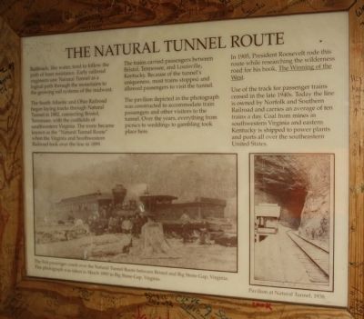
The South Atlantic and Ohio Railroad began laying tracks through Natural Tunnel in 1882, connecting Bristol, Tennessee, with the coalfields of southwestern Virginia. The route became knows as the “Natural Tunnel Route” when the Virginia and Southwestern Railroad took over the line in 1899.
The trains carried passengers between Bristol, Tennessee, and Louisville, Kentucky. Because of the tunnel’s uniqueness, most trains stopped and allowed passengers to visit the tunnel.
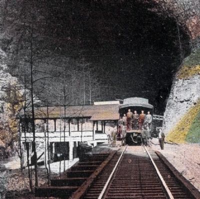
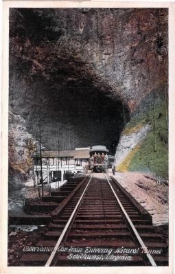
The pavilion depicted in the photograph was constructed to accommodate train passengers and other visitors to the tunnel. Over the years, everything from picnics to weddings to gambling took place here.
In 1905, President Roosevelt rode this route while researching the Wilderness Road for his book, The Winning of the West.
Use of the track for passenger trains ceased in the late 1940s. Today the line is owned by Norfolk and Southern and carries an average of ten trains a day. Coal from the mines in southwestern Virginia and eastern Kentucky is shipped to power plants and ports all over the southeastern United States.
Captions
The first passenger coach over the Natural Tunnel Route between Bristol and Big Stone Gap, Virginia. This photograph was taken in March 1890 in Big Stone Gap, Virginia.
Pavilion at Natural Tunnel, 1938.
Topics. This historical marker is listed in this topic list: Railroads & Streetcars. A significant historical year for this entry is 1882.
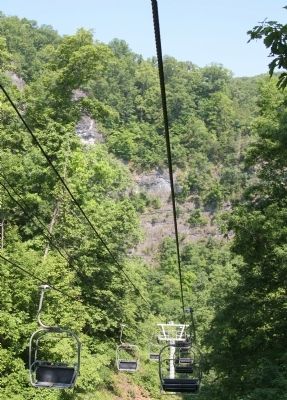
Location. 36° 42.082′ N, 82° 44.68′ W. Marker is near Glenita, Virginia, in Scott County. Marker can be reached from the intersection of Sunbright Highway (County Route 871) and County Route 646. It is in Natural Tunnel State Park, at the kiosk at the viewing platform at the southern entrance to the tunnel on the floor of the natural amphitheatre. It can be reached on foot hiking down the footpath from the visitor’s center, or by taking the chair lift. There is a charge to park your car and a separate charge to use the chair lift. Touch for map. Marker is in this post office area: Duffield VA 24244, United States of America. Touch for directions.
Other nearby markers. At least 8 other markers are within 8 miles of this marker, measured as the crow flies. Carter’s Fort (approx. 0.7 miles away); a different marker also named Carter’s Fort (approx. 1.4 miles away); Speers Ferry (approx. 3.2 miles away); Natural Tunnel: Railroading and Recreation (approx. 3.2 miles away); The Copper Creek Railroad Trestles (approx. 3.2 miles away); The Wilderness Road Crossing of the Clinch River (approx. 3.2 miles away); Lee County / Scott County (approx. 5.8 miles away); Scott County / Lee County (approx. 7.3 miles away).
More about
Photographed By J. J. Prats, May 29, 2011
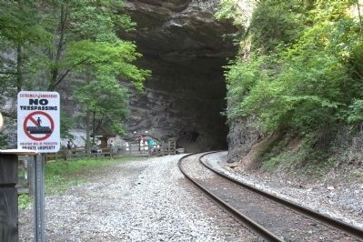
2. The Natural Tunnel, South Entrance
The kiosk where this interpretive panel is located can be seen on the viewing platform in the distance, beneath the tree. The panel faces the tracks. The boardwalk to the viewing platform crosses the railroad tracks here on its way to the chair lift where the photographer is standing.
Regarding The Natural Tunnel Route. The tunnel is 838 feet long, following the curve of the railroad track. It is between 100 and 200 feet wide and between 50 and 80 feet tall. The south exit opens into an natural amphitheatre that is about 400 feet high and 400 feet wide. The north portal amphitheatre is approximately 250 feet high.
Also see . . .
1. Video of Norfolk Southern Train at Natural Tunnel. Train is heading north, with a string of empty coal hoppers. (Submitted on August 20, 2011.)
2. Natural Tunnel: Nature’s Marvel in Stone. 2004 book by Tony Scales on Amazon.com. “As evinced by old postcards, at least by 1906 a pavilion had been built at the South Portal of the Tunnel. ... with the pavilion, the South Portal became the party place and center for dances and galas. ... In these early tourist years, Natural Tunnel had a bit of a risqué reputation and apparently attracted rowdy crowds. The ‘refreshments on the train and at the Tunnel’ also included demijohns of the more potent variety, distilled in the
Photographed By J. J. Prats, May 29, 2011
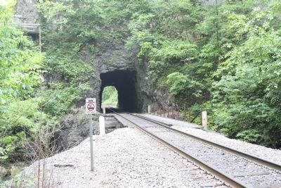
3. The LittleTunnel (Man-Made)
This photograph is taken from the same position as Photo 2, but with the Natural Tunnel behind the photographer. This tunnel had to be cut through the rock so the tracks could align correctly with the entrance to the Natural Tunnel.
Additional commentary.
1. 1925 Southern Railway Timetable
Southern Railway was in charge of this line for passenger service in 1925. The June 28 timetable showed two passenger trains through the tunnel in each direction. Train No. 1 left Bristol at 7:45 a.m. and passed through the tunnel at around 9:55 on its way to Appalachia, Virginia, where it arrived at the Southern Railway station at 10:59. 5 minutes later it called at Union Station in Appalachia for connections with the Interstate Railroad for Pardee, Roda, Norton, and Glamorgan. At 11:16 p.m. Train No. 1 continued to St. Charles, where it arrived at 12:20. Ten minutes later it started its return trip to Bristol as Train No. 4 arriving at Appalachia at 1:40, through the National Tunnel at around 2:50, and arriving at Bristol at 4:50 p.m.
Train No. 2 was Appalachia to Bristol, leaving Appalachia at 7:25 a.m., through the tunnel at 8:15 and arriving at Bristol at 10:35. It turned around as Train No. 3, leaving Bristol at 3:15 p.m., through the tunnel at around 5:30 and arrived at Appalachia at 6:30 p.m.
In Appalachia,
Photographed By J. J. Prats, May 29, 2011
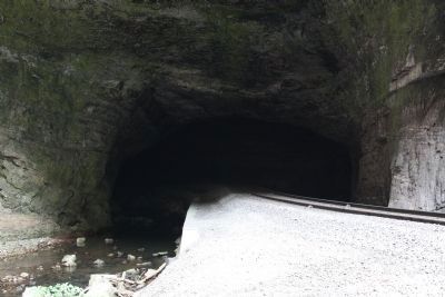
4. The Natural Tunnel
This view is from the viewing platform. The S-shaped tunnel carries both the railroad track and Stock Creek under Purchase Ridge. Within the tunnel, a small tunnel had to be cut because the northern curve of the “S” was too sharp for the rail line.
— Submitted August 21, 2011, by J. J. Prats of Powell, Ohio.
J.J. Prats Postcard Collection, circa 1915/1930
6. Observation Car Train Entering Natural Tunnel, Southwest, Virginia
This white-border postcard without a stamp or postmark has no publisher information printed on it. The number 3115 is shown in the lower left on the image. It shows the pavilion at the south portal described on this marker.
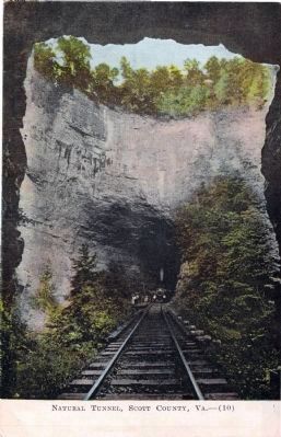
J.J. Prats Postcard Collection, circa 1907/1915
7. Natural Tunnel, Scott County, Va.—(10)
This divided back unused undated colored postcard was “printed and published by J. P. Bell Co., Lynchburg, Va.” Framed by the Little Tunnel, it shows the south portal before the pavilion seen in the previous postcard was built. It has this caption on the back: “Natural Tunnel on the Virginia Southwestern Railway. Scott County, is one of the greatest of Virginia natural wonders. From out of a semi-cylindrical canyon whose perpendicular walls of blue and gray limestone seem to reach to the very skies, Natural Tunnel cleaves its way 900 feet through a mountain to the world beyond; its arches 75 feet high and 80 broad swallowing up railroad, telegraph poles and mountain stream, still have space for more.”
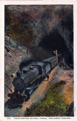
J.J. Prats Postcard Collection, circa 1915/1930
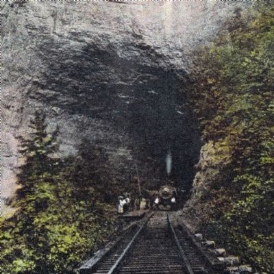
10. 775. Train Leaving Natural Tunnel, Southwest Virginia
This unused undated white-border “C.T. American Art Colored” postcard is also “published by J. P. Bell Co., Inc., Lynchburg, VA. Made in U. S. A.” was printed by C.T. Co. of Chicago. It has the same exact caption as the postcard in image 7. It shows a passenger train stopped posing for the photographer at the north portal of Natural Tunnel.
Credits. This page was last revised on April 28, 2023. It was originally submitted on August 20, 2011, by J. J. Prats of Powell, Ohio. This page has been viewed 2,167 times since then and 103 times this year. Last updated on February 16, 2021, by Carl Gordon Moore Jr. of North East, Maryland. Photos: 1, 2, 3, 4, 5. submitted on August 20, 2011, by J. J. Prats of Powell, Ohio. 6, 7, 8, 9, 10. submitted on October 3, 2014, by J. J. Prats of Powell, Ohio. • Bill Pfingsten was the editor who published this page.
