Carroll-South Hilton in Baltimore, Maryland — The American Northeast (Mid-Atlantic)
Gwynns Falls Valley
From Work to Play
— The Historic National Road - The Road That Built The Nation —
Inscription.
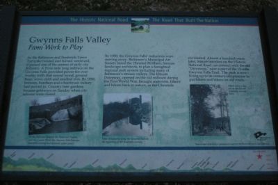
As the Baltimore and Frederick-Town Turnpike twisted and turned westward, it passed one of the centers of early city industry. A three mile long millrace on the Gwynns Falls provided power for over twenty mills that sawed wood, ground flour, wove cloth and smelted iron. By 1850, brewers, butchers and a hairbrush factory had moved in. Country beer gardens became getaways on Sunday when city saloons were closed.
By 1900, the Gwynns Falls’ industries were moving away. Baltimore’s Municipal Art Society hired the Olmsted Brothers, famous landscape architects, to plan a farsighted regional park system including many of Baltimore’s stream valleys. The Ellicott Driveway, opened on the old millrace during the First World War, brought motorists, bikers and hikers back to nature, as the Olmsteds envisioned. Almost a hundred years later, leisure travelers on the Historic National Road can connect with the old “Driveway,” now a part of the 15-mile Gwynns Falls Trail. The park is now living up to its century-old promise to put hikers and bikers on old roads.
Erected by America's Byways.
Topics and series. This historical marker is listed in this topic list: Roads & Vehicles. In addition, it is included in the The Historic National Road series list. A significant historical year for this entry is 1850.
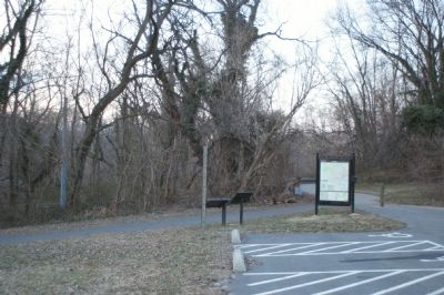
Location. 39° 16.913′ N, 76° 39.573′ W. Marker is in Baltimore, Maryland. It is in Carroll-South Hilton. Marker can be reached from Frederick Avenue (Maryland Route 144), on the right when traveling west. Located at Gwynns Falls Park Trailhead. Touch for map. Marker is at or near this postal address: 65 Ellicott Dr, Baltimore MD 21223, United States of America. Touch for directions.
Other nearby markers. At least 8 other markers are within walking distance of this marker. Ellicott Flour Mills (here, next to this marker); Gwynns Falls Park at Frederick Avenue (a few steps from this marker); Rowhouses: a Baltimore Tradition (about 300 feet away, measured in a direct line); Mt. Olivet Cemetery (approx. ¼ mile away); Early Industries (approx. 0.3 miles away); World War II Memorial (approx. 0.4 miles away); Gwynns Falls Park at Wilkens Avenue (approx. 0.4 miles away); Early Transportation Routes (approx. 0.4 miles away). Touch for a list and map of all markers in Baltimore.
More about this marker. On the lower left is a photo captioned, "At the Fall Line between the Piedmont Plateau and the Coastal Plain, the Gwynns Falls features beautiful scenery and awesome water power."
In the lower center is a "View of industry along the Gwynns Falls in the beginning of the twentieth century."
On the lower right is a photo of "Hikers enjoy a day out on the Ellicott Driveway around 1915."
The background
of the marker is "National Road at Fairview Inn" which is the standard for markers in this series. An elevation diagram of the national road is displayed on the bottom of the marker's face.
Credits. This page was last revised on March 24, 2024. It was originally submitted on January 24, 2008, by Christopher Busta-Peck of Shaker Heights, Ohio. This page has been viewed 1,598 times since then and 18 times this year. Last updated on February 22, 2021, by Carl Gordon Moore Jr. of North East, Maryland. Photos: 1, 2. submitted on January 24, 2008, by Christopher Busta-Peck of Shaker Heights, Ohio. • J. Makali Bruton was the editor who published this page.

