Marker Logo HMdb.org THE HISTORICAL
MARKER DATABASE
“Bite-Size Bits of Local, National, and Global History”
Beale Township near Port Royal in Juniata County, Pennsylvania — The American Northeast (Mid-Atlantic)
 

Academia / Pomeroy Covered Bridge


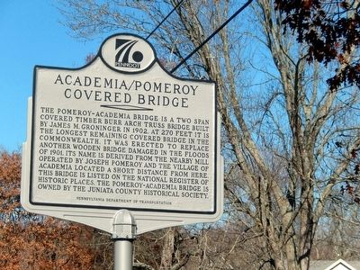
Academia/Pomeroy Covered Bridge Marker image. Click for full size.
Photographed By Don Morfe, November 8, 2015
1. Academia/Pomeroy Covered Bridge Marker
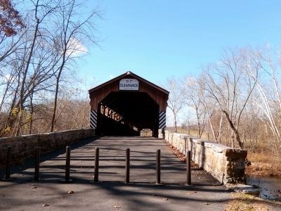
Inscription. The Pomeroy-Academia bridge is a two span covered timber burr arch truss bridge built by James M. Groninger in 1902. At 270 feet it is the longest remaining covered bridge in the Commonwealth. It was erected to replace another wooden bridge damaged in the floods of 1901. Its name is derived from the nearby mill operated by Joseph Pomeroy and the village of Academia located a short distance from here. This bridge is listed on the National Register of Historic Places. The Pomeroy-Academia Bridge is owned by the Juniata County Historical Society.
 
Erected by Pennsylvania Department of Transportation.
 
Topics and series. This historical marker is listed in these topic lists: Bridges & ViaductsSettlements & Settlers. In addition, it is included in the Covered Bridges series list. A significant historical year for this entry is 1902.
 
Location. 40° 29.624′ N, 77° 28.403′ W. Marker is near Port Royal, Pennsylvania, in Juniata County. It is in Beale Township. Marker is at the intersection of Covered Bridge Road and Mill Street on Covered Bridge Road. The marker is off PA 3013. Touch for map. Marker is in this post office area: Port Royal PA 17082, United States of America. Touch for directions.
 
Other nearby markers. At least 8 other markers are within 7 miles of this marker, measured as the crow flies. Tuscarora Academy (approx. 0.8 miles away); Port Royal
Paid Advertisement
Click on the ad for more information.
Please report objectionable advertising to the Editor.
Click or scan to see
this page online
(approx. 5.1 miles away); John Harris (approx. 6.6 miles away); Civil War Memorial (approx. 6.7 miles away); Juniata County (approx. 6.7 miles away); Juniata County War Memorial (approx. 6.7 miles away); Tuscarora Path (approx. 6.7 miles away); In Grateful Acknowledgement (approx. 6.7 miles away).
 
Academia/Pomeroy Covered Bridge image. Click for full size.
Photographed By Don Morfe, November 8, 2015
2. Academia/Pomeroy Covered Bridge
The Bridge is in the far background.
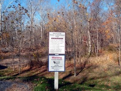
Academia/Pomeroy Covered Bridge image. Click for full size.
Photographed By Don Morfe, November 8, 2015
3. Academia/Pomeroy Covered Bridge
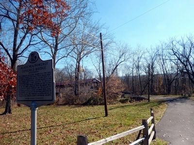
Academia/Pomeroy Covered Bridge-Welcome sign image. Click for full size.
Photographed By Don Morfe, November 8, 2015
4. Academia/Pomeroy Covered Bridge-Welcome sign
 
 
Credits. This page was last revised on February 7, 2023. It was originally submitted on November 19, 2015, by Don Morfe of Baltimore, Maryland. This page has been viewed 479 times since then and 20 times this year. Last updated on February 28, 2021, by Carl Gordon Moore Jr. of North East, Maryland. Photos:   1, 2, 3, 4. submitted on November 19, 2015, by Don Morfe of Baltimore, Maryland. • Bill Pfingsten was the editor who published this page.
Share this page.  
Share on Tumblr
m=167610

CeraNet Cloud Computing sponsors the Historical Marker Database.
This website earns income from purchases you make after using our links to Amazon.com. We appreciate your support.
Paid Advertisement
Apr. 19, 2024