Near West Augusta in Augusta County, Virginia — The American South (Mid-Atlantic)
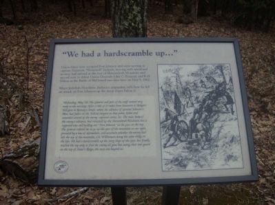
“We had a hardscrabble up…”
Major Jedediah Hotchkiss, Jackson’s mapmaker, tells how he led an attack on Fort Johnson up the steep slopes below it:
Wednesday, May 7th. The General and part of the staff started very early this morning. After a ride of 25 miles from Staunton to Rodgers’ Toll-gate in Ramsey’s Draft, where the advance of General Johnson’s Men, had fallen on the Federal outpost at that point, killed and wounded several of the enemy, captured stores, etc. The main body of the enemy advance, had retreated up the Shenandoah Mountain but is supposed was still holding our “Fort Johnson” at the pass on the top. The General ordered me to go up the spur of the mountain on our right, preceded by a line of skirmishers, and ascertain whether the enemy had left the top of the mountain, Col. Williamson doing the same thing on the left. We had a hardscrabble up the steep slope of the spur, but finally reached the top only to find the enemy all gone but seeing their rear guard on the top of Shaw’s Ridge, the next one beyond us.
Erected by U.S. Forest Service.
Topics. This historical marker is listed in this topic list: War, US Civil. A significant historical month for this entry is May 1862.
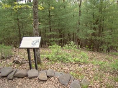
Location. 38° 18.78′ N, 79° 22.933′ W. Marker is near West Augusta, Virginia, in Augusta County. Marker can be reached from U.S. 250, on the right when traveling west. Part of the “Confederate Breastworks Trail” at Fort Edward Johnson. Touch for map. Marker is in this post office area: West Augusta VA 24485, United States of America. Touch for directions.
Other nearby markers. At least 13 other markers are within 2 miles of this marker, measured as the crow flies. “Wee are now looking out for a fight…” (within shouting distance of this marker); “… to go wee did not know where” (within shouting distance of this marker); Healing the Wounds (about 300 feet away, measured in a direct line); “Wee are faring badly…” (about 400 feet away); “… tolerable well fortified” (about 600 feet away); “It was cold business…” (about 700 feet away); Fort Edward Johnson (about 700 feet away); Welcome to Fort Johnson (about 700 feet away); Confederate Breastworks Interpretive Trail (approx. 0.2 miles away); a different marker also named Fort Edward Johnson (approx. 0.2 miles away); “The Shenandoah Mountain Pass is grand indeed…” (approx. 0.2 miles away); Highland County / Augusta County (approx. 0.2 miles away); Mountain House (approx. 1.2 miles away). Touch for a list and map of all markers in West Augusta.
More about this marker. On the right is a drawing depicting Confederate soldiers bringing a cannon up the steep mountain slopes.
Related markers. Click here for a list of markers that are related to this marker. To better understand the relationship, study each marker in the order shown.
Credits. This page was last revised on June 16, 2016. It was originally submitted on March 6, 2009, by Robert H. Moore, II of Winchester, Virginia. This page has been viewed 1,095 times since then and 13 times this year. Photos: 1. submitted on March 6, 2009, by Robert H. Moore, II of Winchester, Virginia. 2. submitted on May 5, 2010, by J. J. Prats of Powell, Ohio. • Craig Swain was the editor who published this page.

