Near West Augusta in Augusta County, Virginia — The American South (Mid-Atlantic)
Healing the Wounds
| — | Confederate Breastworks Trail | — |
Photographed by Robert H. Moore, II, February 27, 2009
1. Healing the Wounds Marker
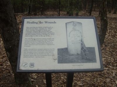
After surviving the Battle of McDowell, in which he lost many comrades, Lt. “Shep” Pryor was later wounded in battle near Culpepper, Virginia. He survived the war, returned to his beloved Penelope, and became Sheriff of Sumter County, Georgia. Lt. Pryor died on May 2, 1911 at the age of 82.
The 12th Georgia Volunteer Infantry fought with honor in Jackson’s Shenandoah Valley Campaign and then moved on to fight with the Army of Northern Virginia, General Early’s Shenandoah Valley Operations and General Lee’s Appomattox Campaign.
Today, national forest managers are protecting this historic site for future generations. This mountain once denuded of trees to provide a clear field for cannon and rifle fire has healed over time, as has this great nation. But, let us remember those who suffered and died – far from home.
Erected by Forest Service, U.S. Department of Agriculture.
Topics. This historical marker is listed in these topic lists: Horticulture & Forestry • War, US Civil. A significant historical month for this entry is May 1862.
Location. 38° 18.774′ N, 79° 23.004′ W. Marker is near West Augusta, Virginia, in Augusta
this page online

Regionally, this marker is in the Shenandoah Valley. It is also in the American South and specifically in the Upper South. Globally, it is in North America, the Western Hemisphere, the Western World, and the Anglosphere. Historically, it finds itself in what was once the territory of the Mississippian Culture, one of the original Thirteen Colonies, one of the Confederate States of America, and the Antebellum South.
Other nearby markers. At least 13 other markers are within 2 miles of this marker, measured as the crow flies: “… tolerable well fortified” (within shouting distance of this marker); “Wee are faring badly…” (within shouting distance of this marker); “We had a hardscramble up…” (about 300 feet away, measured in a direct line); “Wee are now looking out for a fight…” (about 400 feet away); “It was cold business…” (about 400 feet away); Fort Edward Johnson
Photographed by J. J. Prats, May 2, 2010
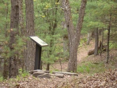
2. Healing the Wounds Marker
Another marker is no longer nearby. Confederate Breastworks Interpretive Trail (was about 600 feet away but has been replaced with another marker now near it).
More about this marker. On the right is a photo of the grave of Captain Pryor.
Related markers. Click here for a list of markers that are related to this marker. To better understand the relationship, study each marker in the order shown.
Photographed by Robert H. Moore, II, February 27, 2009
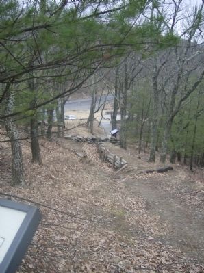
3. View from the Healing the Wounds Marker toward the parking lot
Credits. This page was last revised on August 8, 2026. It was originally submitted on March 6, 2009, by Robert H. Moore, II of Winchester, Virginia. This page has been viewed 1,310 times since then and 26 times this year. Photos: 1. submitted on March 6, 2009, by Robert H. Moore, II of Winchester, Virginia. 2. submitted on May 5, 2010, by J. J. Prats of Powell, Ohio. 3. submitted on March 6, 2009, by Robert H. Moore, II of Winchester, Virginia. • Craig Swain was the editor who published this page.
