Starkweather's Wall: Highwatermark of the West
Perryville • The Battle For Kentucky
— October 8, 1862 —
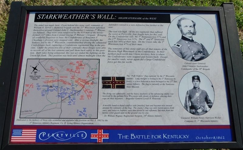
The stand was made here. From behind this stone wall, remnants of William R. Terrill's shattered brigade and the 21st Wisconsin reformed themselves around Colonel John C. Starkweather's veteran 1st Wisconsin Infantry. They were soon reinforced by the 814 men of the newly-formed 121st Ohio from Colonel George P. Webster's brigade. Bringing all available firepower to bear, the Confederates of Benjamin F. Cheatham's division were stopped cold. After a vicious firefight, the Yankees, led by the 1st Wisconsin, counterattacked driving the exhausted Confederates back, capturing a Confederate regimental flag in the process. Under the protective fire of their comrades these troops were able to recover all of the lost cannons and pull them back safely to this position. Both sides being exhausted, this last act ended the fighting on the Union left flank. This position was held until almost midnight when the defenders retired to a new defensive line farther to the rear.
The cost was high. Of the ten regiments that suffered the worst at Perryville, four fought here for this wall. On the Confederate side, the 1st Tennessee lost 57% and the 27th Tennessee lost 51%. The 4th and 9th Tennessee each lost 50% of their men. On the Union side, the 1st Wisconsin lost 47% of their men.
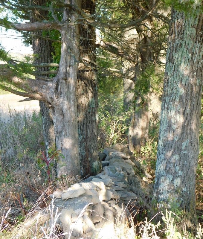
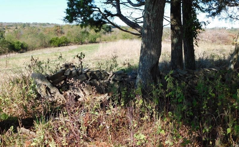
The remnants of this stone wall are all that remain of
the Western High Watermark of the Confederacy. In their farthest push north into Union territory, here is where the Confederates were stopped and beaten back. Except for smaller raids, never again did a large Confederate force get this far north.The "Polk Pattern” flag captured by the 1st Wisconsin Infantry. Long thought to belong to the 1st Tennessee Infantry, it is now believed to have belonged to the 27th Tennessee Infantry. The flag is currently at the Tennessee State Museum.
The firing was admirable, and the heavy musketry of the advancing enemy was received by the gallant First Wisconsin with shouts of defiance, placing their caps on their bayonets. —Brigadier General Lovell H. Rousseau
A terrible hand-to-hand conflict with [musket] butt and bayonet now ensued around the remnants of the flag. The enemy's flag was only twenty paces from ours, and twice its bearers were shot down by our riflemen; but men from our heroic color guard sank to the ground one-by-one. —Dr. William Wagner, Regimental Surgeon, 24th Illinois Infantry
(captions)
Colonel (later General) John Converse Starkweather, Commander of the 28th Brigade
Corporal William Henry Harrison Wicker, Company D, 1st Wisconsin Infantry
Erected by 1st Tennessee Infantry Regiment, Co. B. Living History Organization
Topics. This historical marker is listed in this topic list: War, US Civil. A significant historical date for this entry is October 8, 1862.
Location. 37° 40.483′ N, 84° 58.593′ W. Marker is in Perryville, Kentucky, in Boyle County. Marker can be reached from Whites Road east of Hays Mays Road, on the right when traveling west. Located at Interpretive Marker 40 on the Perryville Battlefield Trail System (Highwater Mark Trail). Touch for map. Marker is in this post office area: Perryville KY 40468, United States of America. Touch for directions.
Other nearby markers. At least 8 other markers are within walking distance of this marker. Starkweather’s Hill (about 300 feet away, measured in a direct line); a different marker also named Starkweather's Hill (about 500 feet away); Act of Mercy (about 600 feet away); The Cornfield (approx. 0.2 miles away); Defense of Parsons’ Ridge (approx. ¼ mile away); On this Spot Brig. Gen. James S. Jackson Fell (approx. ¼ mile away); Sanctuary (approx. ¼ mile away); a different marker also named Defense of Parsons’ Ridge (approx. ¼ mile away). Touch for a list and map of all markers in Perryville.
More about this marker. From the parking pull-off on Whites Road, start at the trailhead for the Highwater Mark Trail and head northwest to the first marker, Starkweather's Wall.
Also see . . . Perryville Battlefield State Historic Site
Credits. This page was last revised on March 3, 2021. It was originally submitted on March 2, 2021, by Bradley Owen of Morgantown, West Virginia. This page has been viewed 230 times since then and 32 times this year. Last updated on March 3, 2021, by Bradley Owen of Morgantown, West Virginia. Photos: 1, 2, 3. submitted on March 2, 2021, by Bradley Owen of Morgantown, West Virginia. • Bernard Fisher was the editor who published this page.


