Perryville in Boyle County, Kentucky — The American South (East South Central)
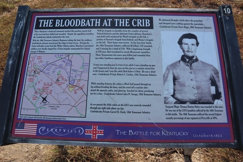
The Bloodbath at the Crib
Perryville • The Battle For Kentucky
— October 8,1862 —
When Donelson’s shattered regiments reached this position, nearly half of his men had been killed and wounded. Despite the appalling casualties, the Confederate attack continued to the west.
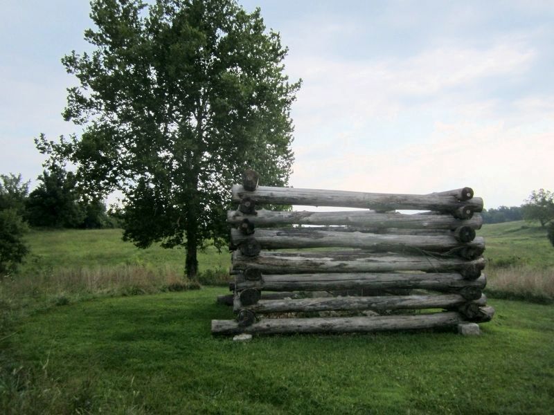
With the 16th Tennessee Infantry Regiment taking the lead, the stubborn Confederate advance moved past the ridge in front of you. Driving the Union defenders away from the Widow Gibson cabin, Donelson’s persistent soldiers were finally stopped by a Union brigade commanded by Colonel George P. Webster.
With his brigade in shambles from the crossfire of several Federal batteries and the obstinate Union defense, Donelson’s men held until reinforced by Wood's brigade on the left, a portion of Stewart's brigade from behind, and Maney's brigade on the left. Their losses were severe. In the four-hour battle, the 16th Tennessee Infantry suffered 46 killed, 170 wounded, and 3 missing for a total of 219. With a beginning strength of 370 men, that translated to nearly 60 percent casualties. These Tennesseans lost more men killed and wounded than any other Southern regiment in the battle.
A man was standing just in front of me while I was reloading my gun and I happened to have my eyes on him just as a canister struck him in the breast and I saw the white flesh before it bled. He was a dead man. -Confederate Private Robert C. Carden, 16th Tennessee Infantry.
While standing between the cabins a Minié ball passed through my leg without breaking the bone, and the wood off a canister shot struck the opposite cabin, and glancing knocked me down, paralyzing me for a time. -Confederate Colonel John H. Savage, 16th Tennessee Infantry.
As we passed the little cabin on the hill I was severely wounded through my right side above my hip. -Confederate Private Carrol H. Clark, 16th Tennessee Infantry
We advanced through a field where grapeshot and shrapnel were rattling against the cornstalks..." -Confederate Private Davis Biggs, 38th Tennessee Infantry
(caption) Sergeant Major Thomas Benton Potter was wounded in this area. He was one of the 219 Casualties suffered by the 16th Tennessee in this battle. The 16th Tennessee suffered the second highest casualty percentage of any regiment at Perryville at 59%.
Erected by Perryville Battlefield State Historic Site. (Marker Number 10.)
Topics. This historical marker is listed in this topic list: War, US Civil. A significant historical date for this entry is October 8, 1862.
Location. 37° 40.279′ N, 84° 58.376′ W. Marker is in Perryville, Kentucky, in Boyle County. Marker can be reached from Park Road near Battlefield Road (Kentucky Route 1920), on the left when traveling east. Located at the Perryville Battlefield State Historic Site. Located at Interpretive Marker 10 on the Perryville Battlefield Trail System (Confederate Right Trail). Touch for map. Marker is at or near this postal address: 1825 Battlefield Road, Perryville KY 40468, United States of America. Touch for directions.
Other nearby markers. At least 8 other markers are within walking distance of this marker. Widow Gibson Cabin (approx. 0.2 miles away); “For God’s Sake, Save That Battery” The 38th Indiana at Perryville (approx. 0.2 miles away); Act of Mercy (approx. 0.2 miles away); Sanctuary (approx. 0.2 miles away); Defense of Loomis’ Heights (approx. 0.2 miles away); Simonson’s Battery (approx. ¼ mile away); Starkweather's Hill (approx. ¼ mile away); Donelson's Advance (approx. ¼ mile away). Touch for a list and map of all markers in Perryville.
Related marker. Click here for another marker that is related to this marker. Old Marker At This Location also titled “Donelson Persists"
Credits. This page was last revised on November 2, 2021. It was originally submitted on October 25, 2019. This page has been viewed 296 times since then and 31 times this year. Last updated on March 6, 2021. Photos: 1. submitted on October 25, 2019, by Bob R Bogle of Tucson, Arizona. 2. submitted on August 25, 2011, by Bernard Fisher of Richmond, Virginia. • Bernard Fisher was the editor who published this page.
Editor’s want-list for this marker. Wide shot of marker and its surroundings. • Can you help?

