
Near Perryville in Boyle County, Kentucky — The American South (East South Central)
Widow Gibson Cabin
Perryville • The Battle For Kentucky
| — | October 8, 1862 | — |
Photographed by David Graff, April 19, 2012
1. Widow Gibson Cabin Marker
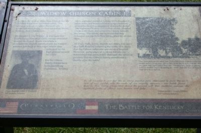
On October 8, the household was spun into confusion as blue-clad Union troops swarmed around the house. Soon, Donelson's Confederate brigade attacked and the Federal soldiers fell back to this ridge, where they reformed on the high ground around the cabin.
For the Gibson family, it must have been a terrifying experience. Artillery shells exploded overhead, bullets cracked against the cabin walls, and wounded Union troops swarmed around the structure desperately looking for shelter. The frightened Widow Gibson took an axe, chopped a hole in the floor and hid with her family beneath the house. The family was so scared that they refused to emerge from their hiding place for several days.
As every barn, home, church and stable was used as a field hospital following the battle, it is likely that the Gibson cabin also served as a hospital. However, archeological work on the site has determined that cannon fire damaged the cabin
this page online
We all bounded to our feet like so many parched peas, determined to pour the contents of our muskets, into the ranks of our ungodly opposers... our bullets found them in their hiding places and strewn the ground with their mutilated carcases—the legitamate fruits of (their) own treason and folly - Union Soldier Joseph Gloren, 80th Indiana Infantry
(captions)
(lower left) Union Sergeant James F. Cantwell, 80th Indiana Infantry
(upper right) This 1885 photograph taken near Perryville shows a small farmhouse tucked under a large tree. While this is not the Widow Gibson Cabin, her cabin may have looked like this. Farming was the predominant activity around Perryville during the 1860s, and this view of farm life may have been typical.
Erected by Kentucky State Parks. (Marker Number 45.)
Topics. This historical marker is listed in this topic list: War, US Civil. A significant historical date for this entry is October 8, 1862.
Location. This marker has been replaced by another marker nearby. It was located near 37° 40.216′ N, 84° 58.53′ W. Marker was near Perryville,
Photographed by David Graff, April 19, 2012
2. Widow Gibson Cabin Site
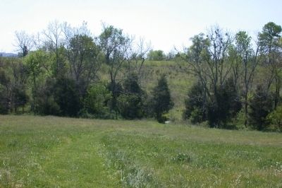
Looking west toward a creek and ridge from the Widow Gibson cabin Site.

Regionally, this marker was in Kentucky’s Bluegrass Region. It was also in the American South and specifically in the Upper South. Globally, it was in North America, the Western Hemisphere, the Western World, and the Anglosphere. Historically, it found itself in what was once the territory of the Mississippian Culture and also the Antebellum South.
Other nearby markers. At least 8 other markers are within walking distance of this location: A different marker also named Widow Gibson Cabin (here, next to this marker); Cleburne's Advance (about 700 feet away, measured in a direct line); The Slaughter Pen (about 700 feet away); The Bloodbath At The Crib (approx. 0.2 miles away); a different marker also named Harris' Battery (approx. 0.2 miles away);
Photographed by David Graff, April 19, 2012
3. Widow Gibson Farm Site
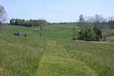
Looking east on the trail toward the reconstructed Widow Gibson crib/barn.
Other markers no longer nearby. Stewart's Attack (was about 800 feet away but has been confirmed missing); Donelson Persists (was approx. 0.2 miles away but has been reported to have been replaced with another marker now near it); The Bloodbath at the Crib (was approx. 0.2 miles away but has been replaced with another marker now near it); Harris' Battery (was approx. 0.2 miles away but has been replaced with another marker now near it); General Polk Behind Enemy Lines (was approx. 0.2 miles away but has been permanently removed); Defense of Loomis’ Heights (was approx. ¼ mile away but has been replaced with another marker now near it); 80th Indiana (was approx. ¼ mile away but has been replaced with another marker now near it).
Regarding Widow Gibson Cabin. The marker is about 350 feet past the Widow Gibson's crib/barn structure that is visible at some distance away as you walk the trail.
Related marker.
Photographed by David Graff, April 19, 2012
4. Widow Gibson Crib/Barn
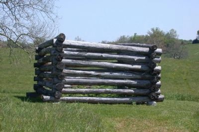
This is a reconstruction of a building that might have been shown in a different 1885 photograph of the battlefield. It is about 350 feet east of the marker.
Also see . . .
1. Friends of Perryville Battlefield. This page contains a printable map of the Perryville Battlefield Hiking Trails including trail stops. (Submitted on February 16, 2013, by David Graff of Halifax, Nova Scotia.)
2. Panoramio 1885 Photo of Widow Gibson's Crib/Barn. This photograph has, however, also been identified as Starkweather's Hill taken from the Cornfield. (Submitted on February 16, 2013, by David Graff of Halifax, Nova Scotia.)
Credits. This page was last revised on November 23, 2025. It was originally submitted on February 16, 2013, by David Graff of Halifax, Nova Scotia. This page has been viewed 1,302 times since then and 31 times this year. Last updated on March 6, 2021, by Bradley Owen of Morgantown, West Virginia. Photos: 1, 2, 3, 4. submitted on February 16, 2013, by David Graff of Halifax, Nova Scotia. • Bernard Fisher was the editor who published this page.
