Bevans in Sussex County, New Jersey — The American Northeast (Mid-Atlantic)
The Village of Bevans
Delaware Water Gap Nat’l Recreation Area
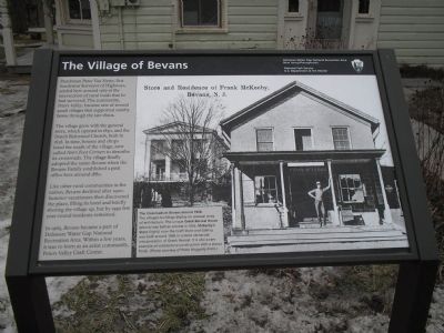
Dutchman Peter Van Nests, first Sandyston Surveyor of Highways, settled here around 1767 at the intersection of rural roads that he had surveyed. The community, Peters Valley, became one of several small villages that supported nearby farms through the late 1800s.
The village grew with the general store, which opened in 1830, and the Dutch Reformed Church, built in 1838. In time, houses and shops lined the roads of the village, now called Hen’s Foot Corners to describe its crossroads. The village finally adopted the name Bevans when the Bevans Family established a post office here around 1880.
Like other rural communities in the nation, Bevans declined after 1900. Summer vacationers then discovered the place, filling its hotel and briefly shoring the village up, but by 1950 few year-round residents remained.
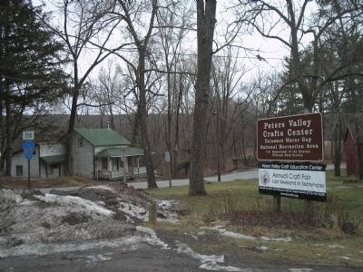
In 1965, Bevans became part of Delaware Water Gap National Recreation Area. Within a few years, it was re-born as an artist community, Peters Valley Craft Center.
Erected by Delaware Water Gap National Recreation Area.
Topics. This historical marker is listed in this topic list: Settlements & Settlers. A significant historical year for this entry is 1767.
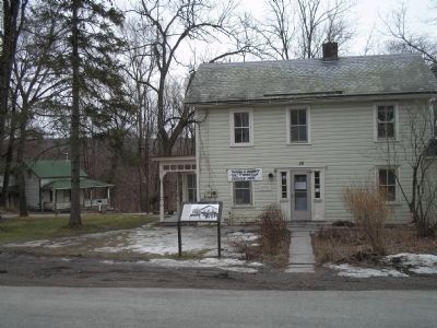
Location. 41° 12.616′ N, 74° 51.265′ W. Marker is in Bevans, New Jersey, in Sussex County. Marker is at the intersection of Old Mine Road and Walpack Road N, on the left when traveling north on Old Mine Road. Marker is in Delaware Water Gap National Recreation Area. Touch for map. Marker is in this post office area: Layton NJ 07851, United States of America. Touch for directions.
Other nearby markers. At least 8 other markers are within 4 miles of this marker, measured as the crow flies. Dingmans Ferry (approx. 0.7 miles away in Pennsylvania); Bevans, New Jersey (approx. 0.9 miles away); a different marker also named Dingman's Ferry (approx. 1.2 miles away in Pennsylvania); Layton, New Jersey (approx. 1˝ miles away); Stokes State Forest (approx. 3˝ miles away); Roosevelt's Tree Army (approx. 3.8 miles away in Pennsylvania); Harnessing the Creek (approx. 3.8 miles away in Pennsylvania); Wallpack, N.J. (approx. 3.8 miles away).
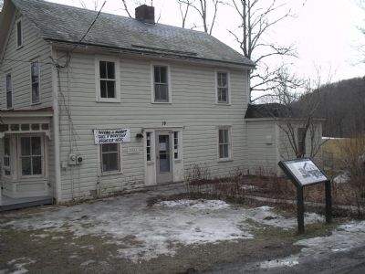
More about this marker. The right side of the marker features a photograph of the Store and Residence of Frank McKeeby, Bevans, N.J. It has a caption of “The Crossroads in Bevans around 1900. The villages’s buildings display an unusual array of architecture. The unique Greek Revival House (above) was built as a home in 1855. McKeeby’s Store (right), now the Craft Store and Gallery, was built around 1850 in a more vernacular interpretation of Greek Revival. It is also a rare example of cobblestone construction with a stucco finish. (Photo courtesy of Patte Haggerty Frato.)”
Also see . . .
1. Delaware Water Gap National Recreation Area. National Park Service website. (Submitted on March 7, 2009, by Bill Coughlin of Woodland Park, New Jersey.)
2. Peters Valley School of Craft. School website homepage (Submitted on March 7, 2009, by Bill Coughlin of Woodland Park, New Jersey.)
Additional commentary.
1. Post Office
Hi, my name is Leandro and I have a 1918 post card showing a picture of the post office back in those days. If you are interested, please reply to this message.
Thank you.
Editor's Note: We are always interested in adding historical photographs related to historical markers in the Historical Marker database. Please consider scanning the postcard and adding the photo to this page using the "Add Photo" link at the top of the page.
Thank you.
— Submitted December 22, 2010, by Leandro A Lemus of Paterson, New Jersey.
Credits. This page was last revised on January 14, 2022. It was originally submitted on March 7, 2009, by Bill Coughlin of Woodland Park, New Jersey. This page has been viewed 2,106 times since then and 37 times this year. Photos: 1, 2, 3, 4. submitted on March 7, 2009, by Bill Coughlin of Woodland Park, New Jersey.


