Near Yauhannah in Georgetown County, South Carolina — The American South (South Atlantic)
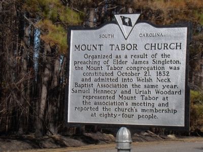
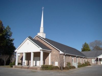
Mount Tabor Church
Erected 1984 by the congregation. (Marker Number 22-19.)
Topics. This historical marker is listed in this topic list: Churches & Religion. A significant historical date for this entry is October 21, 1862.
Location. 33° 36.7′ N, 79° 11.767′ W. Marker is near Yauhannah, South Carolina, in Georgetown County. Marker is at the intersection of U.S. 701 and Exodus Drive (Local Highway 22-264), on the right when traveling north on U.S. 701. Touch for map. Marker is at or near this postal address: 18504 N Fraser St, Georgetown SC 29440, United States of America. Touch for directions.
Other nearby markers. At least 8 other markers are within 9 miles of this marker, measured as the crow flies. Chicora Wood (approx. 6.6 miles away); Prince Frederick's Chapel (approx. 7.4 miles away); Joseph & Theodosia Burr Alston (approx. 8½ miles away); Brookgreen Gardens (approx. 8.6 miles away); Brookgreen Plantation (approx. 8.7 miles away); Washington Allston (approx. 8.7 miles away); Joseph Alston (approx. 8.7 miles away); Washington’s Visit (approx. 8.7 miles away).
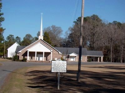
More about this marker. Marker is away from the highway, on the church driveway. It is difficult to notice when driving south because church site is shielded by trees.

Photographed By J. J. Prats, February 23, 2009
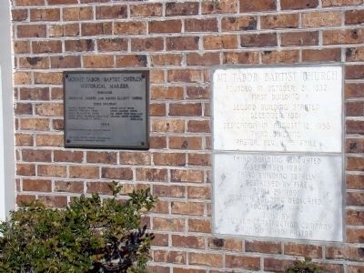
3. Tablets on Church
The brass dedication tablet is titled “Historical Marker,” dated 1984, and lists the names of the Johnnie Young family. The marble tablets read “Mt. Tabor Baptist Church. Founded in October 21, 1832; first building. Second building started December, 1881. Dedication in August 12, 1956, third building, Pastor Rev. J. A. Faile. Third building renovated September 1986. Third building totally destroyed by fire April 29, 1991. Fourth building dedicated August 30, 1992. Built by Johnson Construction Company. Ronald Ward, Pastor.“
Credits. This page was last revised on June 16, 2016. It was originally submitted on March 7, 2009, by J. J. Prats of Powell, Ohio. This page has been viewed 1,273 times since then and 65 times this year. Photos: 1, 2, 3, 4. submitted on March 7, 2009, by J. J. Prats of Powell, Ohio.


