Salisbury in Wicomico County, Maryland — The American Northeast (Mid-Atlantic)
Newtown Historic District
Inscription.
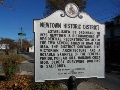
Established by ordinance in 1975, Newtown is distinguished by residential reconstruction after the two severe fires in 1860 and 1886. The district contains fine Victorian architecture and a notable example of the Federal period, Poplar Hill Mansion, circa 1800, oldest surviving building in Salisbury.
Topics. This historical marker is listed in these topic lists: Notable Events • Political Subdivisions. A significant historical year for this entry is 1975.
Location. 38° 22.33′ N, 75° 35.845′ W. Marker is in Salisbury, Maryland, in Wicomico County. Marker is at the intersection of Oakdale Street and Division Street, on the left when traveling north on Oakdale Street. Touch for map. Marker is in this post office area: Salisbury MD 21802, United States of America. Touch for directions.
Other nearby markers. At least 8 other markers are within walking distance of this marker. Poplar Hill Mansion (about 600 feet away, measured in a direct line); Parsons Cemetery (approx. ¼ mile away); Charles H. Chipman Cultural Center (approx. 0.3 miles away); a different marker also named Newtown Historic District (approx. 0.3 miles away); Wicomico Presbyterian Church (approx. 0.3 miles away); Wye Oak Seedling (approx. half a mile away); The General Humphreys Cannon (approx. half a mile away); Historic Byrd Tavern (approx. half a mile away). Touch for a list and map of all markers in Salisbury.
Credits. This page was last revised on March 11, 2021. It was originally submitted on November 29, 2007, by Bill Pfingsten of Bel Air, Maryland. This page has been viewed 1,284 times since then and 10 times this year. Last updated on March 9, 2021, by Carl Gordon Moore Jr. of North East, Maryland. Photo 1. submitted on November 29, 2007, by Bill Pfingsten of Bel Air, Maryland. • J. Makali Bruton was the editor who published this page.
Editor’s want-list for this marker. A wide shot of the marker and its surroundings. • Can you help?
