Fort Loramie in Shelby County, Ohio — The American Midwest (Great Lakes)
Fort Loramie
⎯⎯⎯
The Indian Wars, 1790- 1795
Photographed by Michael Buettner, 1997
1. Fort Loramie Marker
Fort Loramie
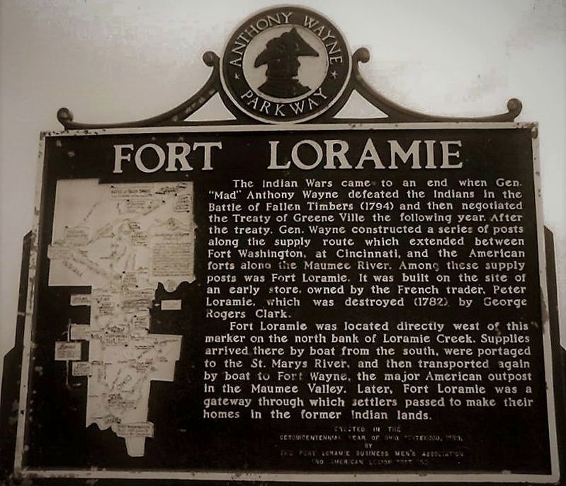
The Indian Wars came to an end when Gen. “Mad” Anthony Wayne defeated the Indians in the Battle of Fallen Timbers (1794) and then negotiated the Treaty of Greene Ville the following year. After the treaty, Gen. Wayne constructed a series of posts along the supply route which extended between Fort Washington, at Cincinnati, and the American forts along the Maumee River. Among these supply posts was Fort Loramie. It was built on the site of an early store, owned by the French trader Peter Loramie, which was destroyed (1782) by George Rogers Clark.
Fort Loramie was located directly west of this marker on the north bank of Loramie Creek. Supplies arrived there by boat from the south, were portaged to the St. Marys River, and then transported again by boat to Fort Wayne, the major American outpost in the Maumee Valley. Later, Fort Loramie was a gateway through which settlers passed to make their homes in the former Indian lands.
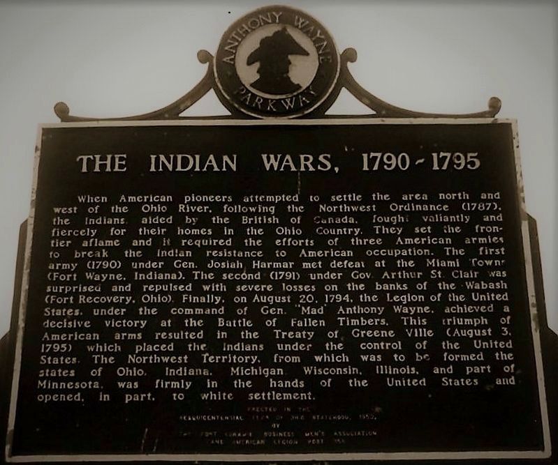
The Indian Wars, 1790- 1795
When American Pioneers attempted to settle the area north and
west of the Ohio River, following the Ordinance of 1787,
the
this page online
Erected 1953 by Fort Loramie Businessmen’s Association and American Legion Post 355.
Topics.
Photographed by Michael Buettner, 1997
2. The Indian Wars, 1790- 1795 Marker
Location. Marker has been reported missing. It was located near 40° 21.638′ N, 84° 22.488′ W. Marker was in Fort Loramie, Ohio, in Shelby County. It could be reached from St. Mary’s Pike (Ohio Route 66). Touch for map. Marker was at or near this postal address: 11255 OH-66, Fort Loramie OH 45845, United States of America. Touch for directions.

Regionally, this marker was in Ohio’s Till Plains. It was also in the American Midwest and in the Corn Belt. Globally, it was in North America, the Western Hemisphere, the Western World, and the Anglosphere. Historically, it found itself in what was once the Haudenosaunee (Iroquois) Confederacy, the territory of the Mississippian Culture, and the Northwest Territory.
Other nearby markers. At least 8 other markers are within walking distance of this location: Fort Loramie (here, next to this marker); Fort Loramie / Lorimier's Trading Post (here, next to this marker); Fort Loramie Town Crest (approx. 0.6
Photographed by Michael Buettner, 1997
3. Fort Loramie Marker
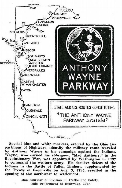
the map detailed on the marker
Other markers no longer nearby. Loramie's Store 1769 & Fort Loramie 1794 (was here, next to this marker but has been confirmed missing); Pioneer Portage (was approx. 0.6 miles away but has been confirmed missing).
More about this marker. The "The Indian Wars, 1790- 1795" side of the marker is typical of several other Anthony Wayne Parkway markers, but the text varies from marker to marker.
Additional keywords. Anthony Wayne Parkway
Photographed by Michael Buettner, 1997
4. Fort Loramie Marker
the Anthony Wayne Parkway logo, these were blue and white, sheet metal markers
Credits. This page was last revised on March 15, 2021. It was originally submitted on September 27, 2017, by Rev. Ronald Irick of West Liberty, Ohio. This page has been viewed 1,237 times since then and 78 times this year. Last updated on March 12, 2021, by Carl Gordon Moore Jr. of North East, Maryland. Photos: 1, 2, 3, 4. submitted on September 27, 2017, by Rev. Ronald Irick of West Liberty, Ohio. • Devry Becker Jones was the editor who published this page.
