Barnes House
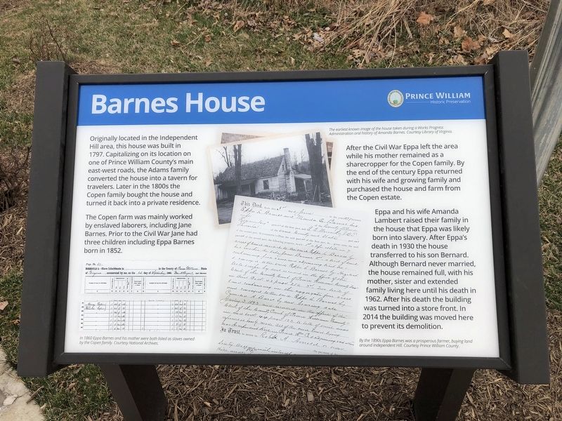
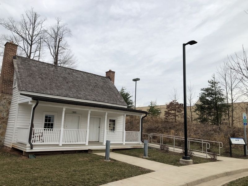
Originally located in the Independent Hill area, this house was built in 1797. Capitalizing on its location on one side of Prince William County's main east-west roads, the Adams family converted the house into a tavern for travelers. Later in the 1800s the Copen family bought the house and turned it back into a private residence.
The Copen farm was mainly worked by enslaved laborers, including Jane Barnes. Prior to the Civil War Jane had three children including Eppa Barnes born in 1852.
After the Civil War Eppa left the area while his mother remained as a sharecropper for the Copen family. By the end of the century Eppa returned with his wife and growing family and purchased the house and farm from the Copen estate.
Eppa and his wife Amanda Lambert raised their family in the house that Eppa was likely born into slavery. After Eppa's death in 1930 the house transferred to his son Bernard. Although Bernard never married, the house remained full with his mother, sister and extended family living here until his death in 1962. After his death the building was turned into a store front. In 2014 the building was moved here to prevent its demolition.
Erected by Prince William County Historical Commission.
Topics and series. This historical marker is listed in these topic lists:
Location. 38° 36.567′ N, 77° 21.452′ W. Marker is in Montclair, Virginia, in Prince William County. Marker can be reached from Waterway Drive, 0.2 miles east of Olivia Way, on the right when traveling east. Touch for map. Marker is at or near this postal address: 5135 Waterway Dr, Dumfries VA 22025, United States of America. Touch for directions.
Other nearby markers. At least 8 other markers are within 2 miles of this marker, measured as the crow flies. Alexander Henderson (approx. 0.8 miles away); “Camp Fisher” Civil War Campsite (approx. one mile away); Troop Movements and Camp (approx. 1.1 miles away); a different marker also named “Camp Fisher” Civil War Campsite (approx. 1.1 miles away); Montclair Veterans Flagpole (approx. 1.2 miles away); Carey M. Perkinson (approx. 1.3 miles away); Maddox Cemetery (approx. 1.3 miles away); Rippon Lodge (approx. 1˝ miles away). Touch for a list and map of all markers in Montclair.
Credits. This page was last revised on March 12, 2021. It was originally submitted on March 12, 2021, by Devry Becker Jones of Washington, District of Columbia. This page has been viewed 268 times since then and 33 times this year. Photos: 1, 2. submitted on March 12, 2021, by Devry Becker Jones of Washington, District of Columbia.

