My Poor Orphans!
— Stones River National Battlefield —
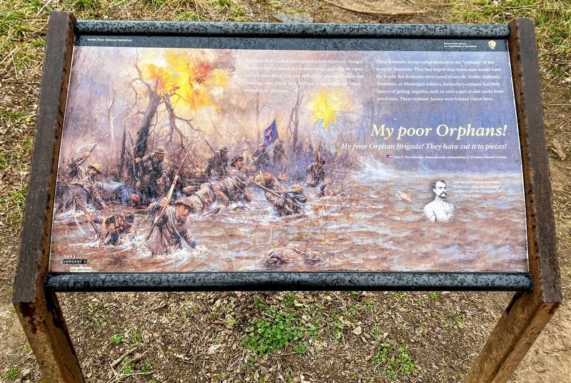
My poor Orphan Brigade! They have cut it to pieces!
John C. Breckinridge, major general, commanding 1st Division, Hardee's Corps
Near here four Confederate regiments from Kentucky charged for over a mile to assault the Federal troops guarding the other side of Stones River. The cost of their late afternoon attack was stunning—over 430 of the 1,200 men in the ranks were killed, wounded, or captured.
These Kentucky troops called themselves the "orphans" of the Army of Tennessee. They had hoped their home state would leave the Union. But Kentucky never voted to secede. Unlike Alabama, Tennessee, or Mississippi soldiers, Kentucky's orphans had little chance of getting supplies, mail, or even a pair of new socks from loved ones. These orphans' homes were behind Union lines.
(caption):
Just six years before this battle, Kentucky's John Breckinridge had been the Vice President of the United States.
Erected by Stones River National Battlefield, National Park Service, US Department of the Interior.
Topics. This historical marker is listed in this topic list: War, US Civil. A significant historical date for this entry is January 2, 1863.
Location. 35° 53.297′ N, 86° 25.457′ W. Marker is in Murfreesboro, Tennessee
Other nearby markers. At least 8 other markers are within walking distance of this marker. McFadden's Ford (within shouting distance of this marker); Battle at Stones River (about 400 feet away, measured in a direct line); Remembering by Rail (about 400 feet away); Stones River Artillery Monument (about 500 feet away); The Very Forest Seemed to Fall (about 600 feet away); Battle of Stones River (about 600 feet away); McFadden Cemetery (about 600 feet away); Battle of Murfreesboro (approx. 0.6 miles away). Touch for a list and map of all markers in Murfreesboro.
Also see . . . Stones River National Battlefield. National Park Service (Submitted on March 15, 2021.)
Additional keywords. My Poor Orphans!
Credits. This page was last revised on March 15, 2021. It was originally submitted on March 14, 2021, by Shane Oliver of Richmond, Virginia. This page has been viewed 285 times since then and 24 times this year. Photos: 1, 2. submitted on March 14, 2021, by Shane Oliver of Richmond, Virginia. • Bernard Fisher was the editor who published this page.
Editor’s want-list for this marker. Wide shot of marker and its surroundings. • Can you help?

